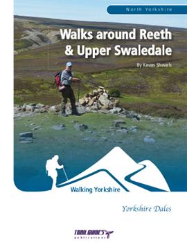
About the Guide
By Keven Shevels
A 112 page full colour A5 booklet describing nine walks and the history and landscape surrounding those walks, each walk starting and finishing within the locality of the village of Reeth in Swaledale.
Considered to be the capital of Upper Swaledale, the village of Reeth stands high above the confluence of the River Swale and the Arkle Beck and over the centuries has kept watch over the changing face of the dale.
Here the Mesolithic hunter/gatherer came on his foraging expeditions, the Bronze Age tribesmen created cattle ranches and began the early steps into agriculture and clashes arose between the native Celts and the invading Anglians who were to form the embryonic England. The Vikings who recognised the similarities between their home and this little rugged dale came and settled, creating as they did so a character that can still be recognised today. During the Medieval period large religious houses became established, evidence of which still exists on the ground and in place names. Then in the 17th and 18th centuries the industrialisation of the dale took place with hundreds employed in the mining and associated industries.
Join the writer in a series of walks that explores both the countryside and the history that shaped it, in this corner of what is thought of as the most beautiful of all the Yorkshire Dales.
Like walking in Swaledale, I can't say that I blame you after all it is a beautiful valley. In which case have you tried one of our other guides to the Dale. Or even better, buy all three books together as the Swaledale Bundle and save 20% off the individual list price.
Contents
1. Introduction.
2. Access and the Right to Roam.
3. The Walks.
4. Weather.
5. Maps.
6. Accommodation, Facilities & Attractions.
7. Tourist Information Centres & Websites.
8. Lead Mining Glossary.
Walk 1. Hurst.
Walk 2. The Southern Dykes.
Special Feature. The Grinton - Fremington Dykes.
Walk 3. Marrick Abbey & Fremington Edge.
Walk 4. Maiden Castle.
Special Feature. Maiden Castle.
Walk 5. The Enclosures of Calver.
Special Feature. Early Life on Calver Hill.
Walk 6. Whitaside Moor & Green Hills.
Walk 7. Surrender Smelt Mill & the Barney Beck.
Walk 8, Grinton How Smelt Mill & the Grovebeck Mines.
Special Feature. Grinton How Smelt Mill.
Walk 9. Harkerside & Apedale.
The Walks
WALK 1: HURST
This route retraces the miner's footsteps along the old track between Reeth and Hurst crossing as it goes the stark remnants of the mining grounds. From Hurst you then follow another old miner's track over to Arkengarthdale, again, from where many miners made the daily slog to work.
DISTANCE: 7.5 miles (12 km). ASCENT: 1,332 feet (406 metres).
START: Reeth. (GR SE 038 992).
TERRAIN: Mainly moorland tracks and field paths.
FGS Grading: F6 [D1, N1, T1, R1, H2]
WALK 2: THE SOUTHERN DYKES
A shorter walk this but a nice winter one when a light dusting of snow can really highlight the land forms and show off some of the landscape archaeology that exists in this part of the dale. The two main features of this walk are a couple of the Dark Age defensive dykes erected across the width of the valley to protect the native Celtic kingdom of the Swale from the encroaching Anglian invaders.
DISTANCE: 3.6 miles (5.7 km). ASCENT: 397 feet (121 metres).
START: Reeth. (GR SE 038 992).
TERRAIN: Mainly field path with a short stretch across moorland.
FGS Grading: F4 [D0, N1, T1, R1, H1]
WALK 3: MARRICK ABBEY &FREMINGTON EDGE
Swaledale has a long history of human habitation going back over thousands of years and on this walk you'll encounter fragments of this rich tapestry and see how, even now, the landscape is still shaped by humans who are long gone.
DISTANCE: 7.3 miles (11.7 km). ASCENT: 935 feet (285 metres).
START: Reeth. (GR SE 038 992).
TERRAIN: Mainly field paths and moorland tracks although there are a couple of road sections on very quiet country lanes.
FGS Grading: F5 [D1, N1, T0, R1, H2]
WALK 4: MAIDEN CASTLE
A walk exploring the Iron Age hill fort of Maiden Castle.
DISTANCE: 4.8 miles (7.6 km). ASCENT: 656 feet (200 metres).
START: Reeth. (GR SE 038 992).
TERRAIN: Mainly field and moorland paths.
FGS Grading: F5 [D0, N1, T1, R1, H2]
WALK 5: THE ENCLOSURES OF CALVER
Calver Hill rises directly behind Reeth and for many walkers it's summit is an obvious objective for a walk. However, how many walkers know the true history of this hill and the landscape that surrounds it.
DISTANCE: 7.6 miles (12.1 km). ASCENT: 1,240 feet (378 metres).
START: Reeth. (GR SE 038 992).
TERRAIN: Because on this walk you are following a trail between prehistoric monuments which, in the main, aren't conveniently located next to footpaths then you will be doing a fair amount of walking off-path.
FGS Grading: F7 [D1, N1, T2, R1, H2]
WALK 6: WHITASIDE MOOR & GREEN HILLS
A walk that follows the course of the River Swale upstream, passing as it does so one of the small fortified settlements from the Iron Age that lie on glacial moraines on the valley floor. The route then loops back over Green Hill, passing through seversl of the numerous mining grounds that line the southern side of the valley, before descending back down to the river to return to Reeth.
DISTANCE: 9.7 miles (15.5 km). ASCENT: 1,093 feet (3333 metres).
START: Reeth. (GR SE 038 992).
TERRAIN: This route encompasses riverside and field paths, a walled lane and well-surfaced moorland tracks.
FGS Grading: F4 [D1, N1, T0, R1, H1]