About the Guide
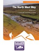
By Keven Shevels
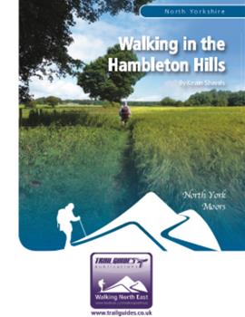
A 112 page full colour A5 booklet describing nine walks, and the history and landscape of the Hambleton Hills which form the south-west corner of the North York Moors.
The Hambleton Hills lie in the south-west corner of the North York Moors National Park. This is an area that is justifiably known for its varied landscape, a land of flat-topped hills interspersed with wooded and tranquil valleys. To the north, the hills are heather-clad moor inhabited by sheep and grouse, then as they gradually run south-wards, their nature changes to more gently rolling hills clad in woodland and fields of grain.
This is a fascinating area, one that has seen mankind take his early steps into agriculture, the introduction of Christianity to this land, and the successful and unsuccessful foreign invader. History has left a pattern on this landscape, one that can be traced as you walk.
Join the author in a series of nine walks as he explores both the countryside and history of one of the country's most popular national parks.
Contents
Contents
Introduction
1. Introduction
2. Access & the Right to Roam
3. The Walks
4. The Weather
5. The Maps
6. Facilities, Tourist Information Centres & Websites
7. Walk Location Map
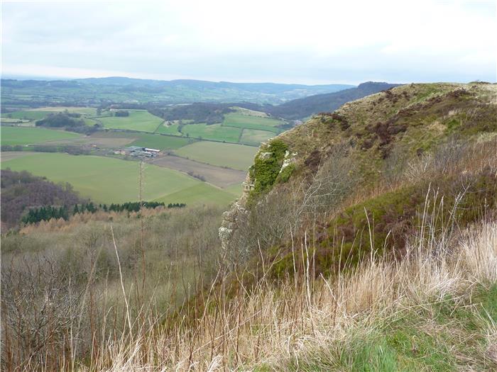
Walk 1: Scotch Corner and Roulston Scar
Battle of Scotch Corner
Roulston Scar Hill Fort
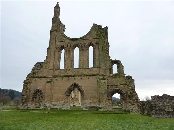
Walk 2: Byland Abbey and Mount Snever
Byland Abbey
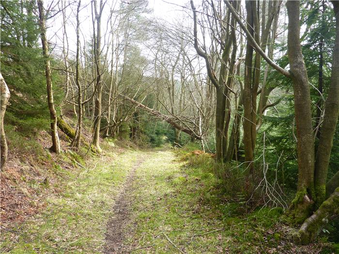
Walk 3: Boltby Forest
Walk 4: The Eastern Dales
Walk 5: Hood Hill
Walk 6: Arden Great Moor
W alk 7: Boltby and Gormire Lake
Gormire Lake
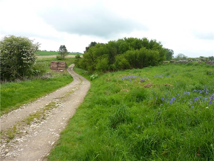
Walk 8: Studfold and Pry Rigg Plantation
Studfold Ring
Walk 9: Black Hambleton
The Hambleton Drove Road
Appendix
Ferguson Grading System
The Author
Walking North East
Disclaimer
The Walks
WALK 1: SCOTCH CORNER AND ROULSTON SCAR.
Not the longest walk in the book but one that is full of interest not least because, if they are flying, you have the opportunity to watch the gliders from the Yorkshire Gliding Club soaring on the thermals above Sutton Bank. However, that fascination aside, on this walk you can tread in the footsteps of our prehistoric ancestors, imagine the screams and shouts of men as they killed and died in a battle between the English and Scots during the Middle-Ages, admire the handiwork of an acclaimed sculptor as he honoured the fallen of another, much later conflict and finally, come up close and personal with one of the region's most well-known landmarks.
DISTANCE: 6.1 miles / 9.8 km.
ASCENT: 715 feet / 218 metres.
TERRAIN: The route is mainly along well-surfaced path and track with a couple of sections of quiet country lane thrown in. There is one short section through the woods leading to the Yorkshire Gliding Club's airfield that may be a bit soft and boggy after wet weather. There is one long descent leading down from the top of the Moors to the outskirts of the village of Oldstead and conversely there is one long slog up High Town Brow as you make your way back to the top of the Moors.
START: The North York Moors National Park visitor centre at the top of Sutton Bank. GR SE 516 831.
TIME: 3½ to 4 hours.
ACCESS: The route is all on public rights of way.
DOGS: As the route is all on rights of way then dogs are allowed. However, you may want to keep them on a lead as you walk round the edge of the escarpment on the return leg. You are unlikely to meet livestock on this walk but you are quite likely to meet other dogs as you come back along Roulston Scar.
FGS GRADING
Grading is T4 [ D1, N1, T0, R1, H1]
WALK 2: BYLAND ABBEY AND MOUNT SNEVER
A walk to the south-east of Sutton Bank that starts just outside Byland Abbey and gives the opportunity to visit the ruins of this, one of the most significant religious houses in the north of England during the medieval period. Sadly, as with most medieval abbeys, the place is now a ruin but still impressive, especially the frame of the circular Rose Window which was the inspiration of the famous Rose Window in York Minster.
DISTANCE: 6.1 miles / 9.8 km.
ASCENT: 801 feet / 244 metres.
TERRAIN: A mixture of field and woodland paths and tracks. In winter and wet weather, some of these paths may be quite muddy. There are a couple of short road sections on this walk. There is a little bit of a steep climb up Abbey Bank Noddle but other than this the climbing is more gradual.
START: Large layby on the western side of Byland Abbey, a short distance outside the hamlet. GR SE 546 785.
TIME: 3¼ to 3¾ hours not including any visit that you might make to Byland Abbey.
ACCESS: The route is all on public rights of way.
DOGS: As the route is all on public rights of way then dogs are allowed. However, as you'll see, there are frequent signs to keep them under close control, i.e. on a lead.
FGS GRADING
Grading is T6 [ D1, N1, T1, R1, H2]
WALK 3: BOLTBY FOREST
The western escarpment of the Hambleton Hills is often steep, in particular around Sutton Bank where it is often cliff-like. This means that the agricultural use that this land can be put to is often limited and as a result a number of forests and woods have been developed over the years. Boltby Forest is one of these
This walk explores the forest, often using rarely-trod paths to go deep within the woods. As an antidote to moorland and hilltop walking this could not be bettered.
DISTANCE: 7.6 miles / 12.2 km.
ASCENT: 738 feet / 225 metres.
TERRAIN: Mainly forest path and track. After wet weather some of the paths can be quite muddy. As the forest is sited along the side of the Hambleton Hills then it is not a flat walk but rather more accurately described as undulating with a number of climbs and descents although nothing that could be described as serious.
START: Sneck Yate car park, GR SE 510 877.
TIME: 3¾ to 4¼ hours.
ACCESS: Boltby Forest is Forestry Commission owned and therefore the public has open access to the land except in cases where there is active forestry operations in progress. In these occurrences please obey all safety notices that you encounter. The route to and from the forest itself is on public rights of way.
DOGS: Dogs are allowed on the land however, please keep them under close control especially if you do encounter any forestry operations.
FGS GRADING
Grading is T3 [ D1, N1, T0, R1, H0]
WALK 4: THE EASTERN DALES
The eastern side of the Hambleton Hills are cut by a large number of narrow, wooded dales many of which feed into the valley of the River Rye, which borders the Hambleton's on this side. This walk explores a couple of these small dales and their woods and along the way comes across a surprising reminder of the monks from Rievaulx Abbey.
DISTANCE: 8.4 miles / 13.5 km.
ASCENT: 1,312 feet / 400 metres.
TERRAIN: Mainly field and woodland paths and tracks. There is a bit of climbing on this walk mainly caused by going down into the valleys and then coming back out again. Some of these climbs may be quite steep.
START: The centre of the village of Cold Kirby. GR SE 533 845. There is ample roadside parking on the approaches into and around the village green. Park considerately and don't inconvenience local residents.
TIME: 4¼ to 4¾ hours.
ACCESS: This route is all on public rights of way.
DOGS: As the route is all on rights of way then dogs are allowed but please keep them under close control. You will encounter livestock in some of the fields including cattle, which during the spring may have young calves with them.
FGS GRADING
Grading is T5 [ D1, N1, T0, R1, H2]
WALK 5: HOOD HILL
Hood Hill stands as an isolated hill separated from the main Hambleton Hills escarpment and is surrounded by the Forestry Commission woodland of Kilburn Woods, whose trees stretch up almost to the summit ridge itself. This is a hill that has a chequered past, both in folklore and history with links to ancient druids, the devil, a long-lost Norman castle and the mysterious crash of a state-of-the-art RAF fighter.
DISTANCE: 5.4 miles / 8.7 km.
ASCENT: 1,040 feet / 317 metres.
TERRAIN: The route is all on woodland paths and tracks. Considering that this is only a relatively small area of woodland, the route is very undulating with some steep climbs especially the long drag up Hood Hill itself.
START: The White Horse and Kilburn Woods car park situated just underneath the White Horse. GR SE 514 812.
TIME: 3 to 3½ hours.
ACCESS: Although not on public rights of way, the walk is all within Kilburn Woods, a Forestry Commission owned woodland and this means that the public has right of access throughout the entire woodland.
DOGS: Dogs are allowed although it may be advisable to keep them on a lead as you go over the top of Hood Hill as there are a couple of steep drops to either side.
FGS GRADING
Grading is T5 [ D0, N1, T1, R1, H2]
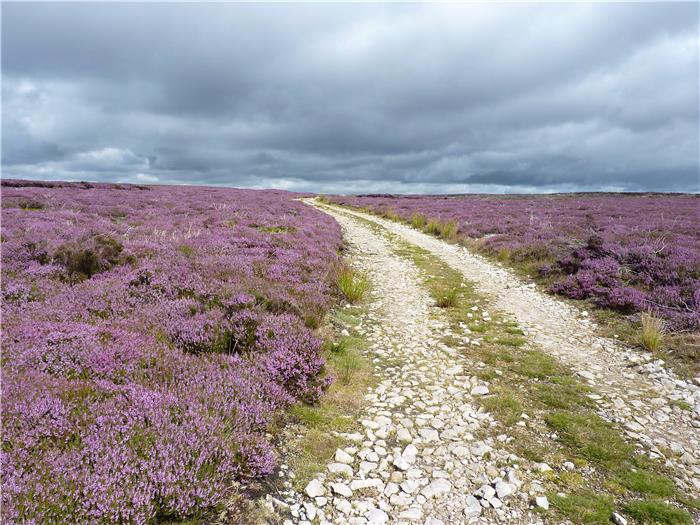
WALK 6: ARDEN GREAT MOOR
As the Hambleton Hills rise to the north they gradually gain in height and the fields and pastures give way to heather moorland. Here, although the sheep still graze, the shooting of grouse becomes dominant with grouse butts and shooter's tracks criss-crossing the moor.
This walk uses the right to roam to follow a series of these tracks across the moor. Along the way you'll come across some surprising reminders of how man has lived on and worked these hills over the ages.
DISTANCE: 9.5 miles / 15.2 km
ASCENT: 1,112 feet / 339 metres
TERRAIN: The route is on moorland track with the opening stretch out of Kepwick up to the moor along a tarmac lane. The climb out of Kepwick to the moor is a long steady one which in places can be a bit steep.
START: Small car park next to the chapel in the village of Kepwick. GR SE 467 909.
TIME: 4¼ to 4¾ hours.
ACCESS: The route uses a mixture of public rights of way and tracks over open access land.
DOGS: Not allowed on the open access land.
FGS Grading
Grading is F4 [ D1, N1, T0, R1, H1]
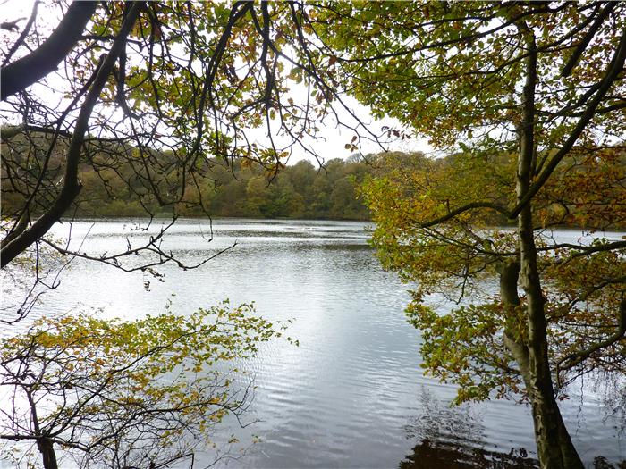
WALK 7: BOLTBY AND GORMIRE LAKE
The west side of the Hambleton Hills is formed by a long escarpment along the top of which runs the Cleveland Way. On the stretch that goes north from Sutton Bank, this provides some outstanding views out over the Vale of Mowbray to the distant reaches of the Pennines.
This walk follows this stretch of the popular long distance trail, discovering some of the hidden secrets from the history of this range of hills. A descent down to the village of Boltby then leads to a low level walk through fields and woods, passing Gormire Lake on the way. There are many tales about this lake and not all of them pleasant. If you believe in the walking dead then be careful, you may see more than you bargain for.
DISTANCE: 7.1 miles / 11.3 km.
ASCENT: 1,060 feet / 323 metres.
TERRAIN: The outward route follows the Cleveland Way along the western edge of the Hambleton Hills and is a fairly easy walk. The route then descends to the village of Boltby which lies below the hills, before returning by field path to Gormire Lake. There then follows a long, and in places steep, climb back up Sutton Bank to the visitor centre.
START: The National Park visitor centre at Sutton Bank. GR SE 516 831 .
TIME: 4 to 4½ hours.
ACCESS: The route is all on public rights of way.
DOGS: As the route is all on public rights of way, then dogs are allowed but please keep them under close control, preferably on a lead. You may want to keep them on a lead anyway as you go along the edge of the escarpment as in places there are cliffs and steep drops. Sheep and cattle will be encountered in some of the fields on the return leg.
FGS GRADING
Grading is T6 [D1, N1, T1, R1, H2]
WALK 8: STUDFOLD AND PRY RIGG PLANTATION
The village of Ampleforth sits along the southern boundary of the North York Moors National Park. To the north lies the southern fringes of the Hambleton Hills while to the south of the village, the countryside becomes more gentle as it merges into the rolling Howardian Hills. This walk starts from Ampleforth and heads north, climbing out of the village to cross the farmland that covers the southern edge of the Hambletons before passing the prehistoric monument of Studfold Ring and entering the Forestry Commission woodland of Pry Rigg Plantation. As with many of the walks on the edge of this range of hills, the walk is dominated by the views across the distant landscape, in this case the Vales of Pickering and York.
DISTANCE: 6 miles / 9.6 km.
ASCENT: 928 feet / 283 metres.
TERRAIN: The route consists of field and woodland paths and tracks, there is one short road section. The stretch through Pry Rigg Plantation may be muddy in bad weather and the winter months. At both the start and end of the walk you go up and down a steep bank but other than that all of the climbs are gradual.
START: The telephone box in the centre of Ampleforth. GR SE 582 787. There is ample on-street parking on the road within the village but be considerate and don't inconvenience the locals.
TIME: 3½ to 4 hours.
ACCESS: The route is all on public rights of way apart from a small section through Pry Rigg Plantation which is on Forestry Commission access land.
DOGS: Dogs are allowed on the footpaths that make up the majority of this walk. They are also allowed through the Forestry Commission's access land at Pry Rigg Plantation although you are asked to keep them on a lead. Although most of the farm land is arable there are still a number of fields where you will encounter livestock (sheep). There are also a number of tall stiles where you may have to help your dog over.
FGS GRADING
Grading is T6 [ D1, N1, T1, R1, H2]
WALK 9: BLACK HAMBLETON
Any walking guide based on a range of hills should, whenever possible, contain a walk going up to the highest point of those hills. This book is no exception with this walk which visits the summit of Black Hambleton, the top that gives its name to this range of hills.
The hills, in turn, give their name to the Hambleton Drove Road, an ancient routeway along the edge of the hills. Sections of this old road are used on some of the other walks in this book but this walk utilises the longest section which, coincidentally, is also used as part of the Cleveland Way.
DISTANCE: 8.1 miles / 12.9 km.
ASCENT: 1,178 feet / 359 metres.
TERRAIN: The majority of this route is on moorland and forest tracks with a section on field paths. There is a road section of just over 2 km on quiet country lanes and the access road to Silton Forest. There are no particularly steep climbs on this walk but there are two long and steady climbs, one from the start up to Black Hambleton and the other through Silton Forest. These two climbs give virtually all of the height gain on this walk.
START: Square Corner parking space above Osmotherley on the Osmotherley to Hawnby road. GR SE 480 959.
TIME: 4 to 4½ hours.
ACCESS: The route is all on public rights of way.
DOGS: As the route is on public rights of way, then dogs are allowed. However, be aware that the fields leading down from the moors and surrounding Nab Farm always contain cattle, often with young calves.
FGS GRADING
Grading is F5 [ D1, N1, T0, R1, H2]