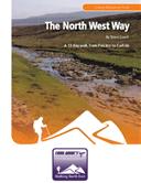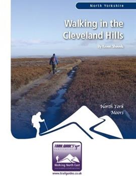
About the Guide
By Keven Shevels
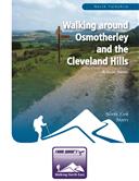
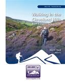
A 112 page full colour A5 booklet describing nine walks, and the history and landscape of the Cleveland Hills, the most northerly part of the North York Moors.
Part of the North York Moors National Park, the Cleveland Hills run along the north-west edge overlooking both Cleveland and Teesside. The name Cleveland coming from the Old English meaning ‘land of the cliffs’ which reflect its rugged escarpments. Here you have the highest points in the National Park, wild windswept heather moorland and wooded escarpments and valleys.
This is a land that saw the footprint of early man and yet was also a catalyst of the Victorian industrial revolution. In a series of nine walks, join the author as he explores this varied area and discovers part of its secret past.
Contents
Contents
Introduction
1. Introduction
2. Access & the Right to Roam
3. The Walks
4. The Weather
5. The Maps
6. Walk Location Map
Walk 1: The Bridestones and Bilsdale 7.8 miles
Walk 2: Commondale Moor 5.8 miles
Wayworth Moor Stone Circle
The Bride Stones
Hob on the Hill
Walk 3: Guisborough Woods 10.3 miles
Cleveland Ironstone
Walk 4: Scugdale and Whorl Hill 5.2 miles
Whorlton Old Church
Whorlton Castle
Walk 5: Baysdale Abbey and Armouth Wath 9.4 miles
Baysdale Head Colliery
Walk 6: Great Ayton Moor and Codhill Heights 8.1 miles
Great Ayton Moor Chambered Cairn
Walk 7: Ingleby Incline and the Thurkilsti 7.3 miles
Rosedale Railway
Walk 8: Quaker’s Causeway and Commondale 7.8 miles
Quakers’ Causeway
Walk 9: Cold Moor and the Garfit Gap 4.6 miles
The Garfit Gap
Appendix
Ferguson Grading System
The Author
Walking North East
Disclaimer
The Walks
WALK 1: THE BRIDESTONES AND BILSDALE.
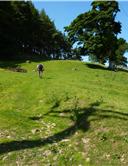
The first walk in the book does a circular of the Bilsdale valley from the village of Chop Gate and illustrates one of the most significant features of the North York Moors, the thousands of Bronze Age burial mounds that lie across the ridges of this upland area. Dating back to a period when the climate was far more favourable than it is now, they help show how well populated the Moors were over 4,000 years ago.
DISTANCE: 7.8 miles / 12.4 km.
ASCENT: 1,539 feet / 469 metres.
TERRAIN: The route is mainly along moorland track with a couple of sections of well-walked field and moorland paths to link them. The route climbs up the side of the valley twice and so there are two long, steady climbs. The descent down from Cock Howe can be steep in places.
START: Chop Gate car park on the B1257 Stokesley to Helmsley road. GR SE 559 993.
TIME: 4 to 4½ hours.
ACCESS: Being pedantic, most of the tracks across the moor, especially Bilsdale West Moor, don’t follow the public right of way, but rather shadow it. However, most people use these tracks rather than the footpaths and so the paths across the moor have become overgrown and in reality the tracks have effectively become the public rights of way.
DOGS: As the route is all on rights of way then dogs are allowed, but please keep them under close control, preferably on a lead. You will be reminded of this many times during the walk. Be aware that you do pass through a couple of farmyards where other dogs may be encountered. Sheep will be met throughout this route.
FGS GRADING
Grading is F5 [ D1, N1, T0, R1, H2]
WALK 2: COMMONDALE MOOR
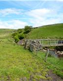
Commondale is a small village in the valley of the River Esk and above the village lies a range of moors that run to the northern edge of the Cleveland Hills. Here the moors provide light and airy walking with views all the way to the coast. These moors also provide the setting for two of the most memorable prehistoric monuments on the North York Moors both of which are visited on this short, but fascinating walk.
DISTANCE: 5.8 miles / 9.3 km.
ASCENT: 659 feet / 201 metres.
TERRAIN: Virtually all the route is on moorland track and path, predominantly track. However, in order to access the stone circle and row of upright stones you do have to walk across open moor with no path, but both of these sections are no longer than 200/300 metres. The main climb is a long steady pull up to the moor ridge from the roadside. There is a short, but quite steep climb after Whiteley Beck is crossed.
START: Car parking space at the side of the Kildale to Commondale road, 800 metres before entering Commondale from the west. GR NZ 657 105.
TIME: 3 to 3½ hours.
ACCESS: The majority of the route is off public rights of way, crossing open access land, especially to visit the prehistoric monuments. Short stretches of footpath are used at both the start and finish of the walk in order to access the moor.
DOGS: Not allowed on the access land.
FGS GRADING
Grading is F3 [ D0, N1, T0, R1, H1]
WALK 3: GUISBOROUGH WOODS
On the northern edge of the Cleveland Hills, the woods around Guisborough hide the remains of a lost industry. For one hundred years ironstone was mined in the Cleveland Hills and it was this that gave birth to the iron and steel industry on Teesside. This walk explores the remains of the mines on this edge of the moors and looks at their legacy.
DISTANCE: 10.3 miles / 16.4 km.
ASCENT: 1,325 feet / 404 metres.
TERRAIN: Mainly on forest track. Most of the climbing on this route could be classed as steady although the climb up alongside Belmont Quarry is steep, but fortunately not too long. The route does go to the top of Highcliffe Nab where there is a long, exposed drop on one side.
START: Guisborough Forest and Walkway Visitor Centre, GR NZ 585 153.
TIME: 4¾ to 5¼ hours.
ACCESS: The route is on Forestry Commission access land. Where there is active forestry operations in progress, please obey all safety notices that you encounter.
DOGS: Dogs are allowed. However, be aware that you will also meet other dogs as the woods are a popular local dog walking area. You will also encounter mountain bikes.
FGS GRADING
Grading is T5 [ D1, N1, T0, R1, H2]
WALK 4: SCUGDALE AND WHORL HILL
A walk along the edge of the Cleveland Hills from the delightful village of Swainby. This could best be described as a walk through a series of woods interspersed by field paths and, as such, is best walked in Spring when the bluebells are in flower.
DISTANCE: 5.2 miles / 8.3 km.
ASCENT: 801 feet / 244 metres.
TERRAIN: Mainly field and woodland paths and tracks. This walk does start and finish with lengthy road walks. The climbing on this walk is more undulating, although there is a fairly steep, but short, climb as you go up Whorl Hill.
START: The main street of Swainby. GR NZ 478 020. There is ample roadside parking along the main street, but park considerately and don’t inconvenience local residents.
TIME: 3 to 3½ hours.
ACCESS: This route is all on public rights of way.
DOGS: As the route is all on rights of way then dogs are allowed, but please keep them under close control. Livestock will be encountered at various stages of this walk and this may include cattle.
FGS GRADING
Grading is T4 [ D0, N1, T0, R1, H2]
WALK 5: BAYSDALE ABBEY AND ARMOUTH WATH
A walk around Baysdale, one of the smallest and most isolated of the dales in the Cleveland Hills. The name Baysdale itself, is derived from the words “Basdale” meaning cow shed valley. This comes from the practice of moving livestock into the steep-sided valley to shelter from the harsh winters. This is also an area that was so infested with wolves that during the 14th century farmers paid their rents in wolf heads and criminals could be freed upon payment of a fine of heads, the number depending upon the severity of the crime. So just in case, be careful of any large dogs that you come across.
DISTANCE: 9.4 miles / 15 km.
ASCENT: 1,424 feet / 434 metres.
TERRAIN: The route is mainly on field or moorland track with a stretch on well-walked moorland path. There are short road sections at both the start and finish of the walk. There is one steepish climb as you make your way up from Baysdale Abbey to the moor of Middle Head. Other than that, the climbs can be considered as steady.
START: The car park at Hob Hole on the Kildale to Westerdale road. GR NZ 652 074.
TIME: 4¾ to 5¼ hours.
ACCESS: The route is all on public rights of way although in one or two places the track that you are following may deviate slightly from the strict right of way.
DOGS: As the route is on rights of way then dogs are allowed. However, livestock will be encountered throughout the route.
FGS GRADING
Grading is F6 [ D1, N1, T1, R1, H2]
WALK 6: GREAT AYTON MOOR AND CODHILL HEIGHTS
The area surrounding Roseberry Topping is a popular walking area, but sometimes being popular is not the same as being well-known and a popular area can still hide secrets. This walk goes across Great Ayton Moor discovering some little known prehistoric monuments and a history that not many people realise.
DISTANCE: 8.1 miles / 12.9 km
ASCENT: 1,260 feet / 384 metres
TERRAIN: The route is on moorland path and track. The main climb is at the start of the walk as you go up to the open moor from the car park. The climbs are more steady than steep unless you visit the top of Roseberry Topping itself.
START: Car park underneath Roseberry Topping on the A173, on the south side of Newton under Roseberry. GR NZ 570 128. There are parking charges on this car park.
TIME: 4 to 4½ hours.
ACCESS: The route uses a mixture of public rights of way and paths over open access land.
DOGS: Not allowed on the open access land.
FGS Grading
Grading is F6 [ D1, N1, T1, R1, H2]
WALK 7: INGLEBY INCLINE AND THE THURKILSTI
For thousands of years the Cleveland Hills have been crossed by old transport routes. In days gone past, man walked on paths across these hills carrying his goods and belongings on his back. After a while that gave way to packhorse trains making their way up and over the ridges of the hills. Eventually, in the days of the ironstone mines, the ingenuity of the Victorian engineer brought the railway to these moors. Not in some quiet way, running easily along the valleys, but straight up the side of the escarpment and then over the wild, windswept moors themselves.
This walk follows two of these routes. A moorland railway built to bring the riches that was ironstone from the mines of Rosedale to the blast furnaces of Teesside and an ancient medieval road that linked York to the towns and villages to the north of the Moors.
DISTANCE: 7.3 miles / 11.6 km.
ASCENT: 997 feet / 304 metres.
TERRAIN: The route is all on track with the outward leg from Bank Foot to Bloworth Crossing being on old railway bed. The remainder is on moorland track. There is a long, steady climb up Ingleby Incline, but after that the route could more accurately be described as undulating.
START: Bank Foot, a short distance to the east of Ingleby Greenhow. Parking is along the side of the track that was once the old railway bed. GR NZ 592 061.
TIME: 3¾ to 4¼ hours.
ACCESS: The route is all on public rights of way.
DOGS: As the route is all on public rights of way, then dogs are allowed, but please keep them under close control, preferably on a lead.
FGS GRADING
Grading is F5 [ D1, N1, T0, R1, H2]
WALK 8: QUAKERS’ CAUSEWAY AND COMMONDALE
As previously stated, routeways have crossed the Cleveland Hills and the North York Moors in general since prehistoric times. This route follows a more modern route that only dates back to the Middle Ages. A stone-paved trod laid so that pack horses and pedestrians could make a safe passage across the moors.
DISTANCE: 7.8 miles / 12.5 km.
ASCENT: 801 feet / 244 metres.
TERRAIN: Most of this walk, other than the section of stone-paved trod that is the Quakers’ Causeway, is on moorland path, some of which can be wet and boggy no matter what time of year it is walked. There is a short section of road walking as you go through the village of Commondale. There are no particularly steep climbs on this walk.
START: Birk Brow car park on the A171 Guisborough to Whitby road. GR NZ 659 148.
TIME: 4¼ to 4¾ hours.
ACCESS: The route is all on public rights of way.
DOGS: As the route is all on public rights of way then dogs are allowed. However, please keep them on a lead, you’ll see many signs reminding you of this. Sheep will be encountered throughout this walk.
REFRESHMENTS ON ROUTE: The Cleveland Inn in the centre of Commondale.
FGS GRADING
Grading is F5 [ D1, N1, T1, R1, H1]
WALK 9: COLD MOOR AND THE GARFIT GAP
A shorter distance walk, but one full of interest as it explores the Garfit Gap which lies below the Wainstones on Hasty Bank. This is an area that is quite enigmatic as it is thought by many to have been sacred and full of meaning to our prehistoric ancestors.
DISTANCE: 4.6 miles / 7.3 km.
ASCENT: 1,112 feet / 339 metres.
TERRAIN: The majority of the route is on forest track or the well-walked Cleveland Way. However, in winter or bad weather, some of these forest tracks may become quite muddy. The short stretch of a couple of hundred metres to visit the mine on the side of Cold Moor involves contouring round the side of a steep hill. There are two long, steady climbs on this walk, following the forest track up to the escarpment and then a steeper climb up the Cleveland Way to the top of Cold Moor.
START: Clay Bank car park on the B1257 Stokesley to Helmsley road. GR NZ 572 036.
TIME: 3 to 3½ hours.
ACCESS: The route is all on public rights of way or open access land either in the forest or on the moor within the Garfit Gap where you explore both the carved stones and the Snake Stone.
DOGS: Dogs are allowed in the forest and on the Cleveland Way as this is a public right of way. Be aware that sheep may be encountered on the open moor and that there are stiles where your dog may need to be lifted over.
FGS GRADING
Grading is F5 [ D0, N1, T1, R1, H2]