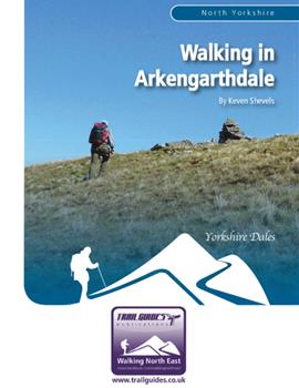
About the Guide
By Keven Shevels
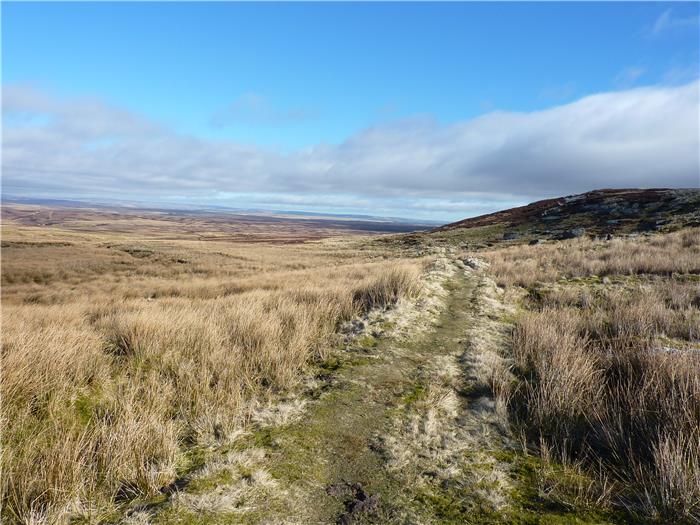
A 112 page full colour A5 booklet describing nine walks, and the history and landscape of the Arkengarthdale, the most northerly of the Yorkshire Dales.
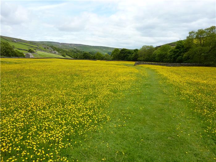
Arkengarthdale, the valley of Arkil’s enclosure and the most northerly of the Yorkshire Dales, the dale that bridges the divide between the high hills of the central Dales in the south and the low-flowing hills that lead to the Stainmore Pass to the north. Although a tributary dale of Swaledale, this is a landscape and a people who have long held their own identity and in many ways is vastly different to it's neighbour to the south.
While this can be a rugged and lonely landscape, it is also one where mankind has carved his mark down through the ages. From the Neolithic stone age to the settlements of the Vikings and then the lead mines of the Victorians, this land has been changed by the hand of man.
Join the author as, in a series of nine walks, he discovers the history and landscape of this valley.
Contents
Contents
1.Introduction
2.Access and the Right to Roam
3.The Walks
4.Weather
5.Maps
6.Facilities, Tourist Information Centres & Websites
7.Lead Mining Glossary
8.Walk Location Map
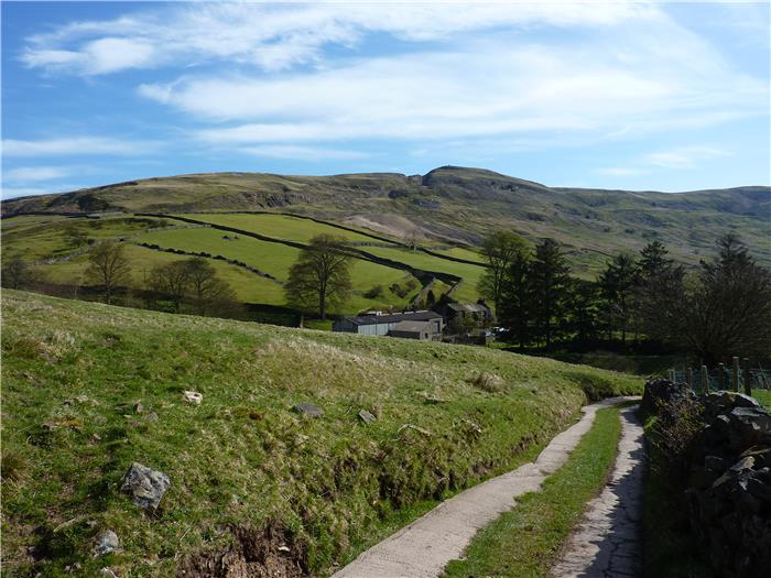
Walk 1: Kitley Hill, Dale Head and Whaw
Bronze Age Settlements
Walk 2: Calver Summit
Cringley Hill Neolithic Enclosure
Walk 3: Reeth Circular
Booze Wood Level
Walk 4: Moulds Side
The CB Mill
Walk 5: Windegg and Slei Gill
Walk 6: Water Crag
Walk 7: Hurst and the Moresdale Road
The Fell End Mines
The Moresdale Road
Walk 8: Cleasby Hill and Hoove
Mud Beck Stone Circle
The Faggergill Mines
Walk 9: Sleightholme Moor and William Gill
Appendix
Ferguson Grading System
The Author
Walking North East Disclaimer
The Walks
WALK 1: KITLEY HILL, DALE HEAD AND WHAW
The northern slopes of Arkengarthdale are dominated by the small, rounded shape of Kitley Hill. In the grand scheme of hills it is not very high and is dwarfed by the bulk of Hoove that lies behind it but its almost perfect conical shape and the fact that it stands alone in front of the main hills behind it mean that the eyes are drawn to it from any part of the upper dale.
Now shown on the OS map as Kitley Hill, this was once known as Kitlaw Hill. The name being a mix of Old Norse and Anglo-Saxon meaning ‘the hill near the cow valley’. This suggests that at one time the land around here was prime grazing land.
DISTANCE: 6.9 mile / 11.1 km.
ASCENT: 1,001 feet / 305 metres.
TERRAIN: Despite the fact that the majority of this route is on public rights of way don't expect to find recognisable paths during the first half of this walk. The route goes over open moor where the paths are not often walked and so, in places, are difficult to follow. The terrain on the section to the farm of Ravens Park is rough but not unduly. From Dale Head the route returns down the length of Arkengarthdale through fields and meadows. There is no real significant climbing on this walk other than the short, steep pull up Kitley Hill itself.
TIME: 4½ to 5 hours
START: Limited roadside parking on the opposite side of the road to the CB Hotel. GR SD 999 030.
ACCESS: This route is all on public rights of way apart from the climb up to the top of Kitley Hill. However, after saying that, the paths across the moor during the first part of the walk are not that defined and it is very easy to lose them but as these moors are access land then it doesn't really present a problem.
DOGS: They are allowed on the public rights of way but keep them under close control, preferably on a lead, as this area is prime sheep grazing land. There are also a number of awkward stiles that mean carrying your dog over plus the route goes through several farmyards where other dogs will be heard if not seen.
FGS GRADING
Grading is F7 [ D1, N1, T2, R1, H2]
WALK 2: CALVER SUMMIT
As you enter Arkengarthdale from Reeth, the entrance to the dale is guarded by the rounded hill of Calver on the left and the cliff faces of Fremington Edge to the right. This is a shorter walk that takes a circular route round and up to the summit of the distinctive Calver Hill, or Mount Calver as it was once known as. Although short in distance, this walk is long in terms of visiting sites of interest. Calver has been used and abused by mankind for over four thousand years and this has left scars on this beautiful hill, in some cases scars that have added to its character, while others not so.
DISTANCE: 4.1 miles / 6.6 km.
ASCENT: 604 feet / 184 metres.
TERRAIN: A mixture of moorland paths and tracks with some walking across open fell to investigate sites of interest. There is one steep climb up to the summit of Calver followed by a fairly steep descent.
TIME: 3 to 3½ hours
START: Large parking space on the right hand side of the road just after passing the Arkle Moor Riding School sign and before descending down into Arkle Town. GR NZ 011 015.
ACCESS: This route follows mixture of public rights of way and paths across open access land.
DOGS: As the walk covers a large portion of open access land then it would be best not to take your dog on this walk.
FGS GRADING
Grading is F6 [ D0, N1, T2, R1, H2]
WALK 3: REETH CIRCULAR
A walk that follows the northern side of the Arkle Beck down from Langthwaite to Reeth and then returns via the southern banks. Along the way it encounters an unexpected mining complex and a stone-walled enigma.
DISTANCE: 6.9 miles / 11 km.
ASCENT: 548 feet / 167 metres.
TERRAIN: This route is mainly comprised of field and riverside paths with a short section of road walking as the route passes through Reeth. There is one stretch where the path goes through an area of reeds next to the Arkle Beck that can be a bit boggy at the best of times but during wet weather can be very squelchy. There is no significant climbing although there are quite a number of small ups and downs as the path follows the side of the beck.
TIME: 3 to 3½ hours.
START: The National Park car park at Langthwaite. GR NZ 005 024.
ACCESS: The route is all on public rights of way.
DOGS: Because the route is all on rights of way then dogs are allowed. However, the vast majority of the route passes through fields that contain sheep and so your dog should be kept under close control, preferably on a lead. There are a number of narrow field stiles where your dog will need to be lifted over.
FGS GRADING
Grading is T4 [ D1, N1, T1, R1, H0]
WALK 4: MOULDS SIDE
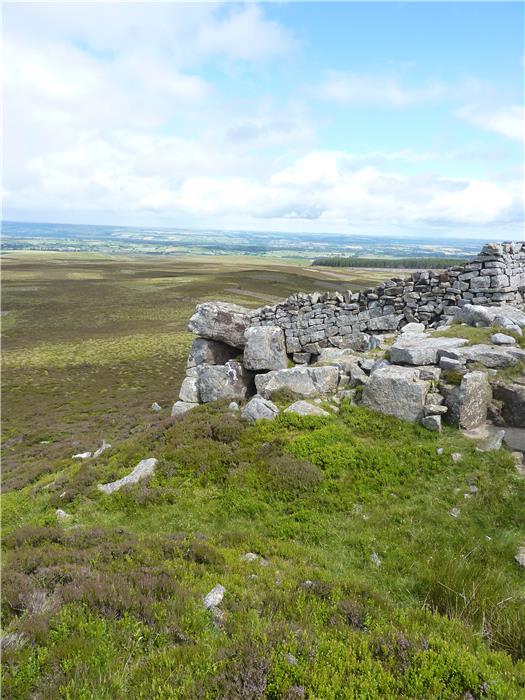
There are estimated to be approximately 10,000 sites from the lead industry surviving in England spanning nearly 3,000 years of mining history from the later Bronze Age, around 1,000 BC, to the present time. Of these, 251 sites have been identified as being of national importance, the landscape at Moulds Side above Langthwaite is one of these that is judged to be of such national importance that it is a scheduled ancient monument. The remains here include a rich multi-period mining landscape containing examples of hush, opencut, shaft and adit mining features. They also include the remains of two early 19th century ore hearth smelt mills along with their extensive flue systems.
The monument includes a number of hushes including Stodart Hush which is considered to be one of the finest examples of a hush in the North Pennines. A hush is a man-made gully excavated in part by using a controlled torrent of water, to reveal and access a vein of lead ore. The name 'hush' is thought to originate from the sound that the water made as it rushed down the gully. These hushes are thought to date to the 17th and 18th century and have a complex water management system of leats, man-made channels, and dams to both gather and move the water to the point of use.
Further up the hillside, above the hushes, lie a number of very large shaft mounds, some up to 4 metres high with a 30 metre diameter. These shafts mostly follow the upper ends of the same veins that the hushes worked, creating a line of mounds as they follow the vein. The shafts being used to go deeper into the veins than the hushes could. The areas between the shaft mounds are often filled with spoil and dressing waste. The line of a vein and its associated workings were often known as a 'rake', the term 'rake' being included in many place names shown on the map.
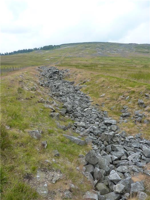
As they were developed during the 18th and 19th centuries, mines became increasingly dependent upon long adits or levels, being driven deep into the sides of the hill. These were dug to give both access to the veins and to also provide drainage for water that gathered in the mine workings. The Danby Lead Level, situated to the north-west of Moulds Side is considered to be a fine example of a stand alone mine based around an adit.
Ore hearth smelt mills were introduced in the 16th century and were continued to be developed and improved up until the late 19th century. Within the Molds Side monument are the remains of two smelt mills, the Octagon Mill and the CB Mill which later replaced it. Fumes from the earlier smelt mill were carried 700 metres along a double arched flue to a chimney on the hillside. Sometime after 1854 a new chimney was built higher up the hillside and connected to the old chimney. This gave a total flue length of almost 1.5 km. The remains of both flues remain laid in the grass on the moor stretching from the side of the road up towards the top of the hill.
This walk takes a tour of Moulds Side, over the landscape of this scheduled monument and discovers some of the history of Arkengarthdale's lead mining past.
DISTANCE: 6.6 miles / 10.6 km.
ASCENT: 991 feet / 302 metres.
TERRAIN: The first part of the walk leading to the hamlet of Whaw is on field paths. From there back to Langthwaite is mainly moorland track followed by a short, 1 km, road walk before following a faint quad track across open moor. There is one long, steady climb to the moor top when you leave Whaw.
TIME: 4½ to 5 hours.
START: Roadside parking space the CB Inn. Langthwaite. GR SD 999 030.
ACCESS: The route is all on public rights of way although in one or two places this is not strictly followed as the moorland track is easier walking than just following the right of way across open moor.
DOGS: Allowed as the route follows rights of way although it would be advisable to keep them under close control, on a lead, due to all the lead workings encountered during this walk. Livestock will be encountered throughout the walk and there is 1 km of road walking.
FGS GRADING
Grading is F6 [ D1, N1, T1, R1, H2]
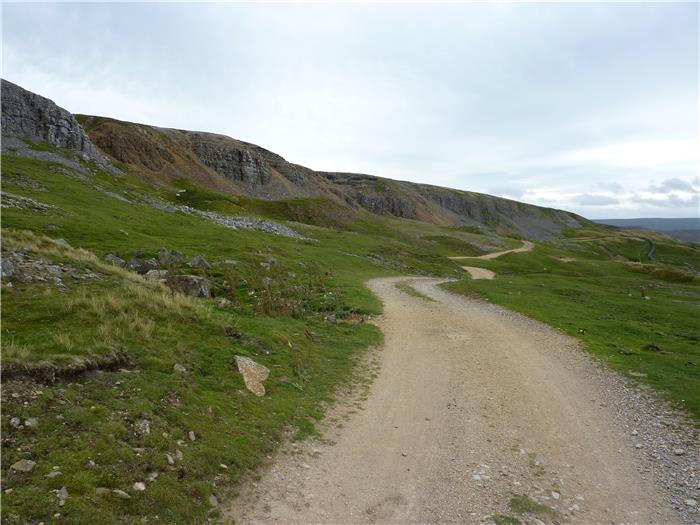
WALK 5: WINDEGG AND SLEI GILL
Barely a foot can be placed within Arkengarthdale without going over one mining ground or another. This walk follows old miner's paths and tracks up to Windegg Scar and the lead veins that were exposed there during the formation of the valley and which were then subsequently exploited by open cast workings. The route then returns via the small valley of Slei Gill which, despite its size, was one of the most heavily mined areas in the dale, an activity that has left a strange rugged beauty within the gill.
DISTANCE: 5.6 miles / 8.9 km.
ASCENT: 984 feet / 300 metres.
TERRAIN: Mainly field and moorland paths and tracks. There is a little bit of a scramble as you enter Slei Gill above the ruins of the waterwheel building but this is only for a couple of metres and not too serious. The climb on this walk is more long and steady rather than being steep.
TIME: 3½ to 4 hours.
START: The car park as you enter Langthwaite from the direction of Reeth. GR NZ 005 023.
ACCESS: The route is mainly on public rights of way although at times the track may deviate from the strict right of way. The path from the shooting hut down into Slei Gill is over access land but once in the Gill itself, then follows a public right of way back to Langthwaite.
DOGS: Allowed on the public rights of way. However, this is sheep grazing and grouse shooting land so please keep them on a lead especially during the nesting season for ground-nesting birds, between May and July. You may want to keep them on a lead anyway as the mining activity has left a number of 'holes' in the ground that you wouldn't want your dog to explore.
FGS GRADING
Grading is F5 [ D0, N1, T1, R1, H2]
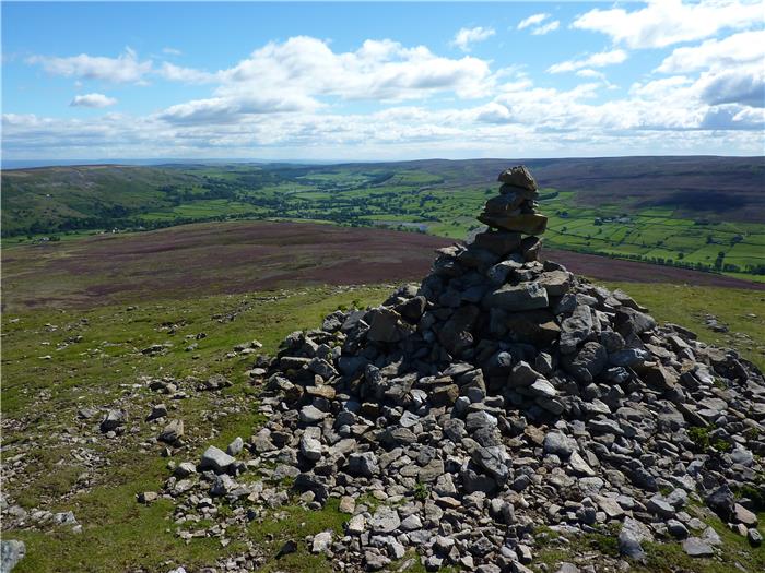
WALK 6: WATER CRAG
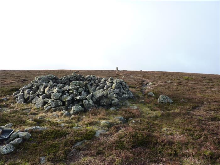
The waters of the Arkle Beck gather on the slopes of Water Crag, the highest point on the Arkengarthdale watershed. Rising to 668 metres (2,192 feet) this hill would qualify as a HEWITT (Hills in England, Wales and Ireland over Two Thousand feet) but for the close proximity of Rogan's Seat 1½ kms away to the south. Although a much more bland hill than Water Crag, Rogan's Seat has the advantage of 672 metres (2,205 feet) in height with insufficient drop between the two for Water Crag to qualify as a summit in its own right.
Out of the two hills, it is Water Crag that has the character and deserves to be the recognised top. It has a distinguishable summit complete with large stone windshelter, it has a trig point, it has a large stone cairn and the tramp across the open moor to get to its top is a worthy challenge to the hill walker.
DISTANCE: 8.1 miles / 12.9 km.
ASCENT: 932 feet / 284 metres.
TERRAIN: This route is all on open moor. The first half of the walk to Punchard Gill Coal Level is on a relatively easily followed path. The second half of the walk from the Coal Level over the top of Water Crag and back to the Tan Hill Inn is over open, pathless moor which at times can be quite hard going and involves bog-hopping and crossing peat hags.
TIME: 4 to 4½ hours.
START: The Tan Hill Inn at the head of Arkengarthdale. GR NY 897 067.
PARKING: Road side parking opposite the Inn.
ACCESS: The first half of the walk to Punchard Gill Coal Level is on public rights of way, i.e. a bridleway. After that you cross open access land to gain the top of Water Crag and return back to Tan Hill.
DOGS: Not allowed on the access land.
FGS GRADING
Grading is F9 [ D1, N2, T3, R2, H1]
WALK 7: HURST AND THE MORESDALE ROAD
A walk for those who prefer a longer distance and like to make a full day out of it. This walk climbs up over Fremington Edge and descends down into the small valleys beyond, that area known as the New Forest, before coming back over the Moresdale Ridge following what is thought to be an ancient routeway. This is a walk of distant horizons, where the views stretch far out in front and give the sense of wide open spaces where you could just walk forever.
DISTANCE: 9.9 miles / 15.8 km.
ASCENT: 1,555 feet / 474 metres.
TERRAIN: The walk is nearly all on moorland track with a section on quiet country lane. Towards the beginning of the walk there is a long, steep climb from Storthwaite Hall up through the old mine workings on Fell End to the top of the moor but after this the climbs are more long and gradual.
TIME: 4½ to 5 hours.
START: Langthwaite car park at the eastern end of the village. GR NZ 005 023
ACCESS: The route is all on public rights of way.
DOGS: As the route is all on rights of way then dogs are allowed. However, please keep them under close control as livestock is encountered throughout the walk and there is also a number of old mining sites, complete with holes and cavities, that you pass through.
FGS GRADING
Grading is F7 [ D1, N1, T1, R2, H2]
WALK 8: CLEASBY HILL AND HOOVE
In the upper dale the hills on the northern side are relatively low-lying and flow down into the Stainmore Gap, the pass between the high Pennines that has been used as a routeway through the hills since man first tentatively expanded away from the coast. But don't make the mistake of not treating these hills seriously, this is a little walked part of the dale with very few footpaths crossing these wide open spaces, it is a wild area where you walk pathless moor and cross peat hags that rear higher than you stand.
However, because this is Arkengarthdale, this is also a walk that can give an unexpected boost to those who enjoy getting away from the beaten path and one that, if you know where to look, can reveal some hidden secrets, a little-known Neolithic Stone Circle, some strangely marked stones next to an isolated crag and the remains of the last working lead mines in the Swaledale orefields.
DISTANCE: 8.4 miles / 13.4 km.
ASCENT: 994 feet / 303 metres.
TERRAIN: Most of this walk is over rough country with very few paths or tracks until the latter stages of the walk. On the higher hills you will be walking in areas of upland bog which in dry weather is not too much of a problem but at the back end of the year or in wet weather can be quite squelchy. There are also areas where you will have to negotiate quite deep peat hags, some seven or eight foot deep. The climbs on this walk are not too steep, more prolonged and steady but because of the terrain crossed will seem a lot harder.
TIME: 4¾ to 5¼ hours.
START: Car parking area next to the road, 100 metres to the west of Beck Crooks Bridge, three miles east of the Tan Hill Inn. GR NY 947 072.
ACCESS: This route is all across public access land.
DOGS: Dogs are not allowed on the access land.
FGS GRADING
Grading is F9 [ D1, N2, T3, R2, H1]
WALK 9: SLEIGHTHOLME MOOR AND WILLIAM GILL
In its lower reaches, Arkengarthdale is very like Swaledale, a narrow rugged valley. However, when you get to the upper reaches, the northern side of the valley opens up into a spread of low moorland ridges that descend down into the distant Stainmore Gap and its crossing of the Pennine range. Flowing across the county border from North Yorkshire into Durham, this moorland presents a wide open landscape where the horizon just seems to go on forever. Across this the Pennine Way makes its way northwards, leaving the Tan Hill Inn, the highest and probably the most isolated, public house in the country, to cross a wide open space of heather and moor grass.
This walk follows the Pennine Way as it descends down into the valley of the Frumming Beck and then returns via an ancient routeway that links the village of Bowes with Upper Arkengarthdale before climbing up the isolated valley of the William Gill to the very watershed of Arkengarthdale and the opportunity to visit a little know coal mine.
DISTANCE: 8.6 miles / 13.8 km
ASCENT: 807 feet / 246 metres
TERRAIN: Half of the walk is along well-surfaced vehicle tracks. However, the other half is across open moor which means wet, boggy ground underfoot and, with the high level return to Tan Hill from William Gill Colliery, you will also encounter one or two peat hags along the way. There is one long, sustained climb up William Gill to the colliery which sits atop the Swaledale/Arkengarthdale watershed and an equally as long but not as steep climb as you follow the Sleightholme Moor Road back up to the Arkengarthdale Road.
START: The Tan Hill Inn at the top end of Arkengarthdale. Roadside parking opposite the inn. GR NY 897 066.
TIME: 3¾ to 4¼ hours.
ACCESS: Most of the route is on public rights of way. However, the trip up to William Gill Colliery and from there back to Tan Hill is over access land.
DOGS: Not allowed on the access land.
FGS GRADING
Grading is F7 [ D1, N2, T2, R2, H0]