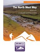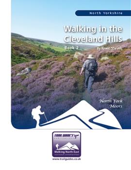
About the Guide
A 112 page full colour A5 booklet describing nine walks, and the history and landscape of the Cleveland Hills, the most northerly part of the North York Moors.Part of the North York Moors National Park, the Cleveland Hills run along the north-west edge overlooking both Cleveland and Teesside. The name Cleveland coming from the Old English meaning land of the cliffs which reflect its rugged escarpments.
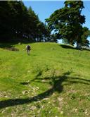
Here you have the highest points in the National Park, wild windswept heather moorland and wooded escarpments and valleys.
This is a land that saw the footprint of early man and yet was also a catalyst of the Victorian industrial revolution. In this, the authors second book of walks on this area, he further explores this varied area and discovers more of its secret past.
Contents
Contents
Introduction
1. Introduction
2. Access & the Right to Roam
3. The Walks
4. The Weather
5. The Maps
6. Walk Location Map
Walk 1: Carlton Bank and Knolls End 5.6 miles
Walk 2: Warren Moor and Leven Vale 5.8 miles
The Warren Moor Mine
Walk 3: The Back of Cock Howe 6.8 miles
Walk 4: Wetherhouse Moor 5.9 miles
Walk 5: Three Crosses and a Leaping Fish 7.9 miles
Walk 6: Round Hill and Greenhow Plantation 7.5 miles
Walk 7: Captain Cooks Country 8.0 miles
Walk 8: Osmotherley and Near Moors 6.1 miles
Walk 9: Fat Betty 8.7 miles
Appendix
Ferguson Grading System
The Author
Walking North East
Disclaimer
The Walks
WALK 1: CARLTON BANK AND KNOLLS END.A walk that takes advantage of the Cleveland Way to show-off the rugged escarpment that fringes the edge of the Cleveland Hills and shows exactly where the name Cleveland came from. Along the way it discovers and visits some little known prehistoric remains, part of a large number that lie scattered across these hilltops.
DISTANCE: 5.6 miles / 9.0 km.
ASCENT: 1,007 feet / 307 metres.
TERRAIN: Moorland paths and track, the majority of which are well defined. There is one km of faint, but distinguishable path as the walk goes round the side of Round Hill. Access to some of the prehistoric features may involve walking across short distances of open moor. There is one long, steady climb up Carlton Bank at the start of the walk.
START: The car park at Lordstones Country Park. GR NZ 525 030.
TIME: 3½ to 4 hours.
ACCESS: The first half of the walk along the Cleveland Way is, as you would expect, along public rights of way. The second half takes advantage of using open access land.
DOGS: Not allowed on the open access land.
FGS GRADING
Grading is F5 [ D0, N1, T1, R1, H2]
WALK 2: WARREN MOOR AND LEVEN VALE
This is a shorter walk that takes in the birth place of the River Leven on the sides of Warren Moor before encountering it again in its infant form as you cross the Leven Vale.
Along the way youll pass the ancient settlement of Baysdale and also find a reminder of ironstone mining, the industry that gave birth to Teesside itself.
DISTANCE: 5.8 miles / 9.3 km.
ASCENT: 994 feet / 303 metres.
TERRAIN: Field and moorland paths and tracks, there are also a couple of sections of quiet country road. There is a long, steady climb to the top of Warren Moor at the start of the walk and then two further climbs as the walk progresses.
START: Small roadside parking space on the right as you enter the village of Kildale from the west. GR NZ 607 093. If this parking space is full then there is alternative parking at Kildale station.
TIME: 3¼ to 3¾ hours.
ACCESS: This route is all on public rights of way.
DOGS: As the route is on public rights of way then dogs are allowed. However, please keep them under close control preferably on a lead. Sheep will certainly be encountered on this walk and cattle may also be met in one or two of the fields.
FGS GRADING
Grading is F5 [ D0, N1, T1, R1, H2]
WALK 3: THE BACK OF COCK HOWE
Behind Cock Howe lies a series of high moorland ridges interspersed by small valleys. These provide the opportunity for some pleasant open moorland walking.
This is a shorter distance walk along a couple of these ridges. Perfect for those shorter winter days when the sun is low and the cold wind blows around those places where a cold wind shouldnt blow. However, it can give the chance of some high winter sunshine over views of the distant hills of these moors.
DISTANCE: 6.8 miles / 10.9 km.
ASCENT: 1,181 feet / 360 metres.
TERRAIN: Apart from the path up to and then back down from Cock Howe itself, the route is all on moorland tracks. The climb up to Cock Howe is long and, in places, quite steep. This means that the descent is also steep. In wet weather this may be slippery so care must be taken.
START: Large car park next to the village hall on the eastern side of Chop Gate in Bilsdale. GR SE 559 993.
TIME: 4 to 4¼ hours.
ACCESS: This route uses a mixture of public rights of way and open access land.
DOGS: Not allowed on the access land.
FGS GRADING
Grading is F5 [ D1, N1, T0, R1, H2]
WALK 4: WETHERHOUSE MOOR
A moorland walk that takes you to a little-walked moor and side valley on the southern edge of the Cleveland Hills. Its one of those walks where youd be unlucky to meet hordes of people.
DISTANCE: 5.9 miles / 9.5 km.
ASCENT: 932 feet / 284 metres.
TERRAIN: Mainly moorland paths and tracks. This walk is probably best done away from the height of summer when the path back down into Fangdale Beck encounters a great deal of head-high bracken. The main climb on this walk is as you leave the valley floor to go up to the moor and, in places, is quite steep.
START: Small parking space immediately over the bridge across the River Seph just after leaving the B1257 to go to Fangdale Beck. GR SE 572 947. TIME: 3 to 3½ hours.
ACCESS: A mixture of public rights of way and open access land is used on this walk.
DOGS: Not allowed on the access land.
FGS GRADING
Grading is F5 [ D0, N1, T1, R1, H2]
WALK 5: THREE CROSSES AND A LEAPING FISH
A walk from the village of Commondale that takes in the northern moors passing as it does the sites of three old moorland crosses, markers that helped guide travellers across these high moors. On its return the route utilises part of the Esk Valley Walk, a route that follows the River Esk from source to sea. The symbol of this walk being a leaping salmon.
DISTANCE: 7.9 miles / 12.7 km.
ASCENT: 833 feet / 254 metres.
TERRAIN: Mixed, incorporating moorland paths and tracks, field paths and tracks and even some woodland walking. There are also a couple of short road stretches mainly towards the start and finish of the walk. The climbing on this route is mainly at the start of the walk as you leave Commondale and go up to Three Howes Rigg. After this the climbing is more of an undulating nature.
START: The crossroads at the centre of Commondale, outside the Cleveland Inn. GR NZ 663 105. There is roadside parking within Commondale, but please dont inconvenience local residents.
TIME: 4 to 4½ hours.
ACCESS: In principle the route is all on public rights of way, however, the path followed across Danby Low Moor is very different compared to the official bridleway which does not exist on the ground. This causes no real problem as this is open access land.
DOGS: Not allowed on the access land.
FGS GRADING
Grading is F5 [ D1, N1, T1, R1, H1]
WALK 6: ROUND HILL AND GREENHOW PLANTATION
Round Hill stands at 1,490 feet, 454 metres, making it both the highest spot in the Cleveland Hills and also the highest spot on the North York Moors. The trig point that marks the top of the hill is easily reached as it stands only a short distance away from the Cleveland Way, the popular long distance national trail.
This walk utilises the Cleveland Way to cross the top of Urra Moor, of which Round Hill is the summit, and then returns through the plantations of the Forestry Commission that line the side of the escarpment at this point.
DISTANCE: 7.5 miles / 12.0 km
ASCENT: 1,184 feet / 361 metres
TERRAIN: The route is on wide, well-established moorland path and track and also forest track. The main climb is at the start of the walk as you go up to Carr Ridge from the B1257 road. This climb is long and steep.
START: Clay Bank car park along the B1257 Stokesley to Helmsley road. GR NZ 572 036.
TIME: 3¾ to 4¼ hours.
ACCESS: The route uses public rights of way throughout the moorland stretch of the walk and then follows tracks across Forestry Commission access land for the remainder.
DOGS: With the route utilising public rights of way and Forestry Commission land then dogs are allowed. However, please keep them under close control as sheep will be encountered throughout the whole of the moor as will ground-nesting birds during May to July.
FGS Grading
Grading is F5 [ D1, N1, T0, R1, H2]
WALK 7: CAPTAIN COOKS COUNTRY
Nestling below the Cleveland Hills escarpment lies the beautiful village of Great Ayton. Now very much a suburb of Teesside, the village has close associations with the renowned navigator Captain James Cook. Indeed the village hosts a small museum that is dedicated to the explorer and which is well-worth a visit as is a walk round the village itself.
This walk follows field and woodland paths through countryside that would have been well-known to Cook and visits a local landmark, a stone obelisk erected in 1827 in memory of the mariner.
DISTANCE: 8.0 miles / 12.8 km.
ASCENT: 1,224 feet / 373 metres.
TERRAIN: Mainly field and woodland paths and tracks. There are two substantial climbs on this walk, one relatively short as you go up through Cliff Ridge Wood and the other longer and steeper as you go up Ayton Banks towards Captain Cooks Monument.
START: The car park at Great Ayton tourist information centre in the centre of the village. GR NZ 563 107. If the car park is full then there is ample roadside parking within the village itself.
TIME: 4½ to 5 hours.
ACCESS: The route is all on public rights of way.
DOGS: As the route is all on public rights of way, then dogs are allowed, but please keep them under close control, preferably on a lead. On the test walk only a few sheep were encountered in the fields around Aireyholme Farm, but that is not to say that there wouldnt be any cattle in the lower fields below the escarpment during the summer months. There are a couple of fairly lengthy road sections on this walk.
FGS GRADING
Grading is T6 [ D1, N1, T1, R1, H2]
WALK 8: OSMOTHERLEY AND NEAR MOORS
A walk at the southern end of the Cleveland Hills on the moors above Osmotherley. A relatively easy walk, but one that makes some surprising discoveries.
DISTANCE: 6.1 miles / 9.7 km.
ASCENT: 495 feet / 151 metres.
TERRAIN: Mainly moorland tracks. There is one short section, following Solomons Lane, where the track as shown on the OS map does not exist on the ground and you do follow rough paths over the moor. There is not a lot of climbing on this walk and it is more gradual than steep.
START: The Sheep Wash car park next to Cod Beck Reservoir near Osmotherley. GR SE 469 994.
TIME: 3 to 3½ hours.
ACCESS: This route is mainly across open access land.
DOGS: Not allowed on the access land.
FGS GRADING
Grading is F3 [ D1, N1, T0, R1, H0]
WALK 9: FAT BETTY
Fat Betty sits on a junction of three high moorland ridges. Fat Betty, otherwise known as the White Cross, is one of a number of Medieval wayside crosses that stand on the North York Moors. The route also passes close by to another of these crosses, Young Ralph Cross, this lies a short distance away and is easily visited.
DISTANCE: 8.7 miles / 13.9 km.
ASCENT: 1,152 feet / 351 metres.
TERRAIN: A very varied route taking in everything from field paths and tracks to indistinct moorland paths and also includes a couple of road sections. The bulk of the climbing is towards the beginning of the walk as you go from Broad Gate Farm up to Fat Betty.
START: Westerdale. GR NZ 664 060. There is adequate roadside parking within the village, but please dont inconvenience local residents.
TIME: 5 to 5½ hours.
ACCESS: The route uses a mixture of public rights of way and open access land.
DOGS: Not allowed on the open access land.
FGS GRADING
Grading is F7 [ D1, N1, T2, R1, H2]