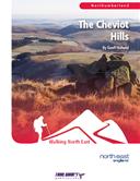
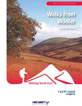
skip to main content
walks from wooler
Walking in Northumberland

Walks from Wooler

ISBN 978-1-905444-51-9

Buy This Now

Please choose which format you would like to purchase this product in.

Postage:

  • £1.40 per book to the UK.
  • £3.42 per book to Ireland and Europe.
  • £4.62 per book to the rest of the World.

About the Guide


By Geoff Holland.

The third edition of this popular book is now available in full colour. With a revised layout and even more photos to help guide the walker this publication has now been expanded to 108 pages.

108 page full colour A5 book containing details of eight walks in the northern Cheviots based on the town of Wooler. The book contains detailed walk descriptions, grid references and detail sketch maps.

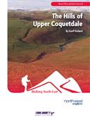
A huge amount of rain has trickled down the burns of the Cheviot Hills since W. Ford Robertson's book, 'Walks from Wooler' was first published in 1926 and, at first sight, the hills seem pretty much the same as they did all those years ago. Yet there has been change, that much is inevitable. This book, by the author of the popular book of walks 'The Cheviot Hills', sets out to discover how that change has affected route descriptions now more than 80 years old and to find out whether those routes are still relevant to the 21st century walker.On eight totally new self-guided walks, this book peeps into a walking past whilst keeping both feet firmly planted in a high-tech walking present. Along the way, it uncovers a world of tackety boots and stout sticks.

The Walks

WALK 1: COLD LAW CONSIDERED
On this walk, as you wander across the slopes of the 452 metre high Cold Law, you will hear the chatter of nearby burns, feel the wind sweep across the neighbouring hills and enjoy lonely, faraway views.
DISTANCE: 6.25 miles (10.1 km) ASCENT: 1214 feet (370 metres)
START: Carey Burn Bridge, Harthope Valley (GR NT976250)
TERRAIN: Relatively clear paths and tracks, many green, and a stretch of tarmac
FGS Grading F8 [ D1, N2, T1, R2, H2]

WALK 2:  A WALK TO THE POLE
This walk follows a quiet course to the summit of the mighty Cheviot crossing, along the way, the cairn-capped top of the rarely visited Blackseat Hill.
DISTANCE: 8.5 miles (13.7 km) ASCENT: 2380 feet (725 metres)
START: Hawsen Burn, Harthope Valley (GR NT954225)
TERRAIN: Mixed fell with a variety of paths and tracks, some rough and boggy
FGS Grading F10 [ D1, N2, T2, R2, H3]

WALK 3: THE ROAD TO TOM TALLON`S CRAG
This walk strides out across acres of windswept heather moor on its outward journey to the rocky outcrop viewpoint of Tom Tallon`s Crag.
DISTANCE: 9.25 miles (14.9 km) ASCENT: 1330 feet (405 metres)
START: The Market Place, Wooler (GR NT993280)
TERRAIN: Generally good paths and tracks, many of which are green, with the odd boggy patch. Two stretches of tarmac.
FGS Grading F9 [ D1, N2, T2, R2, H2]

WALK 4: THE HART HEUGH GLIDDERS
This walk starts in the centre of Wooler and follows a long-neglected route before visiting the tops of Hart Heugh and Brown`s Law.
DISTANCE: 8.25 miles (13.3 km) ASCENT: 1263 feet (385 metres)
START: The Market Place, Wooler (GR NT993280)
TERRAIN: Generally good paths and tracks, many of which are green. Some stretches of tarmac.
FGS Grading F8 [ D1, N2, T1, R2, H2]

WALK 5: HIGH ABOVE THE COLLEGE BURN
On this walk you will follow the ruler-straight valley of the College Burn, considered by many by many to be the finest valley in the county.
DISTANCE: 9.75 miles (15.7 km) ASCENT: 1362 feet (415 metres)
START: Hethpool, College Valley (GR NT893280)
TERRAIN: Mainly clear paths and tracks, some quite rough, and a stretch of tarmac
FGS Grading F9 [ D1, N2, T2, R2, H2]

WALK 6: THE  EASTERN FRINGE
This walk finds its own way to the high ground of Brands Hill exploring on its way the eastern edge of the Northumberland National Park.
DISTANCE: 6.5 miles (10.5 km) ASCENT: 1115 feet (340 metres)
START: Near Langlee, Harthope Valley (GR NT963233)
TERRAIN: Mainly good, clear tracks and paths throughout
FGS Grading F8 [ D1, N2, T1, R2, H2]

WALK 7: FROM VALLEY FLOOR TO SUMMIT CAIRN
This walk visits two of the area`s most popular crags before climbing the steep, north-eastern slopes of Hedgehope Hill.
DISTANCE: 8.25 miles (13.3 km) ASCENT: 1952 feet (595 metres)
START: Hawsen Burn, Harthope Valley (GR NT953225)
TERRAIN: Mainly clear, thin paths over sometimes rough and boggy ground. A stretch of gravel track and tarmac road.
FGS Grading F9 [ D1, N2, T2, R2, H2]

WALK 8: THE LAMBDEN VALLEY HILLS
On the northern side of the valley rise three often-ignored hills that are linked together in this walk.
DISTANCE: 7.5 miles (12.1 km) ASCENT: 2083 feet (635 metres)
START: Hawsen Burn, Harthope Valley (GR NT954225)
TERRAIN: Mainly clear tracks, paths and traces, in places rough, and one short stretch of tarmac.
FGS Grading F10 [ D1, N2, T2, R2, H3]

Customer Reviews

What do our customers think about this guide?

The Great Outdoors (TGO) January 2013

says:

Wooler is a town in Northumberland, situated on the edge of the Cheviot Hills, and gives easy access to large chunks of the National Park. It is a popular destination for walkers and cyclists. Walks from Wooler, unlike other Trailguides, is essentially an update of a book of the same title written by W Ford Robertson and published in 1926. This version is written by Geoff Holland, author of numerous walking guides to the North of England and contributor to various magazines including TGO.


The book has the same clean layout of the other Trailguides publications that I have seen. The introduction explains how Geoff came to write the book, and also contains sections devoted to: how to use the book, information and history of the area, access, weather, and accommodation among others.


There are eight walks contained within the guide. Distance, terrain, and average time are included, as you would expect, grid references to key points on the route are also given. Each walk is then broken down and described in great detail, accompanied by numerous photographs taken by the author.


Don’t expect up to date OS mapping with the route marked; that is not Trailguides’ style. What you do get are clear diagrams based on old OS one-inch maps. All the information required is there, however, a little work is expected of the reader. No bad thing.


Contained within the text are numerous quotes from W Ford Robertson, which add to the entertainment value provided by this book. It really is a good read, a great introduction to a beautiful part of the country, and a useful addition to the bookshelf.

Strider, the Journal of the Long Distance Walkers Association. December 2012.

says:


Walks from Wooler


This paperback presents eight walks based loosely on those in a book with the same title by W. Ford Robertson, published in 1926. The starting points of the walks are easily accessible from Wooler, just south of the Scottish border.


Each walk is from 6 to 10 miles in length, with a detailed description and sketch map, and good colour illustrations. Walks to the higher tops of The Cheviot and Hedgehope Hill are included, but the reader is also taken to less well-known gems of this delightful area.


The author is passionate and knowledgeable about the Cheviots (he has authored several other books on the area) and his comparisons of walking in Robertson's time with today make the book all the more interesting.


Paul Mitchinson North East Guides September 2012

says:


Another cracking little book from Trailguides. This one however, is a little different. It is essentially an update of a book of the same title, written by W. Ford Robertson, and published in 1926.

This version is written by Geoff Holland, author of numerous walking guides to the North of England, and contributor to various magazines.

The book has the same clean layout of the other Trailguides publications that I have seen, inside and out. The introduction explains how Geoff came to write the book, and also contains sections devoted to: how to use the book, information and history of the area, access, weather, and accommodation to name a few.

Wooler is a town in Northumberland, situated on the edge of the Cheviot Hills, and gives easy access to large chunks of the National Park. It is a popular destination for walkers and cyclists.

There are eight walks contained within the guide. Distance, terrain, and time are included as you would expect, grid references to key points on the route are also given. Each walk is then broken down and described in great detail, accompanied by numerous photographs taken by the author.

Don't expect up to date OS mapping, with the route marked: that is not Trailguides' style. What you do get, are clear diagrams based on old OS one inch maps. All the information required is there,  however a little work is expected of the reader. Which can be no bad thing!

Contained within the text are numerous quotes from W. Ford Robertson, which add to the entertainment value provided by this book. It really is a good read, a great introduction to a beautiful part of the country, and a useful addition to the bookshelf.

Walking Pages Website

says:


Each of the walks has clearly written route finding directions and practical information includes distance, ascent, terrain, walking time and grid references for identifiable locations along the route. Each walk has also been assigned a Ferguson Grading System rating. There are no maps, but it is essential when walking in the Cheviot Hills to carry an OS Explorer map and compass.

Newsletter Signup

Submit your email address to keep up to date with latest news & new releases.