About the Guide
By Keven Shevels
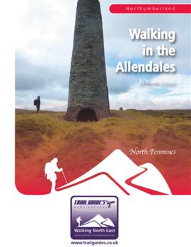
A 112 page full colour A5 booklet describing nine walks, and the history and landscape of the East and West Allendale valleys in Northumberland's North Pennines.
Rising in the North Pennines, on the Durham/Northumberland border, two rivers, the East and West Allen, flow northwards to join and then, ultimately, enter the River South Tyne. Here, within sight of the high Pennines, these rivers have created two rugged little valleys that for centuries were part of the ‘lead dales', the North Pennines Orefield that dominated the world's lead industry.
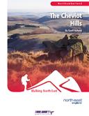
Here the landscape has a different look and feel to it than the other more popular walking areas of Northumberland such as the Cheviot Hills or Hadrian's Wall. Travelling from the high moors to the wooded valleys, join the author as, in a series of nine walks, he explores both the landscape and the heritage of these two dales and discovers what makes them so special.
Contents
Contents
Introduction
1. Introduction
2. Access & the Right to Roam
3. The Walks
4. The Weather
5. The Maps
6. Villages, Refreshments, Accommodation, Visitor Centres and Websites
7. Walk Location Map
Walk 1: Burntridge Moor and the Rowley Burn
Walk 2: The West Allen Valley
Walk 3: Allenheads Circular
Allenheads
Walk 4: Mohope
Walk 5: Rebel Hill and Greenrigg Moor
Walk 6: The River East Allen
The Allen Smelt Mill
Walk 7: Wellhope and Coalcleugh
The Coalcleugh Mines
Walk 8: The Chimneys and Brownley Hill
Flues and Chimneys
Walk 9: Killhope Law
Appendix
Ferguson Grading System
The Author
Walking North East
Disclaimer
The Walks
WALK 1: BURNTRIDGE MOOR AND THE ROWLEY BURN
The low moors to the east of Allendale Town make for excellent walking and despite their lack of height provide an eye-catching vista down and over the Tyne Valley. This walk follows a bridleway across Burntridge Moor to the isolated valley of the Rowley Burn, the bridleway being a descendent of one of the old packhorse routes linking the lead mines of the dale with the shipping ports of the River Tyne. The route then follows another old packhorse route back across the moor to Allendale.
DISTANCE: 10.6 miles / 17 km.
ASCENT: 994 feet / 3,003 metres.
TERRAIN: This route is mainly on field and moorland path and track with two road sections, one at the start and one at the end. The walk does cross the Rowley Burn without the use of a bridge and here, as the stream is quite wide, you are virtually guaranteed to get your feet wet. In times of bad weather or when water levels are high then it might be prudent to do another walk. In the main, the climbing is more long and gradual rather than steep.
TIME: 4¾ to 5¼ hours.
START: The centre of Allendale Town. GR NY 837 558. There is ample parking in the village centre.
MAP: OL43 Hadrian's Wall.
ACCESS: The route is all on public rights of way.
DOGS: As the route is on rights of way then dogs are allowed. However, there are signs at the entrances to the moors requesting that they be kept on a lead and stating that they are not allowed on the access land, off the path. Sheep will be encountered on the moor at most times of the year and although we didn't encounter any on the test walk, there was plenty of evidence that cattle were kept in the fields around the Rowley Burn.
FGS GRADING
Grading is F4 [D1, N1, T1, R1, H0]
WALK 2: THE WEST ALLEN VALLEY.
A walk that explores the lower reaches of West Allendale. Here there is no large villages, just farms either singularly or in small groups scattered through the dale. The starting point for the walk is the Keenley Crossroads, a location that perfectly illustrates the distribution of the population. An isolated spot that is central to all and one that becomes the meeting place for all, hence the perfect location for school and church. And also the start of this walk.
DISTANCE: 5.7 miles / 9.1 km.
ASCENT: 942 feet / 287 metres.
TERRAIN: Mainly field and woodland paths and tracks. There is a lengthy road walk along a quiet country lane at the start of this route. There are two short but steep climbs on this walk.
TIME: 3¼ to 3¾ hours.
START: Parking space at the side of the road at Keenleywell House crossroads above West Allendale. GR NY 798 570.
MAP: OL 43 Hadrian's Wall.
ACCESS: The route is all on public rights of way.
DOGS: As the walk is all on public rights of way then dogs are allowed on this walk. However, please keep them under close control, preferably on a lead, as livestock, including cattle will be encountered at various stages through this walk and there is also pheasant rearing and shooting in Monk Woods.
REFRESHMENTS ON ROUTE: The Elk's Head pub at Whitfield.
FGS GRADING
Grading is T5 [D0, N1, T1, R1, H2]
WALK 3: ALLENHEADS CIRCULAR
Allenheads is an old mining village that sits at the head of the River East Allen, close to where a number of small streams meet to form the river. This is a village that is proud of its mining industry and supports a community-owned heritage centre that tells the story of its industrial past. This in itself is worth the visit irrespective of the walk.
This is a varied walk, crossing the high moors to the east of the valley and then returning along riverside paths following the River East Allen. Along the way it provides extensive views of the effects that lead mining has left on this dale while a little later on getting a bit closer and more personal with the remains that have been left.
DISTANCE:5.8 miles / 9.3 km.
ASCENT:961 feet / 293 metres.
TERRAIN: Mainly moorland and field paths and tracks. There is a stretch alongside the River East Allen that can get a bit boggy in places. Most of the climbing on this walk occurs at the start as you are climbing away from Allenheads.
TIME: 3½ to 4 hours.
START: The Heritage Centre in the village of Allenheads. GR NY 860 453. There is a small number of parking spaces outside the Heritage Centre, further parking can had further in the village but please don't inconvenience the locals.
MAP: OL31. North Pennines. Teesdale and Weardale.
ACCESS:The vast bulk of the walk follows public rights of way but there is a short section of the walk, along the bank of the River East Allen, where you follow a riverside path across open access land.
DOGS: As the route is all on public rights of way then dogs are allowed. However, please keep them under close control, preferably on a lead. Livestock throughout most of the walk.
FGS GRADING
Grading is F5 [D0, N1, T1, R1, H2]
WALK 4: MOHOPE
We owe a considerable number of our place names to the Angles who settled here and formed the ancient kingdom of Northumbria. As with many ancient people, land and land forms were important to them, much more so than today, and so they developed a number of words to describe these various types of landscape. Many of these words are still with us today incorporated within our modern place names.
One such word is "Hop" normally pronounced nowadays as "hope". This word was used to describe a small, enclosed valley that branched out from the main dale and which usually had the desirable quality of having more fertile soil than was available further up the hills. One such place is Mohope, or as it is also spelt Mo Hope, a small valley that branches off the western side of West Allendale. Known as Mollup in 1510, this is the valley that was farmed by Mul.
This is a varied walk the explores the Mohope valley, an area, like many in the Allendales, that was exploited for its mineral riches and which has left a couple of surprising little reminders of this among it's landscape. The walk itself follows a high level traverse along the moors lining the valley before descending to follow the valley floor back to the start.
DISTANCE: 6.1 miles / 9.8 km.
ASCENT: 922 feet / 281 metres.
TERRAIN: Varied terrain ranging from a stony, old packhorse track, faint paths across open moor and field paths. There are short road walks at the start and finish of this walk. There is one main climb on this walk, towards the start of the walk, where the route makes a long slog up the side of Ouston Fell to the open moor.
TIME: 3½ to 3¾ hours.
START: Small parking space next to Blackpool Bridge which spans the River West Allen close to Nine Banks. GR NY 782 524. Descend down from the main road to cross the bridge and immediately after crossing it, there is a road junction on the right, the parking space is located at this junction.
MAP: Unfortunately both maps will be required for this walk. The northern part of the walk being on OL41 Hadrian's Wall and the southern part on OL31 Northern Pennines, Teesdale and Weardale.
ACCESS: This route is all on public rights of way.
DOGS: As the route is all on public rights of way then dogs are allowed but please keep them under close control, preferably on a lead. Livestock will be encountered through much of this walk including cattle, possibly with calves depending upon the time of year. There are a couple of awkward stiles that will require your dog to be lifted over.
FGS GRADING
Grading is T8 [ D1, N2, T2, R1, H2]
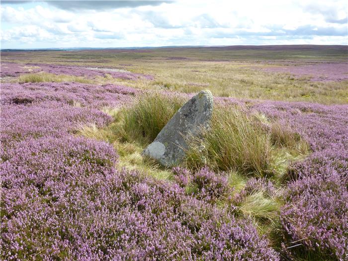
WALK 5: REBEL HILL AND GREENRIGG MOOR
Allendale may be best known for the remains of its lead mining past but there are more to these two valleys than just Victorian mines. This walk goes over the low hills to the east of the valleys, the moors that lead into Hexhamshire. Wide open spaces that present far ranging views in all directions especially to the distant Cheviots to the north. Along the way you get the opportunity to visit some reminders of an even older past, one that stretches back over 4,000 years.
DISTANCE: 7.4 miles / 11.8 km.
ASCENT: 594 feet / 181 metres.
TERRAIN: Moorland path and track with a little bit of off-path walking. The climb out of Catton to the moor is a gradual climb along a quiet country road. Other than at the start there are no other significant climbs on this walk.
TIME: 4½ to 5 hours
START: The centre of the village of Catton, 1½ miles outside Allendale Town. There is roadside parking as the B6295 goes past the village green. GR NY 828 578.
MAP: OL41. Hadrian's Wall.
ACCESS: Most of the route is on public rights of way, however, there are significant proportions over open access land.
DOGS: Not allowed on the access land.
FGS GRADING
Grading is F5 [D1, N1, T2, R1, H0]
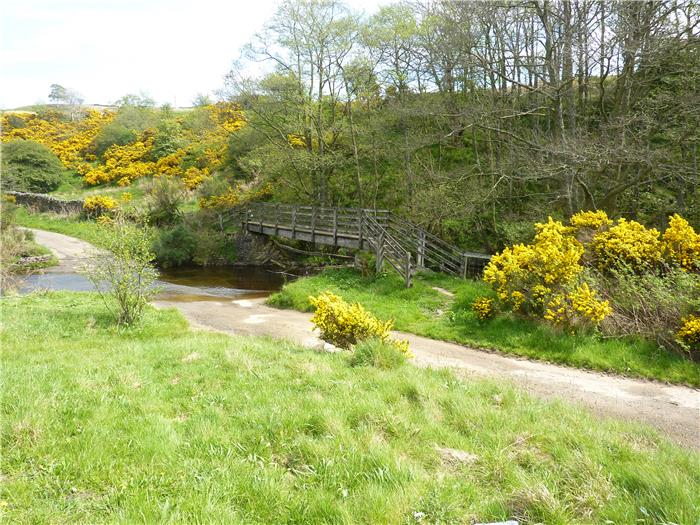
WALK 6: THE RIVER EAST ALLEN
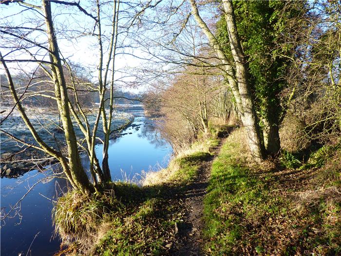
The River East Allen flows past Allendale Town to join with the West Allen and form the River Allen. However, before it joins its sister it provides a delightful riverside walk with a few little surprises up its sleeve. Most people associate the lead industry with the moors of the upper dale but even down in the grassy reaches of the lower valley, traces of this long-gone industry remain.
DISTANCE: 5.7 miles / 9.1 km.
ASCENT: 538 feet / 164 metres.
TERRAIN: Mostly field and woodland paths with one stretch along a very quiet country lane. Some care may be needed where the path runs close to the river as in a couple of places erosion of the bank has occurred. There is one short but steep climb away from the river into the fields around Owlet Hall.
TIME: 4 to 4½ hours.
START: The centre of Allendale Town. GR NY 837 558. There is ample parking in the village centre.
MAP: OL43 Hadrian's Wall.
ACCESS: The route is all on public rights of way.
DOGS: As the route is on rights of way then dogs are allowed. However, please keep them under close control, preferably on a lead. Most of the farm fields that you pass through contain livestock.
FGS GRADING
Grading is T3 [D0, N1, T1, R1, H0]
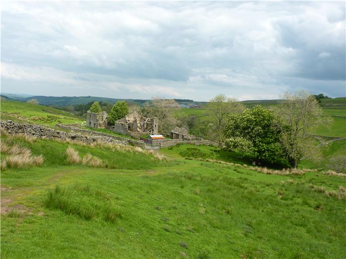
WALK 7: WELLHOPE AND COALCLEUGH
A high-level route that goes along the watershed between West Allendale and the Cumbrian valley of Nentdale. Along the way it visits two isolated mining sites that span the long history of lead mining in this valley. One dating back to the 1700/1800's and the other a product of the recent 20th century. The route also visits the site of the Coalcleugh mine, the largest mine in the dale and for over one hundred years the largest employer in the valley.
With being a high-level route, it also gives the opportunity of some scenic views over to the high hills of the North Pennines while, on a clear day, if you look to the north you can also see the distant hills of The Cheviots.
This walk starts and finishes at the village of Carrshield. Similar to Allenheads, Carrshield was a ‘model' village built during the 19th century for the workers of the Coalcleugh mines. As both villages were built by the same mining company, the Blackett-Beaumonts, at around the same time then they both shared many of the same planning principles of dispersed cottages each with sufficient land to provide a smallholding. However, despite being a ‘model' village made for the miners, Carrshield was based on an older settlement. In 1292 it was known as ‘Carrisideschield', the summer hut on a rocky slope.
DISTANCE: 5.6 miles / 9 km.
ASCENT: 1,106 feet / 337 metres.
TERRAIN: The majority of this route is on paths crossing the open moor. Although faint the paths are fairly well-defined and under normal conditions relatively easy to follow. As with all moorland, in places the path may be a bit wet and boggy. The last section of the walk is down the valley bottom road, which takes about 20/25 minutes to walk. There is a long steady climb at the start of the walk but after that most of the climbs are more gradual, even the one up to the top of The Dodd.
TIME: 4 to 4½ hours.
START: The telephone box at the southern end of the village of Carrshield in West Allendale. GR NY 803 475. There is roadside parking in the village.
MAP: This route is on OL31 North Pennines.
ACCESS: The route is all on public rights of way.
DOGS: As the route is all on rights of way then dogs are allowed but keep them under close control, preferably on a leash. Livestock, especially sheep, will be encountered throughout the walk. You will also be passing through old lead mining areas that have holes and bumps in the ground. There is a 20/25 minute road walk at the end of this route.
FGS GRADING
Grading is F6 [D0, N1, T2, R1, H2]
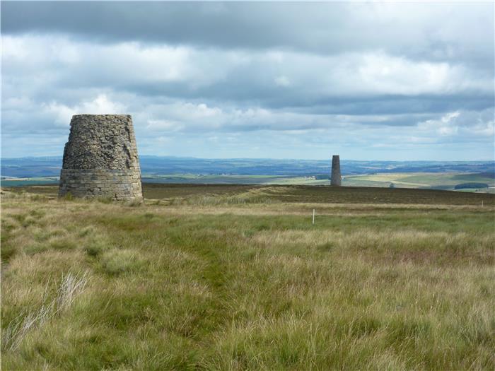
WALK 8: THE CHIMNEYS AND BROWNLEY HILL
The two smelt mill chimneys on the side of the fell above Allendale Town are both visible and instantly recognisable from many miles around. In many ways they have become the emblem of the dale itself and almost all of the publications that feature walks in Allendale include a walk up to the chimneys and justifiably so. They are both an iconic display of the effect of lead mining on these two small dales and a symbol of the Victorian miner's ingenuity.
This walk is no exception and visits the chimneys as part of a route along the watershed between East and West Allendale. Effectively a walk with a foot in each dale.
A lollipop shaped walk that uses the track going past the Allendale chimneys to access the open moors of Acton and Brownley Hill.
DISTANCE: 7.4 mile / 11.9 km
ASCENT: 778 feet / 237 metres
TERRAIN: A walk of two distinct halves. The outward leg follows a moorland track before heading out over pathless moorland to cross Acton Moor and Brownley Hill. As far as pathless moorland goes, this is not too bad although there may be a few rough parts underfoot. Once over the other side of Brownley Hill, the tarmac road is used to return back to the moorland track that you came out on, to head back to the crossroads and the finish of the walk. The climbing on this walk is more steady than steep. However, when going up the rough slope to Brownley Hill, this may seem to be a bit harder.
TIME: 3½ to 4 hours
START: The crossroads on the side-road just past the farm of Frolar Meadows. GR NY 817 552. Parking is on the wide northern grass verge next to the crossroads but please don't inconvenience local users. If you park on the southern verge take care as there is a ditch here that in summer can be hidden by the vegetation.
MAP: OL 43 Hadrian's Wall. Unfortunately this route uses both sides of the map which may be a little unfortunate if you have to turn it over in high winds.
ACCESS: Although the early and closing parts of this walk use public rights of way, the middle section that crosses the moor over Brownley Hill utilises public access land.
DOGS: Not allowed on the access land.
FGS GRADING
Grading is F7 [ D1, N2, T2, R1, H1]
WALK 9: KILLHOPE LAW
As you may have discovered from some of the other walks in this book, wherever you are in the upper reaches of both East and West Allendale, the skyline at the head of the dale is dominated by the bulk of Killhope Law. Standing at 673 metres or 2,208 feet, this hill is technically a mountain and for those who have a yen for it, one of the easiest mountains in the country to reach the top of.
Starting in the valley of the East Allen, this route, for the main part, follows the trail of the Carriers' Way, an old packhorse route used to carry lead ore from the mines in the upper reaches of Weardale over the top of the hill to the smelt mill in Allendale. A route used throughout the year by the heavily-laden horse trains. Much of this way is now decent vehicle track laid down to provide access to the grouse butts on the moor. However, this still doesn't take away the sense of stepping into the wild hills and following the trail of the packhorse men.
DISTANCE: 4.8 miles / 7.6 km
ASCENT: 1,010 feet / 308 metres
TERRAIN: The bulk of the walk is on track, either well-made vehicle track or moorland grass track. The final 400 metres up to the summit of Killhope Law is on a well-walked moorland path, this crosses peat moor and at times can be wet and boggy. There is obviously just the one climb on this walk, which goes to the top and back down. Although a steady climb, this is never what you could call steep.
TIME: 3 to 3½ hours
START: Parking space next to the bridge over the River East Allen on the Allenheads to Coalcleugh road. GR NY 851 465.
MAP: This route is on OL31 North Pennines.
ACCESS: Most of the route is on public rights of way although the first few hundred metres and the upper section where you go across to the summit of Killhope Law are on public access land.
DOGS: Not allowed on the access land.
FGS GRADING
Grading is F4 [D0, N1, T0, R1, H2]