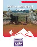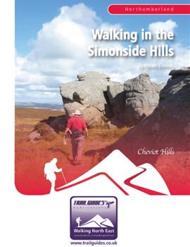

About the Guide
By Keven Shevels
A 112 page full colour A5 booklet describing nine walks, and the history and landscape of the Simonside Hills, a sandstone ridge that stretches from Coquetdale to Redesdale in Northumberland.
The Simonside Hills were a special place for our ancestors and for many people still are. Part of a range of sandstone hills that run up the centre of Northumberland between the Cheviots and the sea, these hills present a wide variety of countryside for the walker to explore.
Running between Coquetdale and Redesdale, to the east the Hills end in the Simonside Ridge, a famous landmark of crags and rocks. To the west, the landscape gradually changes from moorland to rough farm pasture while in the centre the wooded bulk of Harwood Forest dominates.
Here, in this varied landscape, mankind has left many reminders of his presence through the ages. From the Stone Age to the 1940's, there are the remains of habitation and of conflict. Join the author as in a series of nine walks he discovers this special countryside.
Contents
Contents
Introduction
1. Introduction
2. Access and the Right to Roam
3. The Walks
4. Weather
5. Maps
6. Facilities, Tourist Information Centres and Websites
7. Walk Location Map
Walk 1: Lordenshaw 3.9 miles
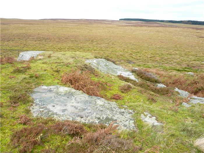
Rock Art
Lordenshaw Hill Fort
Walk 2: Simonside Ridge and the Coquet Cairn 6.8 miles
Duergar
Walk 3: Winter’s Gibbet and Tod Crag 8.4 miles
Walk 4: Todholes and Eastnook 4.8 miles
Old Farm Walls
The Mote Hills
Walk 5: The Stones of Fontburn 5.1 miles
Walk 6: Harehaugh and Witchy Neuk 4.3 miles
Harehaugh Hill Fort
Witchy Neuk Hill Fort
Walk 7: Landshot Hill and Darden Pike 5.6 miles
Landshott Hill
Walk 8: Tosson Hill 10.1 miles
Walk 9: Harwood Forest 7.3 miles
Manside
Appendix
Ferguson Grading System
The Author
Walking North East
Disclaimer
The Walks
WALK 1: LORDENSHAW
No book on walks within the Simonside Hills could possibly ignore the Lordenshaw area. This small area of ground holds such a wealth of historic locations that span not just a few hundred years but several thousand including Neolithic, Bronze Age, Iron Age, Romano-British and Medieval. Despite its relatively short length, this is a walk that is so fascinating due to its historical contents that it will take far longer than expected to complete.
DISTANCE: 3.9 miles / 6.2 km
ASCENT: 715 feet / 218 metres
TERRAIN: Mainly good field and moorland paths throughout giving fairly decent walking, there is a short road stretch at the start and finish of the walk. Leaving the paths to visit the various historic sites does give a little bit of off-path walking but in terms of distance this isn't very far. There is a short but steepish section as you leave the Whitton Burn after crossing it.
TIME: 3½ to 4 hours. Although short, there is that much of interest on this walk that it might take longer to complete than you would expect.
START: Cowhaugh car park on the south side of the river at Rothbury. GR NU 057 015.
ACCESS: The route is all on either public rights of way or permissive paths but there is a little bit of 'wandering' around when locating the various sites.
DOGS: Dogs are allowed on the rights of way and permissive paths, however, please keep them under close control preferably on a leash. Livestock, mainly sheep, will be encountered throughout most of this walk.
FGS GRADING
Grading is F5 [ D0, N1, T1, R1, H2]
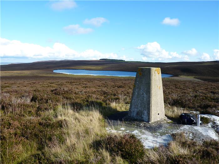
WALK 2: SIMONSIDE RIDGE AND THE COQUET CAIRN
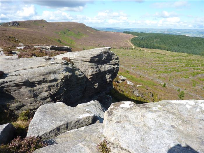
Comprised of Fell Sandstone which was laid down during the Carboniferous period, about 300 million years ago, the Simonside Ridge dominates the Simonside Hills. This ridge has an impressive land form with its scarp slopes and rocky outcrops. While giving impressive views across to the coast and also to the Cheviot range, this means that the ridge itself is visible from many miles away. A factor that certainly had some attraction to our prehistoric ancestors judging by the many Bronze Age burials on and around the ridge.
This walk follows a route over the ridge and then circles round the moors behind Simonside taking a brief visit into the trees of Harwood forest. While there is no guarantee that you will meet any of the Duergar and, going by their reputation, you would not want to anyway, this walk does bring you face to face with one of their unsavoury vices.
DISTANCE: 6.8 miles / 10.5 km
ASCENT: 1,066 feet / 325 metres
TERRAIN: Mainly moorland path. However, these paths are well-walked and so fairly easy to follow. As with all moors there are a couple of soft bits where the feet will get wet. The climb up to the Simonside ridge is quite steep in places and uses a rocky path but as you'll see is very distinct. The path over the ridge itself has been laid with stone flags in many places to help control erosion. The descent down the other end of the ridge is steep and, at the outset before you encounter the stone steps, quite rough.
TIME: 4¼ to 4¾ hours
START: Lordenshaw car park. GR NZ 053 988.
ACCESS: This route follows public rights of way throughout.
DOGS: As the route is on public rights of way, then dogs are allowed.
FGS GRADING
Grading is F7 [ D1, N1, T2, R1, H2]
WALK 3: WINTER'S GIBBET AND TOD CRAG
Being situated close to Rothbury, the northern part of the Simonside Hills is a popular walker's destination. However, the southern part of the hills is less well frequented and as a result, the paths less well trodden. Here the landscape is different to the fell sandstone crags and ridge which dominate the skyline above Rothbury. Instead the countryside is a sequence of low rolling moors.
One point to notice on this walk is the number of native Celtic settlements that date back to the period of the Roman occupation, what is thought of as being Romano-British. During this time of governance by our friends from Italy, despite the popular misconception that the empire ended at Hadrian's Wall, a strategically important road, called Dere Street, ran north through Redesdale, through the Cheviots into what is now Scotland. Situated on this road, at the village of Rochester just north of Otterburn, was the fort of Bremenium. This fort, which housed over 1,000 troops, provided security to both the road and the area. With the need for supplies for the military, settlements and farmsteads were established in the vacinity, the remains of several of which are passed on this walk.
DISTANCE: 8.4 miles / 13.4 km
ASCENT: 594 feet / 181 metres
TERRAIN: A mixture. The first part of the route crosses moorland and goes through a harvested plantation on poorly defined paths. Here the going can be a bit rough and in places boggy. A series of field paths is then followed before entering Harwood Forest for a section along forest tracks. There are two fairly short road sections on this walk. There is no significant climbs or descents on this route.
TIME: 4½ to 5 hours
START: Car parking space opposite Winter's Gibbet on the Elsdon to Cambo road. GR NY 963 908.
ACCESS: In principle the route is all on public rights of way. However, because the path across Todcrag Moss and through the harvested plantation surrounding Tod Crag is very easy to lose then you can virtually guarantee that you wouldn't be able to stick to it. As this area is all open access land then this doesn't matter too much anyway.
DOGS: As the route is on public rights of way, then dogs are allowed. However, keep them under close control preferably on a lead. Sheep and cattle will be encountered at various points along this route.
FGS GRADING
Grading is F6 [ D1, N2, T2, R1, H0]
WALK 4: TODHOLES AND EASTNOOK
A walk around the ancient farmsteads that surround the village of Elsdon. These date back many hundreds of years and have seen many visitors, some more welcome than others. The walk finishes by visiting the Mote Hills, remnants of the Norman castle that ruled this part of Northumberland.
DISTANCE: 4.8 miles / 7.7 km
ASCENT: 561 feet / 171 metres
TERRAIN: Mainly field and woodland paths. There are two sections on very quiet country lanes that provide the access to the farms around Elsdon. There is just the one significant climb on this walk, up along a woodland path leading to Whitlees. The remaining climbs are more gentle and gradual.
TIME: 4 to 4½ hours
START: The car park at the north end of Elsdon, by the bridge over Elsdon Burn. GR NY 937 933.
ACCESS: The route is all on public rights of way.
DOGS: As the route is all on public rights of way then dogs are allowed. However, please keep them under close control, preferably on a lead. You do pass a couple of farms on this route where you may meet other dogs and you will also encounter livestock throughout the route.
FGS GRADING
Grading is T4 [ D0, N1, T1, R1, H1]
WALK 5: THE STONES OF FONTBURN
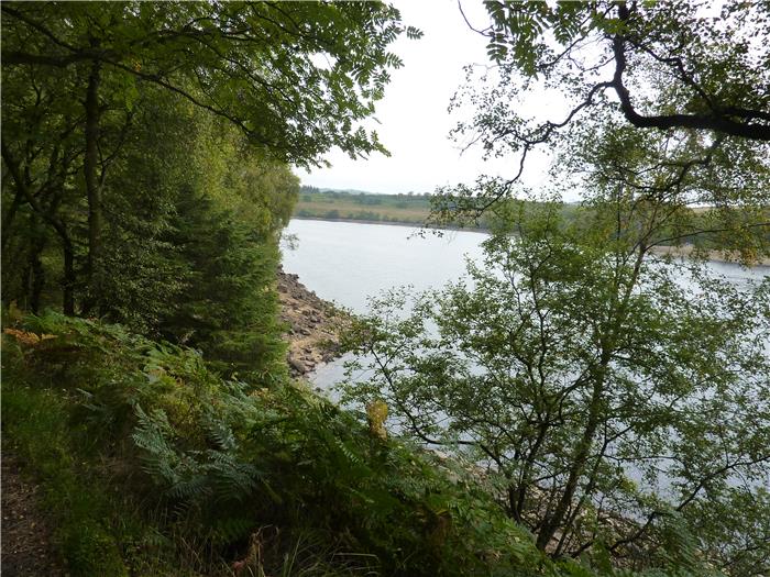
On the southern side of the Simonside Hills lies Fontburn Reservoir. Opened in 1910, the reservoir supplies water to the Morpeth and Bedlington areas and, nowadays is a popular fishing venue for anglers.
Here the land surrounding the reservoir has been home to human occupation for thousands of years. A history that, if you know where to look, has left its traces scattered throughout these low moors. This is a walk that takes you back to the Neolithic stone age, visits remains of the Celtic Votadini tribe who farmed these hills both before and during the Roman occupation and also sees traces of the medieval farmers who took their place as human civilisation evolved.
DISTANCE: 5.1 miles / 8.2 km
ASCENT: 384 feet / 117 metres
TERRAIN: Initially this walk follows a woodland path around the reservoir, you then leave this to cross rough grazing pasture. Although not wild open moor, this can be a bit soft underfoot in places. There are no significant climbs on this walk.
TIME: 3¾ to 4¼ hours
START: The car park on the southern side of Fontburn Reservoir. next to the Fishing Lodge. GR NZ 049 935.
ACCESS: Most of this walk utilises permissive paths, both the Waterside Path round Fontburn Reservoir and the National Trust's Greenleighton Walk. There are also a couple of short stretches on public rights of way.
DOGS: Not allowed on the access land.
FGS GRADING
Grading is F3 [ D0, N1, T1, R1, H0]
WALK 6: HAREHAUGH AND WITCHY NEUK
A shorter walk but one that is full of interest, which explains the length of time needed to complete it compared to the distance. The northern fringes of the Simonside Hills, as they overlook the River Coquet, contain many historic monuments including the oldest yet discovered in Coquetdale. This walk steps back in time and discovers reminders from four different time periods of how conflict has shaped the landscape of these hills.
DISTANCE: 4.3 miles / 6.9 km.
ASCENT: 653 feet / 199 metres.
START: Car parking space near to Woodhouses Bastle. GR NT 967 001.
TERRAIN: Most of the route is off recognised paths although most of this is no more difficult than walking over rough pasture. Despite the height gain, there are only really a couple of steep banks to climb rather than big hills. There is a lengthy road walk in the final stages of this walk.
ACCESS: Virtually all of the walk is on open access land or permissive path, very little of the walk is on public rights of way.
DOGS: Not allowed on the access land.
TIME: 3¾ to 4¼ hours.
FGS GRADING
Grading is F6 [ D0, N1, T2, R1, H2]
WALK 7: LANDSHOT HILL AND DARDEN PIKE
All walking books should contain a variety of routes in order to suit all tastes and so this walk is a hard route over pathless open moor, a route that really demonstrates the more adventurous side of walking in the Simonside Hills. Make no mistake, this walk is a bit of a challenge but no less enjoyable for that.
To the south of the old village of Elsdon lie three hills, Landshot Hill, King's Dod, and the tallest of the three Darden Pike. In a walk that takes in all three of these hills, you'll visit a wilder part of these hills, one that doesn't see too many visitors.
DISTANCE: 5.6 miles / 8.9 km.
ASCENT: 974 feet / 297 metres.
TERRAIN: Most of this route is off-path moorland walking over rough and, in places, boggy ground. In summer when the vegetation is high, then you will be walking through deep heather and tussock grass. Most of the climbing is a steady ascent except for the climb up to Darden Pike which, although is short, is quite steep.
TIME: 4¼ to 4½ hours.
START: The car park at the north end of Elsdon, by the bridge over Elsdon Burn. GR NY 937 933.
ACCESS: Public rights of way are used to go to and from the open moor but the majority of the route is over open access land.
DOGS: Not allowed on the access land.
FGS GRADING
Grading is F6 [ D0, N1, T2, R1, H2]
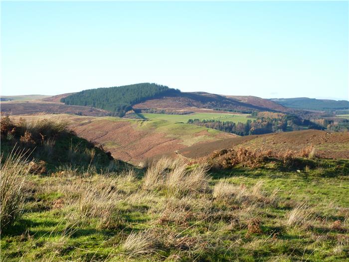
WALK 8: TOSSON HILL
Although popular with walkers because of its striking ridgeline, Simonside is not the highest point in the Simonside Hills. That honour belongs to Tosson Hill which stands amongst the moorland just a few kilometres away. Only 10 metres, thirty feet, higher than Simonside, this hill has a totally different character to the rugged ridgeline of the later and is well-worth the visit to sample its delights.
This is very much a walk of two distinct halves. The first being a moorland walk across the summit of Tosson Hill and then the lower moor of Boddle Moss. The walk then returns via the tracks of Harwood Forest, a forest walk amongst the conifers of the Forestry Commission.
DISTANCE: 10.1 miles / 16.1 km.
ASCENT: 1,201 feet / 366 metres.
TERRAIN: The first part of the walk is a steady climb on tracks and paths up through Simonside Forest, be aware that there is a short but steep climb up to Little Church Rock. Once you have left the forest, there is a fairly easy walk across the moor to the summit of Tosson Hill before you go down a couple of steep descents to cross the moor of Boddle Moss. After that it is a walk on forest tracks circling back through Harwood Forest before descending down through Simonside Forest to return to the car park.
TIME: 5 hours.
START: The Forestry Commission car park at Simonside. GR NZ 037 996.
ACCESS: This route uses a mixture of public rights of way and paths across the open access land on the top of Tosson Hill.
DOGS: Not allowed on the access land.
FGS GRADING
Grading is F6 [ D1, N1, T1, R2, H1]
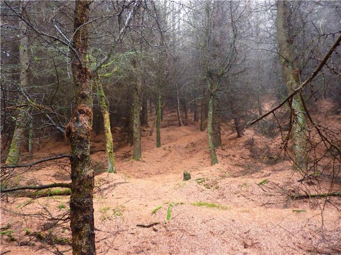
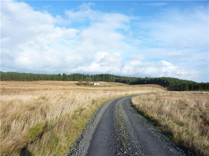
WALK 9: HARWOOD FOREST
The interior of the Simonside Hills are dominated by the man-made coniferous forest of Harwood. Planted in the 1950's the forest provides an abundance of easy, pleasant woodland walking. However, before the trees were planted this was an isolated area dominated by the grazing of sheep and as you walk through the trees you can still catch glimpses of this past.
Even though in the past most of this land was given over to the grazing of sheep, at some point a wood must have existed. In Old English the word ‘har' meant hoary or grey and was often applied to stones. As stones were used extensively to mark land boundaries, especially between one estate and another, then the word ‘har' began to be associated with those boundaries. The name Harwood is the wood that marks the boundary between the two baronies of Hartburn and Redesdale.
DISTANCE: 7.3 miles / 11.7 km.
ASCENT: 571 feet / 174 metres.
TERRAIN: The route is all on well surfaced forest tracks except for the optional part of the walk to view the remains at Manside. This follows a rough and boggy path for 1 km although it is well worth the walk to visit them. There are no steep hills on this walk, more long and gradual.
TIME: 3½ to 4 hours.
START: Car park within Harwood Forest. GR NZ 000 907. Just after you have entered the forest a road sign indicating ‘by-pass' and ‘car park' directs traffic up a left-hand track. Shortly after this you'll come to a crude hand painted no entry sign. On a weekend there is no problem going past this and following the track as it bears right and comes to a T-junction of tracks. This is the parking space, next to the wooden hut.
ACCESS: Walkers are allowed free access within Harwood Forest except where, for safety reasons, harvesting operations are in progress. Please obey any Forestry Commission warning signs.
DOGS: Allowed in the forest.
FGS GRADING
Grading is T3 [ D1, N1, T0, R1, H0]