About the Guide
By Peter McEwen
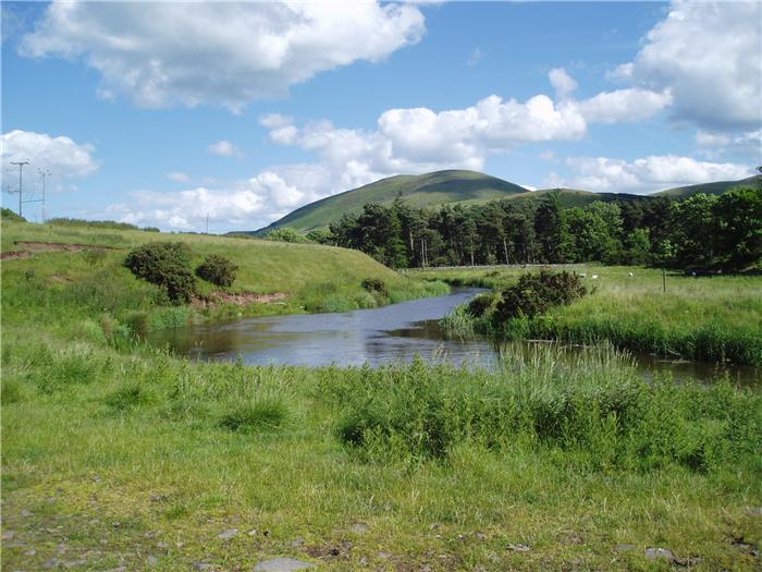
The community of Kirknewton lies on the north eastern edge of the Cheviot Hills. Now a tranquil oasis, this area has a long and varied history, much of it steeped in bloodshed that runs from the ancient Celts to the Border Reiver.
In a series of eight walks the author explores both the history and the nature of this edge of the wildest range of hills in England. Here the walker is in the minority, outnumbered by the wild goats, roe deer and mad march hares.
Starting from Kirknewton, this collection of walks includes gentle strolls along the valley bottom as well as more strenuous expeditions onto the higher tops surrounding the village. Within this book there is a walk for everybody whatever their ability or inclination.
The Walks
WALK 1: THE RIVER WALK
A shorter walk that explores the countryside of the River Glen.
DISTANCE: 2.2 miles (3.5 km) ASCENT: 138 feet (42 metres)
START: Kirknewton Village Hall (GR NT 913 303)
TERRAIN: Tarmac road and track, field/gravel path.
FGS Grading T1 [ D0, N0, T0, R1, H0]
WALK 2: KINGS AND KILTS
DISTANCE: 3.4 miles (5.5 km) ASCENT: 653 feet (199 metres)
START: Kirknewton Village Hall (GR NT 913 303)
TERRAIN: Way-marked tracks and paths, and a stretch of tarmac.
FGS Grading F5 [ D0, N1, T0, R1, H3]
WALK 3: YEAVERING BELL
DISTANCE: 5.4 miles (8.6 km) ASCENT: 1,221 feet (372 metres)
START: Kirknewton Village Hall (GR NT 913 303)
TERRAIN: Way-marked tracks and paths, some green, steep descent off Yeavering Bell.
FGS Grading F6 [ D0, N1, T1, R1, H3]
WALK 4: THE TORS
DISTANCE: 11.1 miles (17.9 km) ASCENT: 2,178 feet (664 metres)
START: Kirknewton Village Hall (GR NT 913 303)
TERRAIN: Way-marked tracks and paths, some green. Open access land with less well-defined paths.
FGS Grading F9 [ D1, N2, T1, R2, H3]
WALK 5: HETHPOOL LINN
DISTANCE: 4 miles (6.5 km) ASCENT: 630 feet (192 metres)
START: Kirknewton Village Hall (GR NT 913 303)
TERRAIN: Way-marked tracks and paths, some green and less well-defined paths. Short section of path with exposed roots. Some tarmac.
FGS Grading T3 [ D0, N1, T0, R1, H1]
WALK 6: CHEVIOT HILLS HERITAGE WALK
DISTANCE: 8.2 miles (13.2 km) ASCENT: 1,896 feet (578 metres)
START: Kirknewton Village Hall (GR NT 913 303)
TERRAIN: Way-marked tracks and paths, some green. Open access land with less well-defined paths. Some tarmac.
FGS Grading F10 [ D1, N2, T2, R2, H3]
WALK 7: MID HILL
DISTANCE: 6.7 miles (10.7 km) ASCENT: 1,355 feet (413 metres)
START: Kirknewton Village Hall (GR NT 913 303)
TERRAIN: Way-marked tracks and paths, some green. Open access land with less well-defined paths. Some tarmac.
FGS Grading F8 [ D1, N2, T1, R1, H3]
WALK 8: COLDSMOUTH HILL
DISTANCE: 12.1 miles (19.5 km) ASCENT: 2,871 feet (875 metres)
START: Kirknewton Village Hall (GR NT 913 303)
TERRAIN: Way-marked tracks and paths, some green. Open access land with less well-defined paths. Some tarmac.
FGS Grading F11 [ D2, N2, T2, R2, H3]