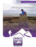
About the Guide
By Keven Shevels
A 112 page full colour A5 booklet describing nine walks and the history and landscape surrounding those walks, through the length of the Weardale valley.
Weardale, the valley of the Prince Bishops, given shortly after the Norman Conquest to the Bishops of Durham to rule as their own, this rugged dale has a long and turbulent history.
Join the author in a series of nine walks as he explores the countryside of this dale from the lower grazing pastures surrounding Wolsingham up to the high, windswept moors of the Pennine watershed. Once heavily exploited for it's mineral wealth, this now quite and tranquil dale is a haven for the walker seeking to broaden their horizons and sample what the Bishops once ruled with a rod of iron.
Author Biography :
Kev has been involved with outdoor sports for over forty years since his school days doing the Duke of Edinburgh award, spending his time either walking, running and latterly mountain biking through the countryside of the North East and beyond. He is not ashamed to admit that he is one of these boring people who can sit and spend hours reading a map the way that other people read a book. His great delight is coming up with new routes that he can subsequently explore and investigate especially if he can couple this with his interest in history, in particular the prehistoric. This usually means much more than a walk as his routes tend to take a view not only on the landscape but also its relationship with events and occurrences that have happened in the past. In many ways this curiosity and knowledge of the Durham Dales can make him a perfect guide to this under-valued part of our region. Now in his fifties, Kev has been unable to continue his running due to injury problems but instead has been co-author of one of the most innovative series of coaching books for fell and trail runners in recent years. He now brings his easy to read, informative style of writing to guide books for those who walk in the countryside of County Durham, his home county.
Contents
1. Introduction
2. Access and the right to roam.
3. The walks.
4. Weather.
5. Maps.
6. Tourist information centres & websites.
7. Mining and quarrying.
8. Lead mining glossary.
Walk 1: Fatherley Hill & Wolsingham Park Moor.
Fatherley Hill Currick.
Walk 2: The Mineral Line & Windy Hill.
The Weardale Iron Company Railway.
Walk 3: The Bollihope Watershed.
The Lang Man O'Bollihope.
Walk 4: Back O'Five Pikes.
Walk 5: Wearhead & Sedling Rake.
The Sedling Burn Valley.
Walk 6: Pawlaw Pike.
Walk 7: Newlands & Fawnlees.
Walk 8: Cowhorse Hush & Cuthbert's Level.
Cowhorse Hush.
Walk 9: The Quarries of Bollihope.
The Walks
WALK 1: FATHERLEY HILL & WOLSINGHAM PARK MOOR
A medium distance walk that crosses the low moors to the north of Frosterley and which has links to the prehistoric past. The hills here are low lying compared to the ones further up the dale and flow down to join the plains of Mid-Durham. Although not of great height, they still present opportunities for excellent walking and some outstanding views over the lower lying lands to the east. The majority of this walk is over open access land and so is not that often walked, take the opportunity for some quiet reflection.
DISTANCE: 9.5 mile / 15.2 km.
ASCENT: 1,512 feet / 461 metres.
TERRAIN: A long steady climb up a tarmac track leads onto the open moor where moorland tracks and paths are followed. These moorland tracks and paths are, in the most part, well defined and easily followed although there is an optional stretch of 300 metres that is pathless and involves heather bashing. Not all of these tracks have a hard surface and during the winter months and after bad weather may be wet and muddy.
START: Frosterley Station car park. GR. NZ 024 369.
MAP: The bulk of this walk is on map OL307 Consett & Derwent Reservoir, however, the initial stages up the tarmac lane to the open moor are on OL31 North Pennines.
DOGS: Not allowed on the access land.
ACCESS: This route uses some public rights of way but in the main crosses open access land.
FGS GRADING
Grading is F7 [ D1, N1, T1, R2, H2]
WALK 2: THE MINERAL LINE & WINDY HILL
A walk of two distinctive halves. The first part of the walk follows the route of an old mineral railway opened up in the 1800's, as it gently curves it's way round the side of the dale to the terminus in the Rookhope valley. The second half is true fell walking over wide, open moor to attain the summit of the rarely visited, at least by walkers, Windy Hill.
DISTANCE: 8.9 mile / 14.2 km
ASCENT: 1,247 feet / 380 metres
TERRAIN: After an initial steep climb up the road out of Westgate, the route following the old mineral line over to Rookhope is relatively gentle and undemanding although there is a steep descent down to the crossing of the Park Burn due to the railway embankment over the burn having disappeared. In places where the line goes through a cutting, the ground within the cutting may be a bit wet and boggy and it may be better to walk to one side along the top of the bank. The return from Rookhope is a long steady climb over fairly pathless moor to the summit trig on Windy Hill before descending back down to Westgate, part of which involves a lengthy road section.
TIME: 5 hours.
START: Large lay-by on the north side of the road, opposite the caravan site, as you pass through Westgate. GR NY 906 380.
MAP: OL307 Consett and Derwent Reservoir.
DOGS: Even though dogs are allowed on the public rights of way and there does not appear to be any restrictions on them over the access land this may not be a suitable route to take your dog. There are quite a number of fences and gates where they will need to be lifted over plus there is the proximity of the open shaft at Park Burn and although there is both a small distance and a wire fence between you and the steep drops into Heights Quarry they are still there.
ACCESS: The route is all on public rights of way apart from the stretch used to access the summit trig point on Windy Hill where you cross open access land.
FGS GRADING
Grading is F7 [ D1, N1, T2, R1, H2]
WALK 3: THE BOLLIHOPE WATERSHED
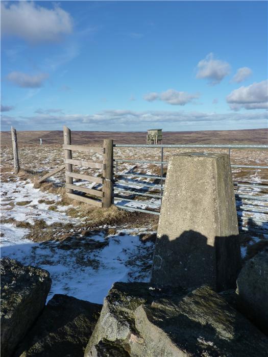
A walk high along the watershed of the Bollihope valley, among the peat hags and streamlets that feed down into the burn and, ultimately, the River Wear itself. Don't be fooled by the distance and height gained on this walk, it is more tiring than they would suggest due to the ups and downs of the peat hags and the extra distance put in walking round the worst of the boggy ground. However that said, this is a walk that you could get a lot of satisfaction out of completing, especially, if you take a break at the trig point on Harnisha Hill. From this vantage point you can look out and trace almost the full route of the walk across the skyline as it circles round above the valley.
This walk also gives you the extra of a visit to see the cairn of the Lang Man O'Bollihope, reputably the grave of a giant warrior.
DISTANCE: 9.4 miles / 15 km.
ASCENT: 1,220 feet / 372 metres.
TERRAIN: Mainly pathless high-level moor complete with it's share of peat bogs. The final stretch is a 3 km road walk down the B6278 back to the car.
TIME: 4 to 5 hours.
START: Parking space alongside the B6278 road on the north side of the Bollihope Burn. GR NY 985 352.
MAP: Explorer OL31 North Pennines.
DOGS: Not permitted on the open access land.
ACCESS: The route is entirely over open access land.
FGS GRADING:
Grading is F11 [D1, N2, T3, R3,H2]
WALK 4: BACK O' FIVE PIKES
This is a walk that traverses the western slopes of Five Pikes and the expansive open moorland of Pikestone Fell. Being not very high, these hills can be quite deceptive as they offer far-sweeping views to distant horizons. Throughout the walk this route utilises the well-laid out system of shooter's tracks established over this moor by the Bollihope Estate.
DISTANCE: 10.6 miles / 17 km
ASCENT: 919 feet / 280 metres
TERRAIN: The majority of the route is on well-surfaced moorland track. There is one stretch along a well-walked moorland path and the final stretch from Blackburn Lodge follows a quiet tarmac lane.
TIME: 4 to 5 hours.
START: Parking space at the top of West Bank above Wolsingham, at the start of the minor road leading to Blackburn Lodge and Doctor's Gate. GR NZ 073 357.
MAP: Explorer OL31 North Pennines.
DOGS: Not permitted on the open access land.
ACCESS: Most of this route follows shooter's tracks over open access land.
FGS GRADING:
Grading is F4 [D1, N1, T0, R2,H0]
WALK 5: WEARHEAD AND SEDLING RAKE
A walk of two distinct halves. The first following the Weardale Way along the valley floor upstream from St John's Chapel to Wearhead, at times walking close to the riverbank while at other times a field or so away from the river. The second half of the walk from Wearhead back to St John's Chapel climbs up the side of the fell and follows an old packhorse track along the edge of the valley which, on a nice day, gives some superb views of the dale before it descends back down to the valley floor.
DISTANCE: 7.2 mile / 11.5 km
ASCENT: 1,004 feet / 306 metres
TERRAIN: A walk of two halves. The first half up to Wearhead utilises field and riverbank paths, most of which are quite well walked. From Wearhead the route climbs the side of the valley, some of which can be quite steep, to return to St Johns Chapel by moorland tracks and paths. Some of these moorland tracks and paths can be quite wet and muddy in places even during summer. A short stretch following a bridleway from Queensbury up to the Sedling Rake track is more of a faint path across open moor but while a bit rough underfoot, is fairly easy to negotiate as there is a wall nearby to guide you.
TIME: 4½ to 5 hours
START: The large car parking area on the east side of St Johns Chapel, just before you enter the village. GR NY 886 379
MAP: OL31 North Pennines
DOGS: As this route is all on public rights of way then dogs are allowed. However, keep them under close control and on a lead, especially when going through the areas of old mine workings as there are old shafts, levels and other holes in the ground. Livestock will be encountered throughout the route and there are a couple of farmyards that you pass through where other dogs will definitely be encountered.
ACCESS: This route is all on public rights of way.
FGS GRADING:
Grading is F5 [D1, N1, T0, R1,H2]
WALK 6: PAWLAW PIKE
On the southern side of the Bollihope valley the slopes gently rise to a vast expanse of low-lying moorland. A small crest-line is formed by the hills of Long Man, Pawlaw Pike and Five Pikes, after which the heather moor continues to stretch away south to break upon the timber borders of Hamsterley Forest several miles distant. This is the land of the red grouse reared, as in many other parts of the Durham uplands, to face the gun during the shooting season.
In recent times the whole nature of these uplands has changed with the demands of the shooting estates. What was once open moor now contains long, sweeping vehicle tracks which provide access for shooters and gamekeepers. And then there is the moor itself, now a patchwork mosaic of heather beds where the new growth is stimulated by the controlled burning of the older plants. Whereas we think of these moorlands as being beautiful wild places, in fact they have been shaped by the hand of man just as much as any urban parkland.
DISTANCE: 7.5 miles / 12 km
ASCENT: 938 feet / 286 metres
TERRAIN: Initially well-surfaced vehicle track giving way to moorland path as you pass the hill of Five Pikes. The route does cross a short stretch of open moorland between the Fine Burn and Pye Close where there is very little in the way of paths.
TIME: 4 to 5 hours.
START: Car parking area next to the Bollihope Burn. GR NZ 006 349.
MAP: OL31 North Pennines.
DOGS: Not permitted on the open access land.
ACCESS: The initial part of the route uses public access land and then from Five Pikes onwards utilises public rights of way.
FGS GRADING:
Grading is F6 [D1, N1, T1, R1,H2]
WALK 7: NEWLANDS AND FAWNLEES
A shorter distance walk that visits a part of the dale that is not so often frequented by walkers. A surprisingly pleasant walk that presents a range of environments for the walker.
DISTANCE: 4.75 miles / 7.5 km
ASCENT: 830 feet / 253 metres
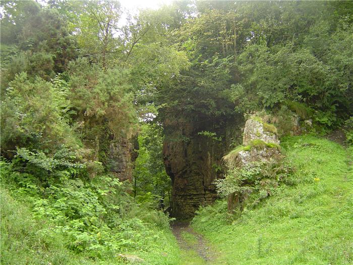
TERRAIN: The route is almost entirely on field paths and tracks with a short stretch through woodland. There are no significant climbs on this route although there is one short, steep one.
TIME: 3 to 3½ hours.
START: Lay-by on the south side of the A689 road running from Wolsingham to Frosterley. Heading from Wolsingham it is the second parking space encountered. GR NZ 046 369.
MAP: OL31 North Pennines.
DOGS: With the route being all on public rights of way then dogs are allowed, however, as livestock will be encountered throughout this route please keep them under close control.. The route does pass through a number of farmyards and so it is very likely that you will encounter other dogs. Also a number of the stiles encountered on the walk are high, narrow and awkward stiles built into the stone walls and you may have to lift them over, If they are large dogs then this may be a ‘fun' experience.
ACCESS: The route is all on public rights of way.
FGS GRADING:
Grading is T5 [D0, N1, T1, R1,H2]
WALK 8: COWHORSE HUSH & CUTHBERT'S LEVEL
At the top end of Weardale lies a relic of the old lead mining days. Nothing so small as a level entrance or the 'donut' of a shaft, this stretches a full three quarters of a mile down the side of the hill and is deep enough to hide three double-decker buses.
Cowhorse Hush is the biggest and deepest hush within Weardale and one of the largest in the North Pennines. A man-made excavation cut deep into the side of the hill, nearly three hundred years of toil and back-breaking labour forced a massive quantity of ore from the vein beneath this hill.
DISTANCE: 5.8 mile / 9.3 km
ASCENT: 833 feet / 254 metres
TERRAIN: The bulk of the walk is on field path and track. However, there are sections of the walk, at the top end of the valley, where you walk over open moor and rough pasture, both of which can be wet and uneven underfoot. There are two stream crossings, the Killhope Burn and the Wellhope Burn, where you have to cross without the aid of a bridge. In wet weather or times of high water then it may be advisable not to do this walk. There is a long steady climb over rough ground up the side of Cowhorse Hill and the descent down to the Wellhope Burn crossing can be a bit rocky and slippery.
TIME: 4½ to 5 hours.
START: Car park on the right of the main road as you enter Cowshill from the east. GR NY 857 406.
MAP: OL31 North Pennines.
DOGS: With the route being on public rights of way then dogs are allowed. However, you will find fences where they will need to be lifted over, farmyards where you will meet farm dogs, two streams to cross without the use of bridges, livestock, including ducks and geese, in very close proximity throughout the route plus when you are in the mining areas there will be holes in the ground where you will have to make sure that your dog doesn't enter. In short, even though they may be allowed it may be advisable not to take your dog on this walk.
ACCESS: The route is all on public rights of way apart from the two little 'explores' around Cowhorse Hush and Cuthbert's Level where you are utilising access land. However, the paths around Wellhope and Hole Dam are not well walked or marked and so you can find yourself easily straying off the public footpath.
FGS GRADING:
Grading is F5 [D0, N1, T1, R1,H2]
WALK 9: THE QUARRIES OF BOLLIHOPE
A lower level walk that roughly follows the course of the Bollihope Beck from it's mouth, where it joins the River Wear, to where it emerges onto the open moor.
In the past, the valley of the Bollihope Burn has been heavily exploited for it's mineral wealth with the landscape being cut and carved by the hand of man. The majority of these sites are no longer used and nature is in the slow process of reclaiming them back as her own. This has, in itself, given rise to a new rich and varied landform, born of both man and nature.
Part of this walk follows the route of the Mineral Valley Walk set up by Durham County Council and along the way encounters a number of information boards that explain these sites, what you can see and the site's part in the industrial history of the valley.
DISTANCE: 6.2 miles / 9.9 km
ASCENT: 453 feet / 138 metres
TERRAIN: Mainly field paths and tracks.
TIME: 4 to 4½ hours.
START: Frosterley Station Car Park. GR NZ 024 369.
MAP: Explorer OL31 North Pennines.
DOGS: The route is all on rights of way and so dogs are allowed but keep them under close control. Livestock can be expected throughout the walk.
ACCESS: The route is all on public rights of way.
FGS GRADING:
Grading is T4 [D1, N1, T1, R1,H0]