
About the Guide
By Keven Shevels
A 112 page full colour A5 booklet describing nine walks, and the history and landscape surrounding those walks, through the length of the Weardale valley.
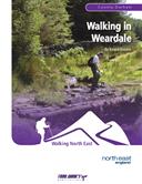
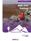
Weardale, the valley of the Prince Bishops. Following the success of his previous two books, 'Walks from Stanhope' and 'Walking in Weardale', the author continues his exploration of this beautiful but rugged little dale. One of the former 'lead dales' of the North Pennines and also one of the birth places of the North East's iron and steel industry, this is an area that is rich in industrial history.
With these industries now gone, Weardale is rapidly gaining a reputation for its natural beauty and becoming a magnet for discerning walkers. Join the author in another series of nine walks as he explores the countryside of this dale, from the lower grazing pastures surrounding Wolsingham up to the high, windswept moors of the Pennine watershed and discover what makes this valley so special.
Contents
Introduction
- Introduction
- Access and the Right to Roam
- The Walks
- Weather
- Maps
- Tourist Information Centres & Websites
- Lead Mining Glossary
- Walk Location Map
Walk 1: The Mines of Middlehope (5.7 miles)
The Mine Workings in the Middlehope Valley
Walk 2: Park Wall, Tunstall and Baal Hill (6.3 miles)
The Holy Well
Walk 3: Harnisha Hill (6.9 miles)
Lead Mining and the Bollihope Valley
Walk 4: Chapelfell Top and Noon Hill (7.7 miles)
Walk 5: Ashes House and the Biggins (7.3 miles)
Walk 6: High above the Stanhope Burn (9.1 miles)
Bolt's Law Incline
Walk 7: The Burnhope Valley (4.8 miles)
Burnhope Reservoir and Village
Walk 8: Knitsley Fell and Black Banks (4.6 miles)
Walk 9: Pikestone Fell (8.8 miles)
Appendix
Ferguson Grading System
The Author
Walking North East
Disclaimer
The Walks
WALK 1: THE MINES OF MIDDLEHOPE
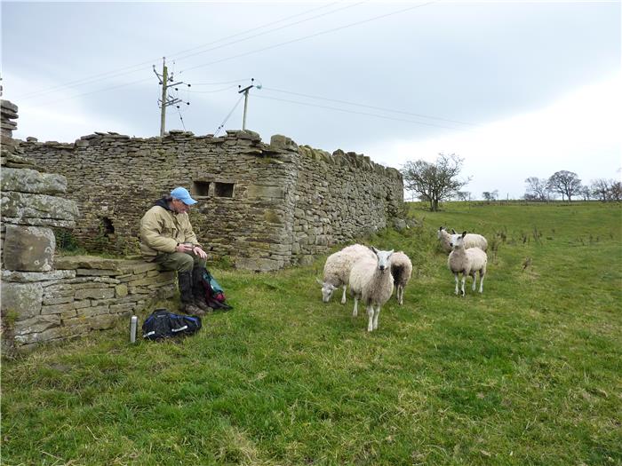
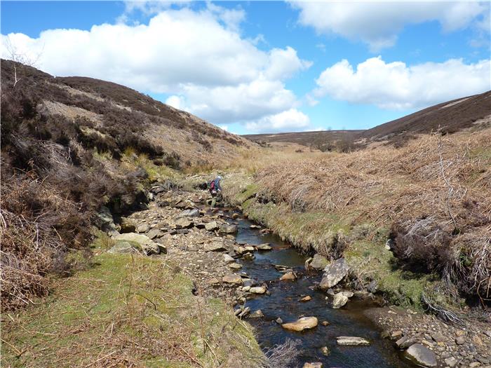
Weardale will always be associated with lead mining. It was one of the "lead dales" of the North Pennines which dominated the world's lead market during the 18th and 19th centuries. Of all of the mining areas of Weardale, the Middlehope valley was one of the most productive and consequently one of the richest, although it was not necessarily the miners that toiled under the ground who gained these riches.
The valley of the Middlehope Burn was a very rich mining area. So important that a railway was routed into it to take the product to market. Throughout the length of the valley, mines and workings scarred the landscape. The entire nature of this small valley was changed, possibly forever. Even now, over a hundred years later, the outline of buildings, reservoirs, workings and retaining walls can be easily seen as they stretch up the length of the valley.
One of the most visible but often not recognised legacies of the lead mining days is the network of paths and tracks that criss-cross the dale. Many of these were made in response to the needs of the mines, even the smallest most remote mine needed a track for packhorses and men. With the larger, heavier worked mines the need was for substantial, well-made tracks and paths that could be used with no difficulty, in any weather and for 365 days of the year. Considerable effort and expense was expended in constructing these paths and tracks and now, even after over one hundred years of little or no maintenance, and being a shadow of what they used to be, if you look close you can still see the remains of the original tracks.
This walk travels up the valley visiting these relics of a long gone era and exploring the history of both the mines and the transport network.
DISTANCE: 5.7 miles / 9.1 km.
ASCENT: 810 feet / 247 metres.
TERRAIN: This route follows old miner's paths and tracks throughout. However, in times of wet weather these can be quite muddy and in certain places, erosion has left them a little bit rough underfoot. There is one fairly steep climb as you leave Low Slitt Mine but the other climbs are long and gradual. The descent from the Seeingsike Road down to the Middlehope Level is quite steep and badly eroded. There is also one ford on this route which in times of high water may be difficult to cross.
TIME: 4 to 4½ hours.
START: The car park at the community hall on the south side of the River Wear at Westgate. At the road junction next to the Hare and Hounds, take the minor road and cross the bridge over the river, the community hall is the last turning on the left before you leave the village. GR NY 910 380.
MAP: Unfortunately this walk is on the corner of two maps and so requires both to cover the full route, OL31 North Pennines and OL307 Consett and Derwent Reservoir.
ACCESS: The route is all on public rights of way except for the stretch from Low Slitt Mine up to the road which is a permissive path.
DOGS: Dogs are allowed throughout the route. However, please keep them on a lead especially on the permissive path section. You may want to do this anyway, as with any walk that explores old mining grounds you are quite likely to come across "holes in the ground" that your dog may disappear down particularly if it is a small terrier type. There are a number of high stiles that you will probably need to lift your dog over.
FGS GRADING
Grading is T5 [ D0, N1, T1, R1, H2]
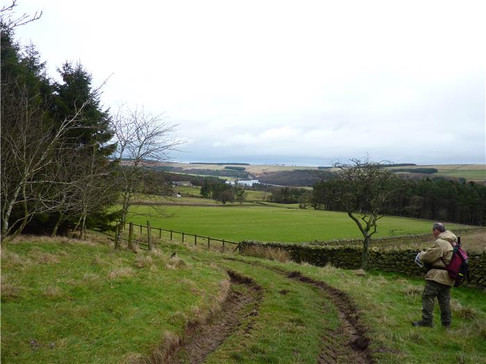
WALK 2: PARK WALL, TUNSTALL AND BAAL HILL
A walk exploring both sides of the Waskerley Valley leading up to Tunstall Reservoir. At any time of the year this walk presents some outstanding views.
DISTANCE: 6.25 mile / 10 km.
ASCENT: 686 feet / 209 metres.
TERRAIN: Mainly field paths and tracks. In wet weather some of these can be quite muddy. The two main climbs on this walk are more long and steady rather than steep.
TIME: 4 to 4½ hours.
START: Demense Mill Picnic Site long-stay car park in Wolsingham. GR NZ 076 375.
MAP: Unfortunately this route falls on two different maps with the beginning and end of the walk as you exit and enter Wolsingham being on OL31 North Pennines and the bulk of the walk, further north, being on OL307 Consett and Derwent Reservoir.
ACCESS: This route is all on public rights of way.
DOGS: As the route is all on public rights of way then dogs are allowed. However, be aware that there is one very tall and awkward ladder stile to get your dog over. Livestock will be encountered throughout this walk and you do pass through two farmyards where other dogs may be encountered.
FGS GRADING
Grading is T5 [ D1, N1, T1, R1, H1]
WALK 3: HARNISHA HILL
This may be a shortish walk in terms of distance but it is a little toughie due to the fact that virtually all of the route is off-path across open moor. There is plenty of bog-dodging and heather bashing on this one. If you don't want to get your feet wet then try a different walk.
That said, this is still a very enjoyable walk taking in the wilder side of Bollihope and on a good day offers some exceptional views over the Bollihope valley.
DISTANCE: 6.9 mile / 11 km.
ASCENT: 1,227 feet / 374 metres.
TERRAIN: The bulk of this walk is across pathless open moor including stretches of peat bog. There is a long steady climb from the valley floor to the summit of Harnisha Hill.
TIME: 3½ to 4 hours.
START: Car parking area next to the Bollihope Burn. GR NZ 006 349.
MAP: Explorer OL31 North Pennines.
ACCESS: The majority of this route is on open access land.
DOGS: Not allowed on the access land.
FGS GRADING
Grading is F10 [D1, N2, T3, R2, H2]
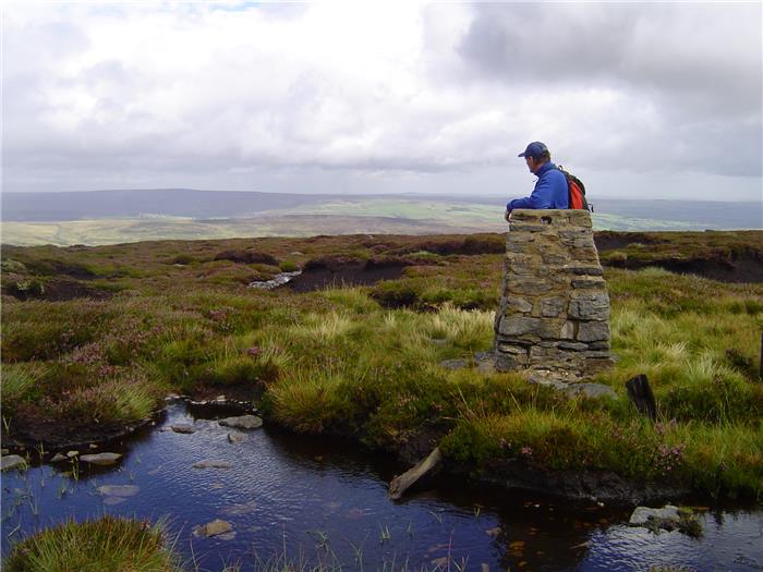
WALK 4: CHAPELFELL TOP AND NOON HILL
An open fell walk that takes in a couple of the high hills on the south side of Weardale. This is a true wilderness walk that would appeal to the adventurous fell walker as the vast bulk of the walk is away from the public rights of way network and goes across pathless, open moor to take in the summit of Chapelfell Top a high moorland hill of 703 metres or 2,306 feet.
DISTANCE: 7.7 mile / 12.3 km
ASCENT: 1,355 feet / 413 metres
START: The large car parking space on the left side of the road as you enter St John's Chapel from the east. GR NY 886 379
MAP: OL31 North Pennines.
TERRAIN: This is an open moor walk with a steep, prolonged climb and rough, pathless terrain including, on the top of the fell, peat hags and groughs.
ACCESS: The bulk of this route is on open access land although public rights of way are used to access the open moor and are also used along the valley floor.
DOGS: Dogs are not allowed on the access land.
FGS GRADING
Grading is F10 [ D1, N2, T3, R2, H2]
WALK 5: ASHES HOUSE AND THE BIGGINS
A more low-level walk that follows the southern bank of the River Wear before returning back to its start point through the farmland half-way up the side of the dale.
DISTANCE: 7.3 miles / 11.7 km
ASCENT: 528 feet / 161 metres
TERRAIN: This route is mainly over field paths with a couple of short stretches of tarmac lane. There is a short but steep climb up the road leading from Wolsingham Bridge.
TIME: 3½ to 4 hours
START: Car park on main road through Frosterley. GR NZ 025 369
MAP: Explorer OL31 North Pennines
ACCESS: This route is all on public rights of way.
DOGS: As the route is all on rights of way then dogs are allowed but keep them under close control, on a lead, as livestock will be encountered throughout the route. In all probability you will also encounter other dogs as you pass through the farms along the route.
FGS GRADING
Grading is T4 [D1, N1, T1, R1, H0]
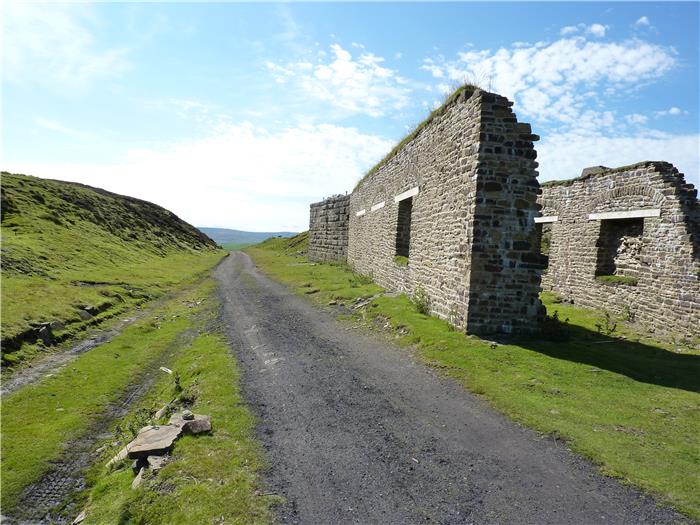
WALK 6: HIGH ABOVE THE STANHOPE BURN
High on the moors above Stanhope lies an old railway system that was built for the mineral industry, to transport both lead and ironstone from the mines further up the dale to the smelters and blast furnaces outside Weardale. This was the highest railway system in the country and crossed wild windswept moorland even in the depths of winter. Nowadays we marvel at the ingenuity of the Victorian engineer and how they would face obstacles that we would think twice about, this walk explores one of these challenges that they meet and conquered.
DISTANCE: 9.1 mile / 14.6 km.
ASCENT: 853 feet / 260 metres.
TIME: 4½ to 5 hours.
START: The car park at Parkhead Station, above Stanhope on the B6278 Stanhope to Edmundbyers road. GR NZ 003 431.
MAP: OL307 Consett and Derwent Reservoir.
TERRAIN: This walk utilises either old railway trackbed or vehicle track across Stanhope Common. However, the final half mile from the Stanhope Burn up to the side of the road is steeply uphill across open country.
ACCESS: The first half of the walk uses public rights of way until just after Boltslaw Incline is reached and from there tracks and paths over open access land are used to return to Parkhead.
DOGS: Not allowed on the access land.
FGS GRADING
Grading is F3 [D1, N1, T0, R1, H0]
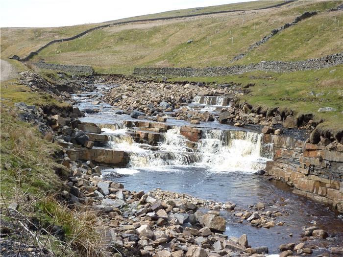
WALK 7: THE BURNHOPE VALLEY
Burnhope Reservoir sits at the top end of Weardale collecting the waters from the Burnhope Burn, a quiet burn that flows down from the high Pennine hills. Once you go past the reservoir this is a quiet little valley which doesn't see the boots of many walkers. This is a bit of a shame really as it does deserve more visitors than it gets. Although not a particularly long walk, this does give a flavour of this lovely but rarely visited spot.
.
DISTANCE: 4.8 miles / 7.6 km.
ASCENT: 404 feet / 123 metres.
TIME: 2¾ to 3¼ hours.
START: The car parking space at the southern end of the dam at Burnhope Reservoir. GR NY 848 388.
MAP: Explorer OL31 North Pennines.
TERRAIN: The majority of the walk is on well-surfaced gravel path or track. However, there is a section of around one mile that is on moorland grass track which can be boggy underfoot in wet weather. There is a crossing of the Burnhope Burn without the aid of a bridge, so you will get your feet wet and it may be best to avoid this walk at times of high water levels. There is one short but steepish climb up the side of the valley.
ACCESS: The walk around the reservoir itself uses permissive paths provided by Northumbrian Water. The walk from the reservoir up the valley and back down is across open access land.
DOGS: Not allowed on the access land.
FGS GRADING
Grading is F2 [D0, N1, T0, R1, H0]
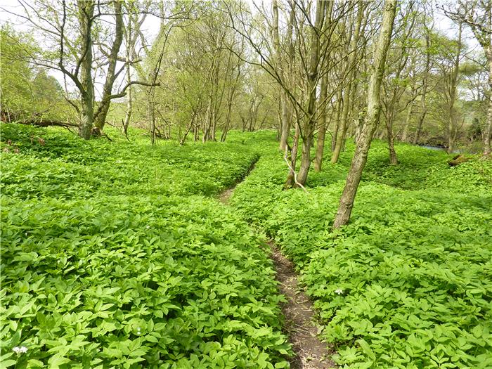
WALK 8: KNITSLEY FELL AND BLACK BANKS
A walk that takes you east along the south side of the river from Wolsingham and one that has two distinct halves. The first half is a field walk leading up to the little-visited trig point on Knitsley Fell. There then follows a delightful descent through the woods of Black Banks Plantation before following the wooded banks of the River Wear back to Wolsingham.
DISTANCE: 4.6 miles / 7.4 km
ASCENT: 591 feet / 180 metres
TERRAIN: A walk that is split into two distinct halves. The first half, leading up to the trig point on Knitsley Fell is almost exclusively field paths. The second half of the walk makes a delightful descent down through Black Banks Plantation to the side of the River Wear and then follows a riverside path back to Wolsingham Station. Virtually all the climbing is in the first half of the walk and is more long and gradual rather than steep.
TIME: 3½ to 4 hours
START: Parking space at the side of the road outside the entrance to Wolsingham station. GR NZ 075 368. Alternative parking is available within the station car park itself.
MAP: OL31 North Pennines, Teesdale and Weardale. A small section of the walk, roughly 400-600 metres, is on map OL305 Bishop Auckland.
ACCESS: The route is all on public rights of way apart from the summit of Knitsley Fell which is located in an area of open access moorland.
DOGS: As the route is on public rights of way then dogs are allowed. However, be aware that you do go through several farm yards and that during most of the route you will encounter livestock. During spring this will mean encountering lambs and young calves. There are also a few ladder stiles on this route which will mean lifting your dog over.
FGS GRADING
Grading is T6 [D1, N1, T1, R1, H2]
WALK 9: PIKESTONE FELL
A walk that starts in Hamsterley Forest. The forest, which is Durham's largest, lies between Weardale and Teesdale and it is always debatable which area it falls under. However, as this walk explores the moors on the Weardale side of the forest, and in particular a couple of little-known moorland valleys, then it has been included here.
While most people expect the remains of lead mining in the upper reaches of Weardale, it sometimes comes as a surprise to encounter them lower down the valley. This walk encounters the remains of two little-known mining enterprises isolated on these low lying moors and also a long-forgotten farmstead.
DISTANCE: 8.8 miles / 14 km.
ASCENT: 1,378 feet / 420 metres.
TIME: 4½ to 5½ hours.
START: The Grove car park in Hamsterley Forest. GR NZ 067 299. There is a parking charge in this car park.
MAP: OL31 North Pennines, Teesdale and Weardale.
TERRAIN: Mixed. Forest track and moorland track and path. A relatively hard moorland walk with a couple of stream crossings. Paths on the moor may at times be quite indistinct and difficult to see. This walk contains a stream crossing, in times of wet weather when water levels will be high do not attempt this route. Instead try one of the drier alternatives.
ACCESS: This walk uses a mixture of public rights of way and also tracks across open access land on the moors.
DOGS: Not allowed on the access land.
FGS GRADING
Grading is F8 [ D1, N1, T2, R2, H2]