About the Guide
By Sam Ferguson
A 102 page full colour A5 booklet describing eight walks, and the history and landscape surrounding these walks in the historic county of Dorset.
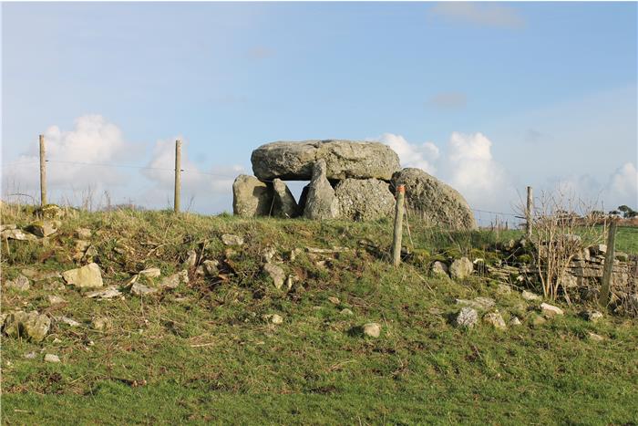
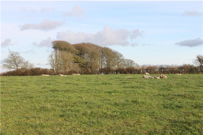
Have you ever walked around Dorset and noticed all those strange lumps and bumps across the hillsides and wondered what those are. Some of these are nothing, built by modern farmers usually as rubbish tips, others are monuments built thousands of years ago by prehistoric people in memory of their ancestors or to defend themselves against incoming enemies.
As you follow the walks in this book you will look at Dorset with a different eye, each of those mounds, lumps and bumps has a story to tell and each is different, most are combined with local myths and legends to give many spooky stories – mainly involving the Isle of Wight!
Let archaeologist Sam Ferguson guide you on various walks through Dorset where you will be informed, educated and entertained as you get an archaeologists view of the county.
Author Biography :
Sam Ferguson
Sam has had an interest in the outdoors throughout his life starting off in his hometown deep in the North Pennies, he was soon travelling the world to partake in a huge range of activities. Sam's exploration of the world was held up slightly when he became a student at Bournemouth University. Having now graduated with an honours degree in field archaeology Sam thought what better way to share his passion for the outdoors and the archaeology of Dorset than to write this book. Having lived in Dorset for seven years Sam has actively explored all areas of Dorset both as a working archaeologist, an outdoor enthusiast and as a tourist. The walks in this book are written from those explorative days to give you an insight into the past of Dorset and all its well preserved archaeological monuments and countryside. Some of the monuments are not too well known others very familiar; all an amazing sight.
Having worked as an archaeologist based in Dorset, Sam has had the chance to see most of the monuments visited in this book in much more detail than most of us, having dug up or surveyed a good proportion of them, alongside that nothing is more important to the archaeologist than local knowledge, this book is mainly written from knowledge gained off local people and local archaeologists.
Over the past few years Sam has developed his writing skills by writing small (and sometimes large!) articles for many international outdoor magazines, all of these skills coming together to create this book which combines his passions for writing, walking and archaeology.
Hopefully this book will inspire you, educate you but most of all give you a passion for the outdoors in whatever form it may take.
Contents
Contents
Introduction
1. Introduction
2. Archaeological Monuments and features
3. Access & the Right to Roam
4. The Walks
5. The Weather
6. The Maps
7. Towns, Villages & Accommodation
8. Tourist Information Centres & Websites
9. Time Line
10. Scheduled Ancient Monuments
Walk 1 – The Barrow Round
Walk 2 – Abbotsbury Stone Circle
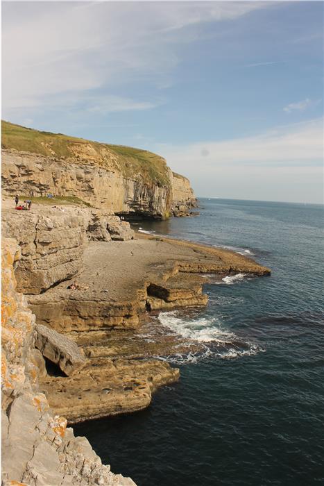
Walk 3 – Winspit Walk – The Sorrow of the Halsewell
Walk 4 – Cerne Abbas Giants Stride
Walk 5 – Agglestone Amble
Walk 6 – Portland – Coastline Quarry Stroll
Walk 7 – Creech Grange View
Walk 8 – Lulworth – Smugglers Cove Canter
Appendix
Ferguson Grading System
The Author
Acknowledgements
Trailguides Limited
Disclaimer
The Walks
WALK 1: THE BARROW ROUND
DISTANCE: 6.9miles (11.11km)
ASCENT: 536.09ft
HIGHEST POINT: Hardy Monument (612 876)
TERRAIN: Mostly country paths with some walking through open fields. They are mostly well-trodden paths that are usually in good condition, although there are some paths which are difficult to locate and follow. There is also some road walking on minor roads.
TIME: 2.5 to 3.5 hours
START: Start at the small car park at the base of the small hills grid reference 615 877
MAP: OL 15 Purbeck and South Dorset
DOGS: There are no restrictions for dogs on this walk and the barrow ridge is a common walk for dog owners. However there may be livestock in some of the fields so a lead will be necessary. There is a small amount of road walking along quiet country roads as there is no footpath.
ACCESS: There are no access issues on this walk; all paths are rights of way and public ground.
WILDLIFE INTEREST: rabbit, brown hare, badger, fox, deer.
REFRESHMENTS: Portesham Village contains some pubs and a small shop. Some small villages are located a short drive away, there are no amenities at the car park or at the nearby Hardy Monument car park.
NEARBY LOCAL INTEREST: Maiden Castle, Dorchester Town, Dorset County Museum
FGS GRADING.
Grading is T4 [D1, N1, T1, R1, H0]
WALK 2: ABBOTSBURY STONE CIRCLE
DISTANCE: 6.35 miles (10.2km)
ASCENT: 541ft
HIGHEST POINT: Grey Mare and Her Colts (583 870), 200m
TERRAIN: Well worn paths and tracks with some road walking on small countryside roads and private track ways. Some of the paths can be muddy after prolonged wet weather.
TIME: 3-4 hours
START: Car park at grid reference 578 852
MAP: OL 15 Purbeck and South Dorset
DOGS: There are no restrictions for dogs on this. However there may be livestock in some of the fields so there will be a need for a lead, there is also some walking through a private golf course which required your dog to be kept on its lead.
ACCESS: There are no access issues on this walk; all paths are rights of way and public ground.
WILDLIFE INTEREST: Fox, Badger, Deer, and butterflies amongst others.
REFRESHMENTS: The Swan Inn in Abbotsbury, adjacent to the starting car park, good pub serving local food and real ale.
NEARBY LOCAL INTEREST: Swannery, gardens, abbey (and barn!), village church, sub-tropical gardens.
FGS GRADING.
Grading is T4 [D1, N1, T0, R1, H1]
WALK 3: WINSPIT WALK – THE SORROW OF THE HALSEWELL
DISTANCE: 4.8 miles (7.7km)
ASCENT: 400ft
HIGHEST POINT: Halfway along the priests way (988 781)
TERRAIN: Mostly country paths with some road walking along both tarmac and dirt roads. There is some walking through open fields. The paths can be treacherous in heavy rain and the winter.
TIME: 2-3 hours
START: National Trust car park (£1 Donation to park, free for National Trust members) at grid reference 974 777.
MAP: OL 15 Purbeck and South Dorset
DOGS: There are no restrictions for dogs on this walk. However there may be livestock in some of the fields so there will be a need for a lead. There is a small amount of road walking along quiet country roads where there is no footpath.
ACCESS: There are no access issues on this walk, all paths are rights of way and public ground.
WILDLIFE INTEREST: rabbit, brown hare, badger, fox, deer, and lizards
REFRESHMENTS: Square and Compass Pub, Worth Matravers, a historic local pub with a museum of local geology and fossils.
NEARBY LOCAL INTEREST: Museum within Square and Compass pub, Swanage Village
FGS GRADING.
Grading is T7 [ D0, N1, T1, R2, H3]
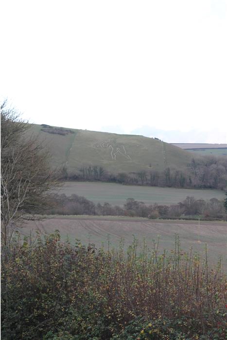
WALK 4: CERNE ABBAS GIANT'S STRIDE.
DISTANCE: 5.8 miles (9.33km)
ASCENT: 402ft
HIGHEST POINT: 641 023 (807ft)
TERRAIN: Mostly country paths with some road walking along both tarmac and dirt roads. There is some walking through open fields. The paths can be treacherous in heavy rain and the winter with some being difficult to find as they are rarely walked.
TIME: 2.5 – 3 hours
START: Car park at grid reference 663 014
MAP: OS Explorer Map 117 – Cerne Abbas and Bere Regis
DOGS: There are no restrictions for dogs on this. However there may be livestock in some of the fields so there will be a need for a lead. There is a small amount of road walking along quiet country roads where there is no footpath.
ACCESS: There are no access issues on this walk, all paths are rights of way and public ground.
WILDLIFE INTEREST: rabbit, brown hare, badger, fox, deer
REFRESHMENTS: The Royal Oak, Cerne Abbas. The New Inn.
NEARBY LOCAL INTEREST: The giant itself, village of Cerne, The church within Cerne Abbas.
FGS GRADING.
Grading is T3 [D0, N1, T1, R1, H0]
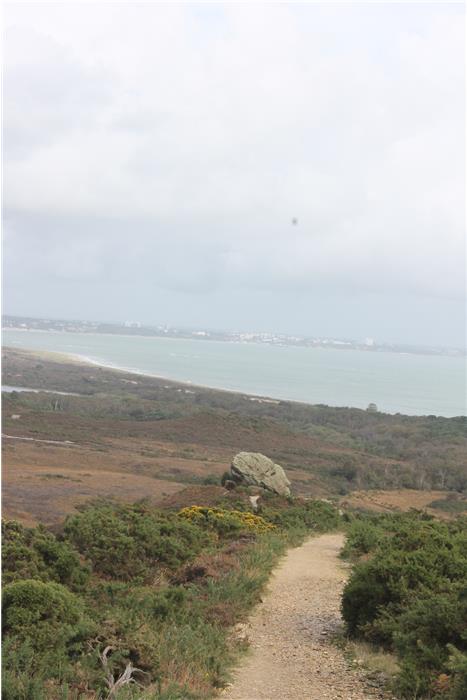
WALK 5: AGGLESTONE AMBLE.
DISTANCE: 2.51 miles (4.03km)
ASCENT: 337ft
HIGHEST POINT: Slightly along the first track leading from the car park 017 819
TERRAIN: Thin paths mainly of sand, some of dirt. Can be difficult after long periods of rain and during winter.
TIME: 1-2 hours
START: Car park at grid reference 017 818
MAP: OL 15 Purbeck and South Dorset
DOGS: There are no restrictions for dogs on this. However there may be livestock in some of the fields so there will be a need for a lead there is also some walking through a private golf course which requires your dog to be kept on its lead.
ACCESS: There are no access issues on this walk, all paths are rights of way and public ground.
WILDLIFE INTEREST: Fox, Badger, Deer, and butterflies amongst others.
REFRESHMENTS: The nearest village is Studland village which contains some pubs, Corfe is also a 15 minute drive away as is Sandbanks, both of which contain some great bars, pubs and restraunts.
NEARBY LOCAL INTEREST: Brown Sea Island, Poole Harbour, Studland Bay, Studland Beach, Sandbanks Ferry, Sandbanks Beach
FGS GRADING.
Grading is T2 [D0, N1, T0, R1, H0]
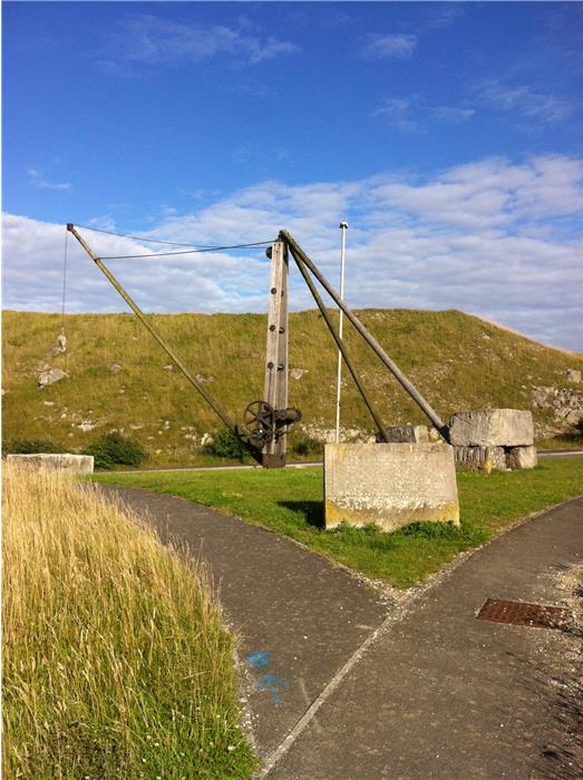
WALK 6: PORTLAND - COASTLINE QUARRY STROLL
DISTANCE: 8.5miles (13.7km)
ASCENT: 426ft
HIGHEST POINT:
TERRAIN: Good paths and tracks with some road walking. The tracks and paths are regularly maintained and usually in good condition.
TIME: 3-5 hours (+30mins exploration time for Tout Quarry)
START: Cheyne Wears car park (694 705)
MAP: OL 15 Purbeck and South Dorset
DOGS: There are no restrictions for dogs on this. However there may be livestock in some of the fields so there will be a need for a lead. There is a small amount of road walking along quiet country roads where there is no footpath.
ACCESS: There are no access issues on this walk, all paths are rights of way and public ground.
WILDLIFE INTEREST: dolphins, sharks, butterflies, crickets, goats, seals, as well as many birds of prey
REFRESHMENTS: Along the length of the walk are many visitor centres and small bars, pubs and café's. At the end of the day best bet is The Cove pub on Chesil beach, a fantastic place to see the sunset with a great rustic atmosphere and is usually full to the brim during summer months, it serves local ale and fantastic food.
NEARBY LOCAL INTEREST: Portland Museum, Chesil Beach (and visitor centre), Weymouth Beach.
FGS GRADING.
Grading is T4 [D1, N1, T1, R1, H0]
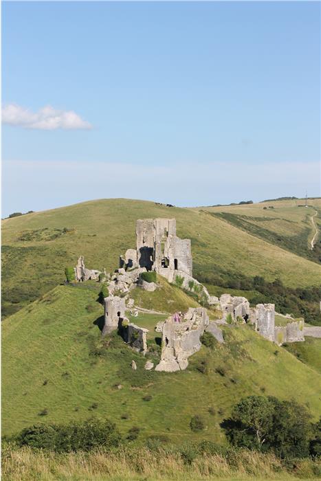
WALK 7: CREECH GRANGE VIEW.
DISTANCE: 6.5miles (10.5km)
ASCENT: 572ft
HIGHEST POINT: The folly 912 817
TERRAIN: Good paths and tracks with some road walking. The tracks and paths are regularly maintained and usually in good condition although can become feint during some seasons.
TIME: 3-4 hours
START: Car park at grid reference 905 817
MAP: OL 15 Purbeck and South Dorset
DOGS: There are no restrictions for dogs on this. However there may be livestock in some of the fields so there will be a need for a lead. There is a small amount of road walking alone quiet country roads where there is no footpath.
ACCESS: There are no access issues on this walk, all paths are rights of way and public ground.
WILDLIFE INTEREST: Fox, Badger, Deer, Goats (surrounding Corfe Castle), Greater Horseshoe Bat (at dusk), and rare butterflies amongst others.
REFRESHMENTS: Many pubs in the surrounding villages. Corfe village is home to some amazing pubs serving local food and good ale. The Greyhound Inn is one of the better ones with an old feel and great views of Corfe Castle from the large beer garden, and live music some evenings which can be a nice way to finish off a walk – good ale and good music!
NEARBY LOCAL INTEREST: Corfe Castle, Jurrasic Coast, Swanage Historic Village
FGS GRADING.
Grading is T2 [D1, N1, T0, R1, H0]
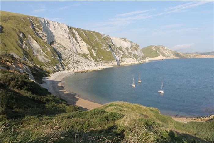
WALK 8: LULWORTH - SMUGGLERS COVE CANTER.
DISTANCE: 3.6 miles (5.8km) – Durdle Door add on: 2 miles (3.2km)
ASCENT: 531.5ft
HIGHEST POINT: Bindon Hill (839 802) – Durdle Door add on: Near the summit of Hambury Trout (815 802)
TERRAIN: Some walking along stone beaches, mainly paths and tracks that are well maintained. Some walking along cliff paths with unprotected drops – beware at these areas. The area past Lulworth Cove (grid ref) is MOD land and can be closed for public access, always check access before setting off for this walk by contacting the local tourist information centre (01929 552740).
TIME: 1.5 – 2.5 hours
START: Start at the car park at the base of the valley which is a pay and display car park, free parking can be found nearby in the villages. Car grid reference is 626 878
MAP: OL 15 Purbeck and South Dorset
DOGS: There are no restrictions for dogs on this walk but be careful whilst walking along the coastal path as steep cliffs and sudden drops are common. Dogs running off cliffs after seagulls is not uncommon at Lulworth!
ACCESS: Parts of this walk are within MOD land, always check access when you are planning to walk in this area and remember this can change without notice. ALWAYS obey signs stating the range is in use. The fossil forest and Mupe Bay are worth seeing but not worth being shot at for!
WILDLIFE INTEREST: rabbit, brown hare, badger, fox
REFRESHMENTS: Within Lulworth village there are many pubs and small coffee shops as well as a National Trust visitor centre. Many of these are seasonal though!
NEARBY LOCAL INTEREST: Durdle Door, Tyneham Village, Lulworth Village
FGS GRADING.
Grading is T4 [D0, N1, T1, R1, H1]