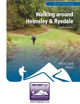
About the Guide
By Keven Shevels
A 112 page full colour A5 booklet describing nine walks, and the history and landscape surrounding those walks, around the market town of Helmsley and the valley of the River Rye.
The small market town of Helmsley lies on the southern edge of the North York Moors National Park and flowing past the edge of town lies the River Rye. Born high on the slopes of the Cleveland Hills, this river cuts a deep sided valley as it makes it's way through the flat-topped Tabular Hills passing Hawnby, Rievaulx and finally Helmsley before entering the Vale of Pickering.
As it heads north-west from Helmsley, a network of footpaths takes you through this valley, along wooded trails and riverside fields to the heather clad moors that line the upper reaches of this quiet, little dale. For the walker, this presents some of the best countryside that Yorkshire has to offer. It's little wonder that the medieval monks chose this valley to site their monasteries and settlements. Here history mixes with the countryside with four thousand years of human habitation lying amongst the trees, in the fields and across the moors. A walk here tells you much more than where your next footstep goes.
Author Biography :
Kev has been involved with outdoor sports since his school days when participation in the Duke of Edinburgh award revealed the beauties of hill and dale and resulted in him walking or running through the countryside of the North East and beyond for most of the last forty years. Many of these trips into the great outdoors being visits to the heather-clad uplands of the North York Moors, an area for which he has developed a great fondness.
Over the last six years, Kev has put pen to paper describing routes through the North
Pennines that reveal his passion for both the countryside and the history that has shaped it and the people who live upon it. That, coupled with an in-built curiosity to go and view things that spark his interest, tend to result in routes that take the reader into new, undiscovered areas and reveal a history that may not be apparent from the outside. He is not ashamed to admit that he is one of these boring people who can sit and spend hours reading a map like more normal people read a book. His great delight is coming up with new routes that he can subsequently explore and investigate. All of this has resulted in an easy to read, informative style of guidebook that has proved very popular among the walking fraternity and received very favourable reviews in both local and national press.
Now Kev returns to one of his favourite areas, the North York Moors, and in this, the second in a number of books that he is planning on the Moors, he explores the area around Helmsley following the valley of the River Rye up into the Moors themselves.
Contents
Contents
Introduction
1. Introduction
2. Access & the Right to Roam
3. The Walks
4. The Weather
5. The Maps
6. Facilities, Tourist Information Centres & Websites
Walk 1: Griff Grange Circular
Walk 2: Rievaulx and Low Gill
Walk 3: Beck Dale and Ash Dale
Walk 4: The Two Rivers
Walk 5: A Circuit of Rye Head
Walk 6: Riccal Dale
Walk 7: The Hills Behind Hawnby
Walk 8: Roppa Edge and the Magna Via
Walk 9: Sunny Bank and Arden Hall
Appendix
Ferguson Grading System
The Author
Walking North East
Acknowledgements
Disclaimer
The Walks
WALK 1: GRIFF GRANGE CIRCULAR
Rievaulx Abbey is one of the landmarks of Ryedale and at the height of its power, one of the most important abbeys in the north of England. However, an abbey doesn't exist by religion alone and many of them 'encouraged' gifts of land and property from their benefactors. The patrons of the abbey, effectively paying for their salvation. In this way they provided an income upon which the abbey and it's order of brothers could exist but it also enabled the abbeys to become rich and powerful in their own right.
This walk follows the Cleveland Way high above the valley of the River Rye and does a circuit to visit the remains of medieval Griff. One of the monastic granges of Rievaulx Abbey, gifted to the abbey with its first parcels of land and one of the cornerstones upon which the fantastic wealth of the abbey was based.
DISTANCE: 5.4 miles / 8.7 km.
ASCENT: 659 feet / 201 metres.
TERRAIN: Mainly well-walked path and track along the Cleveland Way with a short section on field path and another short section on road along a quiet, country lane. There are three short, fairly steep climbs but nothing too serious.
START: The entrance to the long stay car park in Helmsley. GR SE 610 838.
TIME: 3 to 3½ hours.
DOGS: Allowed on the public rights of way and also on the permissive paths. However, please keep them on a lead particularly on the permissive paths around Griff Farm. The fields here contain livestock and are used for lambing ewes and young lambs during Spring.
ACCESS: Most of the route is along public rights of way including the Cleveland Way. However, the stretch from Griff Lodge over to the roadside, including the exploration of the field containing the Medieval village, is on permissive footpaths, the permission ending in September 2020.
FGS Grading
Grading is T3 [ D0, N1, T0, R1, H1]
WALK 2: RIEVAULX AND LOW GILL
On the flat topped hills above the Rye valley there are a number of small villages dotted amongst the fields and in many ways these belong to the Rye as the valley itself does. This walk starts from one of these villages, Old Byland, which stands on a broad spur of land high above Ryedale and for a period of time was the home to the second abbey in Ryedale. From the village the walk descends down into Ryedale before passing both the village and the Abbey of Rievaulx. As you walk right past the abbey's front door, so to speak, then it may be worthwhile carrying some money in case you decide to visit this, one of the major religious houses of the north of England during the middle ages.
On the return back to Old Byland, the path passes up the dry valley of Low gill which, on the right day, can itself be a delight to walk. A quiet, secluded valley which gives the impression that the outside world is on a different planet.
Old Byland is an ancient settlement, one of only two in Ryedale that was left standing by William the Conqueror during his Harrying of the North in the years after the Conquest, the other being Helmsley. Tucked away behind the village green lies All Saints Church. Built by the monks of Byland Abbey during the 12th century, while they resided at Tylas, the church replaced an earlier Saxon one. Constructed in the Norman style, parts of the original Saxon building have been incorporated into it, such as the rare semi-circular Saxon sundial in the east wall of the porch, look close to see the ten hours of a Saxon day. As you approach the church, have a look at the winged horses carved into the stones beside the porch, the winged horses being associated with St Oswald, the 7th century Anglo-Saxon king of Northumbria.
DISTANCE: 5.7 miles / 9.1 km.
ASCENT: 564 feet / 172 metres.
TERRAIN: The route is mainly field and woodland paths and tracks although there is a lengthy stretch on quiet country roads as you go through the village of Rievaulx and round Ashberry Hill. There is no significant climbing apart from a short, steep section in the final half mile of the walk as you come back into Old Byland.
START: Old Byland village green, GR SE 550 859. Cars can be parked next to the green but please be considerate to local residents and don't block access.
TIME: 3¼ to 3¾ hours not including any visit that you might make to Rievaulx Abbey.
DOGS: As the route is all on public rights of way, then dogs are allowed. However, be aware that the fields towards the start of the walk normally contain cattle and at certain times of the year there are young calves with them. There are a number of tall stiles where your dog may need to be lifted over and there is a lengthy road section going through Rievaulx and round to Ashberry.
ACCESS: The route is all on public rights of way.
FGS GRADING
Grading is T3 [ D0, N1, T1, R1, H0]
WALK 3: BECK DALE AND ASH DALE
Helmsley is a bustling little market town and for obvious reasons a popular tourist spot. However, not too far away from the town lie two narrow wooded valleys that are really only accessible to the walker and even then they are not visited by too many of them.
DISTANCE: 6.6 miles / 10.5 km.
ASCENT: 499 feet / 152 metres.
TERRAIN: Mainly woodland track and path, although easy to follow the path may be slightly overgrown by ferns and brambles during the height of summer. The two wooded valleys are linked by a section of field paths and a short section of road walking along a quiet lane. There is only the one climb that is not too steep but will make the lungs breath a bit heavily, thankfully it is not too long.
START: The main long-stay car park in the centre of Helmsley. GR SE 610 838.
TIME: 3 to 3½ hours.
DOGS: As the route is all on public rights of way then dogs are allowed. However, you are requested to keep them on a lead especially as you make your way through the pheasant enclosure in Beck Dale.
ACCESS: This route is all on public rights of way.
FGS Grading
Grading is T3 [ D1, N1, T0, R1, H0]
WALK 4: THE TWO RIVERS
As it flows through the North York Moors National Park, the River Rye is joined by the River Seph, it's largest tributary while still in the park. The Seph itself flows the length of Bilsdale before joining the Rye at Seph Mouth, a couple of miles east of Hawnby. This walk takes a circular route encompassing the banks of both rivers.
DISTANCE: 4.9 miles / 7.8 km.
ASCENT: 774 feet / 236 metres.
TERRAIN: Most of the route is on field and woodland paths and tracks with a section along a tarmac farm access road. There is a short section of a couple of hundred metres of walking on a public road. Most of the climbing on this walk could be considered as steady although there are one or two small sections that are short and steep.
TIME: 3 to 3½ hours.
START: The car park of Hawnby village hall. GR SE 542 894. The car park lies in the lower portion of Hawnby on the left-hand side of the road to Kepwick, just after passing the Village Store and Tea Rooms.
ACCESS: The route is all on public rights of way.
DOGS: As the route is all on public rights of way then dogs are allowed. However, be aware that a large number of the fields along this route do contain cattle, quite often with young calves, and it may be best not to take your dog with you. .
FGS GRADING
Grading is T5 [ D0, N1, T1, R1, H2]
WALK 5: A CIRCUIT OF RYE HEAD
The Rye flows through the gentle, rolling Hambleton Hills down to Helmsley and then enter the Vale of Pickering. However, it begins life on the harsher Cleveland Hills further to the north. This route is a high moorland walk that encircles Rye Head, the shallow moorland bowl that acts as the gathering ground for the springs that join to form the infant River Rye. Along the way the walk passes a number of sites that date back to the prehistoric Bronze Age, over four thousand years ago when the climate was much milder and these hilltops were prime agricultural land supporting a sizeable population.
DISTANCE: 9.3 mile / 14.8 km
ASCENT: 974 feet / 297 metres
TERRAIN: Most of the route is on well-made moorland tracks, however, the final stretch from Dale Head back to the parking space is across moorland path which is normally quite wet and muddy. There are no strenuous climbs along the route, more long and steady.
TIME: 3¾ to 4¼ hours.
START: Car parking space at Low Locker Moor on the Osmotherley to Hawnby road. GR SE 511 944.
DOGS: Not allowed on the open access land.
ACCESS: The route is a mixture of public rights of way and tracks over open access land.
FGS GRADING
Grading is F4 [ D1, N1, T0, R1, H1]
WALK 6: RICCAL DALE
The River Riccal lies a short distance away from Helmsley and is a tributary of the River Rye, joining it a few miles south-east of the town. The river is formed by the meeting of two streams coming down from the moors before it starts a slow meandering course through a narrow valley cut into the Tabular Hills. This slow meandering is what has given the river its name, in the 14th century it was known as Ricolvegraines meaning Rye Calf where the word Calf is a small island near a larger one. The islands being formed by the changing course of the meandering river.
The river valley is, as one look at the map will show, one long woodland. Unlike many of the more modern plantations comprised mainly of conifers, the valley is mainly the more native broadleaved trees being wooded with hazel, birch and especially beech. In spring the ground is covered by large groups of bluebells giving vast swathes of colour. However, even in autumn when the leaves are differing shades of colour, this wooded valley is a joy to walk.
DISTANCE: 7.2 miles / 11.5 km
ASCENT: 551 feet / 168 metres
START: Helmsley main car park. GR SE 610 838.
TERRAIN: Mainly field and woodland paths and tracks. The descent into and the climb out of Riccal Dale are fairly steep but are not particularly long and so not too bad.
TIME: 3½ to 4 hours.
ACCESS: The route is all on public rights of way.
DOGS: As the route is on rights of way then they are allowed. However, if your dog is one that chases birds then you may have trouble controlling them as the woods are full of pheasants strolling around. This also means that during the shooting season your dog may hear a few loud bangs. Livestock will also be encountered as you cross the fields in the early and finishing stages of the walk. There is also the probability that you will meet the farm dogs as you cross the yard at Reagarth Farm.
FGS Grading
Grading is T4 [ D1, N1, T1, R1, H0]
WALK 7: THE HILLS BEHIND HAWNBY
The village of Hawnby sits above the River Rye in the upper reaches of the dale. Behind the village, the hills rise to join the moors of the Cleveland Hills but not before they produce two striking summits immediately behind the village itself. This walk takes the opportunity to climb both of these, Hawnby Hill and Easterside Hill, and explore the moors beyond. Here you will experience a rare opportunity on the North York Moors, a walk along a narrow ridge line with spectacular views in all directions.
DISTANCE: 7.2 miles / 11.5 km.
ASCENT: 1,250 feet / 381 metres.
TERRAIN: This walk encompasses a variety of terrain ranging from field and moorland paths to moorland tracks with even a little bit of heather bashing if you decide to explore the prehistoric field system that is encountered on the route. As the walk goes over the top of Hawnby Hill and almost to the top of Easterside Hill then there are two fairly steep climbs and correspondingly steep descents although they are not that particularly long. The other climbs on the route are a lot more gradual.
TIME: 4½ to 5 hours.
START: Hawnby Village Hall car park GR SE 542 894. This is located in the lower half of the village just past the village shop and tea rooms. The car park itself is behind the village hall. Although there is no parking charge, people using the car park are asked to make a donation to village hall funds.
DOGS: At the time of test walking there were no signs prohibiting dogs and most of the route is on rights of way where they are allowed. However, as this is sheep grazing land please keep them under close control preferably on a lead. You may want to anyway as you go over Hawnby Hill, as there is a steep drop to either side.
ACCESS: The start of the walk, going over Hawnby Hill, is on access paths although most of the route after that is on public rights of way. There are parts of the route where the tracks do not strictly adhere to the rights of way but the route across the moor is all open access land and so does not create any problems.
FGS GRADING
Grading is F6 [ D1, N1, T1, R1, H2]
WALK 8: ROPPA EDGE AND THE MAGNA VIA
Roppa Edge lies just over five miles away from Helmsley amongst the Forestry Commission's Newgate Bank plantation. However, don't look for the name Roppa Bank on the map, according to the OS it goes by a number of names such as Rievaulx Bank, Ayton Bank and Helmsley Bank but to the local population it is simply Roppa Bank. The name Roppa coming from Rauthe, meaning 'Red' and may refer to the presence of red shale or ironstone.
This is a walk that touches history but in many more ways than you would expect. Here the landscape is in direct contact with the past and you can see traces of our prehistoric ancestors, travel in the footsteps of William the Conqueror, see innovative ways of providing water to 18th century villages and experience the suffering during the Second World War. And on top of all that, you can brush close to the scene of a brutal 19th century murder.
DISTANCE: 8.4 miles / 13.5 km.
ASCENT: 876 feet / 267 metres.
START: The Forestry Commission car park at Newgate Bank on the B1257 Helmsley to Stokesley road, approximately five miles north of Helmsley. GR SE 564 889.
TIME: 4¾ to 5¼ hours.
TERRAIN: A mixture of moor and woodland paths and tracks. The outward path across the moor, following the route of the Magna Via, is nowadays a narrow walker's path and while distinctive and normally easy to follow, can in places be overgrown by tall heather and can also be wet and boggy. The climbing on this walk is mainly slow and gradual, however, the final sting in the tail is a long, steady climb up through the woods back to the car park.
ACCESS: The majority of the route is on public rights of way although most of the route coming back over the moor uses shooters tracks over access land.
DOGS: Although the majority of this route is on public rights of way, large chunks of the route are over access land and here, unfortunately, dogs are not allowed.
FGS GRADING
Grading is F5 [ D1, N1, T1, R1, H1]
WALK 9: SUNNY BANK AND ARDEN HALL
As we have seen in the two previous walks that go across the open moor, The Hills Behind Hawnby and The Rye Head Circular, there is ample evidence of prehistoric man and his settlements on these southern hills of the North York Moors. This walk explores the deeply cut valleys to the south-west of the River Rye and along the way discovers prehistoric monuments of a different kind, dykes and burial grounds.
DISTANCE: 6.4 miles / 10.2 km.
ASCENT: 1,093 feet / 333 metres.
TERRAIN: Mainly field and woodland paths and tracks. In both winter and wet weather some of these woodland paths can be quite muddy. Most of the climbing is fairly steady although there is a short but quite steep climb up from the footbridge across the River Rye towards the end of the walk.
TIME: 4 to 4½ hours.
START: Hawnby village hall car park. GR SE 542 894.
DOGS: As the route is on public rights of way, then dogs are allowed. However, please keep them under close control as livestock will be encountered at various points along the route.
ACCESS: The route is all on public rights of way. If you wish to explore the Cross Dyke and the burial mounds then there is a permissive access agreement in place that does allow you to do so.
FGS GRADING
Grading is T6 [ D1, N1, T1, R1, H2]