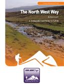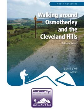

About the Guide
A 112 page full colour A5 booklet describing nine walks and the history and landscape surrounding the village of Osmotherley on the edge of the North York Moors.
By Keven Shevels
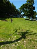
The village of Osmotherley lies on the edge of the North York Moors National Park, at the point where the rugged Cleveland Hills meet the more gentle, rolling Hambleton Hills. This is an area with a history that stretches back to the early days of human exploration and settlement. A history that has left it's mark right up to the present time.
Here the walker is presented with a mixture of landscapes to explore. The rugged, heather moorland, the rolling grassland of the lower hills, and the forests of conifer and broad-leaved trees that line the edges of the moors. Join the author on a series of walks as he explores both the landscape and the history of this part of one of the country's most popular national parks.
Author Biography :
Keven Shevels
Kev has been involved with outdoor sports since his school days when participation in the Duke of Edinburgh award revealed the beauties of hill and dale and resulted in him walking or running through the countryside of the North East and beyond for most of the last forty years. Many of these trips into the great outdoors being visits to the heather-clad uplands of the North York Moors, an area for which he has developed a great fondness.
Over the last six years, Kev has put pen to paper describing routes through the North Pennines that reveal his passion for both the countryside and the history that has shaped it and the people who live upon it. That, coupled with an in-built curiosity to go and view things that spark his interest, tend to result in routes that take the reader into new, undiscovered areas and reveal a history that may not be apparent from the outside. He is not ashamed to admit that he is one of these boring people who can sit and spend hours reading a map like more normal people read a book. His great delight is coming up with new routes that he can subsequently explore and investigate. All of this has resulted in an easy to read, informative style of guidebook that has proved very popular among the walking fraternity and received very favourable reviews in both local and national press.
Now Kev returns to one of his favourite areas, the North York Moors, and in this, the first in a number of books that he is planning on the Moors, he explores the area surrounding Osmotherley which stands at the point where the Cleveland Hills meets the Hambleton Hills.
Contents
Introduction
1. Introduction
2. Access & the Right to Roam
3. The Walks
4. The Weather
5. The Maps
6. Facilities, Tourist Information Centres & Websites
The Hambleton Drove Road
Walk 1: Mount Grace Priory
Mount Grace Priory
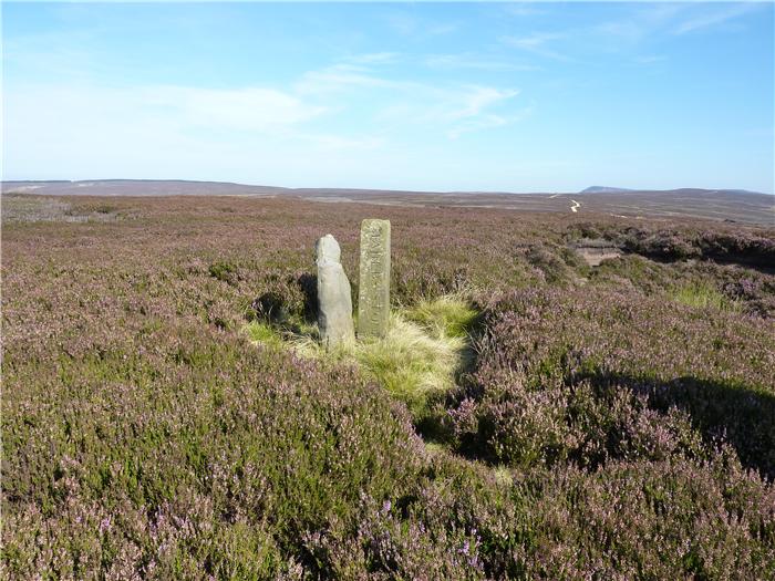
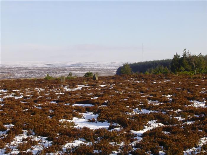
Walk 2: The Stones of Thimbleby Moor
Rock Art on Thimbleby Moor
Nine Stones
Walk 3: Arnsgill and Cow Ridge
Iron Howe Settlement
Walk 4: Lady’s Chapel & Hambleton Drove Road
Lady’s Chapel
Starfish SF10C
Walk 5: Thimbleby Bank and Silton Forest
Walk 6: Above the Cod Beck
Walk 7: Miley Pike and Holy Well Gill
Walk 8: A Circuit of Black Hambleton
Low Locker Moor Settlement
Walk 9: A Stroll Over to Thorodale
Steeple Cross Dyke
Kepwick Long Barrow
Round Barrows
Appendix
Ferguson Grading System
The Author
Walking North East
Acknowledgements
Disclaimer
The Walks
WALK 1: MOUNT GRACE PRIORY
Situated slightly to the north west of Osmotherley lies Mount Grace Priory, the finest surviving example in the country of a monastery of the Carthusian order. Now owned by the National Trust and managed by English Heritage, the site is open to visitors and makes an ideal subject for a walk.
DISTANCE: 2.5 mile / 4 km.
ASCENT: 515 feet / 157 metres.
TERRAIN: The route is mainly field paths and tracks with a section going through the woods surrounding the Priory. In places the path may be a bit soft and muddy. There is a steady climb back up out of the woods after visiting the Priory.
START: The Market Cross, Osmotherley. GR SE 456 972.
TIME: For the walk itself, allow 1 to 1½ hours. However, if you do visit the Priory then you can quite happily add another 2/3 hours, dependent upon how much time you spend exploring the site.
DOGS: As the route is on rights of way then dogs are allowed. Unfortunately they are not allowed into Mount Grace Priory itself.
ACCESS: This route is all on public rights of way.
FGS Grading
Grading is T4 [ D0, N1, T0, R1, H2]
WALK 2: THE STONES OF THIMBLEBY MOOR
In the last walk we visited a site of major religious significance dating back to the Middle Ages. On this walk you will visit another site of possible religious significance but this one being much, much older dating back to man's very early days on the moors.
Located on the northern end of the Hambleton Hills, Thimbleby Moor is a relatively small area of enclosed moorland covered with deep heather. The land rises to an area of higher ground hidden within the forestry plantations of Silton. Near to this high point is a group of standing stones known as the Nine Stones. However, further down the slope towards Oak Dale lie a number of cup and ring marked stones. Unfortunately all but one lie on private land and are not readily accessible. But the one that is, is arguably one of the best examples of rock art found on the North York Moors.
DISTANCE: 3.1 mile / 5 km.
ASCENT: 217 feet / 66 metres.
START: Square Corner parking space on the moorland road from Osmotherley to Hornby. GR SE 479 959.
TIME: For the walk itself, allow 1½ to 2 hours. However, you can easily add on at least another hour dependent upon how much time you spend exploring the two sites.
TERRAIN: The first part of this walk is along a decent moorland vehicle track. The second part is totally the opposite involving a walk uphill across pathless moor complete with heather bashing and avoiding the odd "boggy bit". The climbing, although over rough ground which always makes it harder, is more long and steady rather than steep.
ACCESS: This route is all on open access land.
DOGS: Not allowed on the access land.
FGS Grading
Grading is F5 [ D0, N1, T2, R2, H0]
WALK 3: ARNSGILL & COW RIDGE
A walk that follows two ridge lines across the moors and on the way discovers a mysterious prehistoric settlement full of stone cairns, over three hundred of them laid out over the side of the hill.
DISTANCE: 5.6 mile / 9 km
ASCENT: 755 feet / 230 metres
TERRAIN: Well-surfaced moorland tracks throughout with a short section of road walking both at the start and towards the end of the walk. There are two main climbs on this walk although neither of them are particularly steep, more long and slow.
TIME: 3½ to 4 hours.
START: Small roadside car park at Low Locker Moor next to the bridge over the River Rye on the road from Osmotherley to Hawnby. GR SE 511 944.
DOGS: As the route is all on public rights of way then dogs are allowed although they should be kept under close control. Livestock, mainly sheep, will be encountered throughout the route. There is a lengthy road section at the end of the walk.
ACCESS: The route is all on public rights of way. However, if you do explore the old field system on the descent from Iron Howe then you will leave the right of way and will be on access land.
FGS Grading
Grading is F4 [ D0, N1, T0, R1, H2]
WALK 4: LADY'S CHAPEL & THE HAMBLETON DROVE ROAD
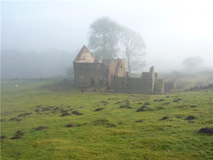
This is a walk that follows the hills northwards from Osmotherley and takes the opportunity to visit Lady's Chapel. Closely linked with Mount Grace Priory, the Chapel is one of the earliest religious houses established in this part of the North York Moors and, surprisingly, is still in regular use.
The walk then continues through the woodland bordering the edge of the escarpment before descending over open moorland to the glacial channel of Scarth Nick before following the Hambleton Drove Road back towards Osmotherley.
DISTANCE: 5.9 mile / 9.4 km
ASCENT: 768 feet / 234 metres
TERRAIN: Mainly field and moorland path and track with a short section of road walking. A section of the track climbing up from Cod Beck is badly eroded but otherwise the tracks have a fairly good walking surface. Most of the climbs are gradual although the climb up the eroded section from Cod Beck is quite steep.
TIME: 3½ to 4 hours.
START: The Market Cross, Osmotherley. GR SE 456 972.
ACCESS: Public rights of way are used for most of this walk. However, a short stretch of permissive path is used to link Lady's Chapel with the Cleveland Way but this does not imply that this is or ever will be a right of way and at certain times access may be blocked. If you are uncertain about using this section then you can easily retrace your steps back from Lady's Chapel to the Cleveland Way and then follow that until you re-join the route proper.
DOGS: Are allowed on the rights of way. The permissive section is used by local dog walkers, however, please keep your dog under close control when on this section. Livestock may be encountered at various points during this walk.
FGS GRADING
Grading is T4 [ D0, N1, T0, R1, H2]
WALK 5: THIMBLEBY BANK & SILTON FOREST
A walk that can be very easily classified as a woodland walk as the bulk of it's distance is under the canopy of the trees. Although you do touch the open moor, it is only a brief touch which for a walk around Osmotherley makes a very pleasant change.
DISTANCE: 7.5 mile / 12 km
ASCENT: 1,273 feet / 388 metres
TERRAIN: Mainly woodland path or track. The outward leg follows a path that climbs up through the woods and plantations that line Thimbleby Bank while the return follows forest tracks through Silton Forest. The paths on Thimbleby Bank can, in places, be muddy and slippery and the descent into Oak Dale is both steep and rocky due to the path being badly eroded. Care needs to be taken on this section. Part of this route does utilise quiet country roads from the forest to the village of Over Silton. There is a steady climb on flagged stone path out of Oak Dale up to the moor at Square Corner.
TIME: 4 to 4½ hours.
START: Small roadside parking space at the bottom of Sandpit Lane. This lies on the southern side of Thimbleby, on the left side of the road as you exit the village. GR SE 448 952.
DOGS: As the route is all on rights of way then dogs are allowed but do keep them under close control. Be aware that this walk starts close to the Thimbleby Shooting Ground and if there is any shooting going on, then the sound of it can be heard very clearly at the start and finish of the walk. If your dog is nervous of loud bangs and noises then this may make this walk a little awkward.
ACCESS: The route is all on public rights of way.
FGS GRADING
Grading is F5 [ D1, N1, T0, R1, H2]
WALK 6: ABOVE THE COD BECK
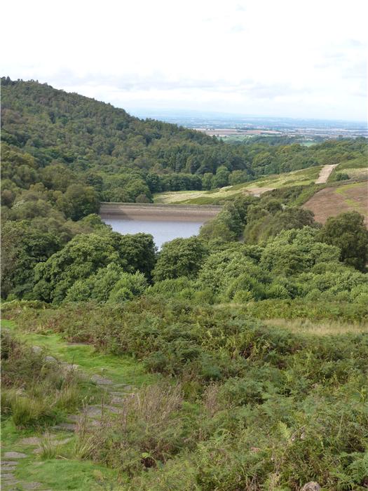
The Cod Beck rises to the north of Osmotherley, formed by the joining of moorland streams. Unusually it then flows north to south forming a small valley that in some ways cuts Osmotherley, situated on it's ridge, off from the main escarpment of the moors before it makes it's way out into the Vale of Mowbray, flowing through Thirsk and, ultimately, joining the River Swale at Topcliffe.
The name Cod Beck probably comes from the Celtic word “coed” meaning woody and would have described the nature of the valley in days past.
This walk crosses from Osmotherley over to the eastern side of this valley before taking a circular route above the valley and up onto the moors where the beck is formed and then returning back down the western side to the village.
DISTANCE: 4.3 mile / 6.9 km
ASCENT: 653 feet / 199 metres
START: Osmotherley Market Cross. GR SE 456 972
TERRAIN: A real mixture of terrain underfoot on this walk. Initially the walk follows field paths before joining an ancient lane running along the eastern slopes of the Cod Beck valley. Woodland tracks and paths are then followed as you circle round the Cod Beck Reservoir before climbing up a well-trodden moorland path on the western side of the valley. The last section of the walk follows a green track and tarmac lane back down to Osmotherley. The route can be quite muddy in places especially the walled lane passing the farm of Rocky Plain and you do have to use stepping stones to cross the Cod Beck at the top end of the Reservoir, although at times of high water there is a footbridge across a little bit higher up the stream. There are two main climbs on the walk which can be considered to be more steady rather than particularly steep.
TIME: 3 to 3½ hours.
ACCESS: The route is all on public rights of way with the exception of the stretch from the road next to the Cod Beck up the side of the hill to join the Cleveland Way. However, as this stretch forms part of the Lyke Wake Walk it is quite well-trodden and defined.
DOGS: Allowed although keep them under close control. There is a strong probability that you will encounter cattle in the walled lane adjacent to Rocky Plain Farm.
FGS Grading
Grading is T4 [ D0, N1, T0, R1, H2]
WALK 7: MILEY PIKE & HOLY WELL GILL
The heather clad expanse of the North York Moors is nowadays very closely associated with grouse shooting. Although hunting and shooting have always happened on the moors it was during the Victorian era that grouse shooting really developed.
Shooting grouse had been popular with the upper classes since the 1820's but became increasingly fashionable from 1852 onwards. At this time the Balmoral Estate in Scotland was bought by Queen Victoria and Prince Albert and their trips north brought about a craze for all things “Highland”. This included grouse shooting, Prince Albert was an avid hunter and would go shooting every morning during his stays at the castle.
This passion for the grouse caught on with the wealthy English landowners and the weekend shooting party became a feature of many country estates. For a rich and privileged elite the provision of what we would now call the infrastructure for supporting this pastime, such as shooting lodges, access tracks, grouse butts, etc., was easily enough provided.
This walk takes you away from the public rights of way and runs along the light and airy ridges that lie just in from the escarpment edge. Here, high above the source of the River Rye you'll discover the remnants of the heyday of the Victorian shooting parties.
DISTANCE: 6.6 mile / 10.5 km.
ASCENT: 482 feet / 147 metres.
TERRAIN: The bulk of the route uses moorland tracks with steady gradual climbs. However, there is a short section of a couple of hundred metres in the middle of the walk, where the track ends and you have to make your way across open country to join a narrow path that, ultimately, joins another track. During this "rough" stretch you do have to make a descent through bracken to the side of a stream, in the height of summer this bracken may be shoulder high making it a little bit difficult to see your footing.
TIME: 3½ to 4 hours.
START: Square Corner parking space above Osmotherley, on the Osmotherley to Hawnby road. GR SE 479 959.
DOGS: Not allowed on the access land.
ACCESS: Most of this route utilises the access land that runs over Osmotherley Moor. It is only in the closing stages when you are following the Hambleton Drove Road that public rights of way are used. Many of these tracks have grouse butts lying alongside or close to them which means that during the grouse shooting season, and in particular August, then it might be better to only use this route on a Sunday.
FGS GRADING
Grading is F4 [ D1, N1, T0, R2, H0]
WALK 8: A CIRCUIT OF BLACK HAMBLETON
The mass of Black Hambleton rears itself up on the moors behind Osmotherley. Standing at 399 metres (1,312 feet) this is the highest of the Hambleton Hills and it's shoulder is crossed by a section of the old drove road which at this point also forms part of the Cleveland Way. This walk does a circuit of this hill and on it's way visits one of the many prehistoric settlements that lie on this part of the North York Moors. As a final "treat" there is an option of an out and back visit to the trig point standing on the high point of this sprawling hill.
DISTANCE: 6.4 mile / 10.3 km
ASCENT: 830 feet / 253 metres
START: Square Corner parking space above Osmotherley, on the Osmotherley to Hawnby road. GR SE 479 959.
TIME: 3½ to 4 hours.
TERRAIN: The bulk of this walk is on tracks across the moor although there is a section using field and moorland paths which, at certain times, can be wet and muddy. If you explore the remains of the prehistoric settlement then you will be walking off the path through the heather. The climb up from the side of the valley to the moor on top of Black Hambleton is long and in some sections quite steep.
ACCESS: The first section of the walk uses public rights of way but from then on the route follows paths and tracks over access land until the Cleveland Way is reached at the Hambleton Drove Road.
DOGS: Not allowed on the access land.
FGS GRADING
Grading is F6 [ D1, N1, T0, R2, H2]
WALK 9: A STROLL OVER TO THORODALE
Osmotherley lies at the point where the Cleveland Hills meet the gentler, rolling Hambleton Hills. Unlike the more northern hills, those of the Hambletons are built on a bed of limestone and this well-drained rock gives rise to a thin but fertile brown soil which in many places supports a natural, pastoral farmland even on the higher slopes.
This walk starts just a little to the south of Osmotherley, at the small village of Kepwick and presents just a small example of the glorious walking that the Hambleton Hills can offer. Along the way it also takes the opportunity to explore artefacts from three ages in the development of man, the Neolithic, the Bronze Age and the Iron Age. Time periods in which humans left an indelible mark on the landscape of these moors.
DISTANCE: 8.4 mile (13.5 km)
ASCENT: 896 feet (273 metres)
TERRAIN: A complete mix ranging from field path and track, forest path and track to moorland path and tracks. There is even a section of walking across rough open moorland when exploring the long barrow. There is one long climb at the beginning of the walk that can be steep in places as it goes up an eroded gully. Later on your steps are retraced back down this gully. There is one section that passes through an area of scrubby woodland that is always wet and muddy no matter what time of year that you use it.
TIME: 4¾ to 5¼ hours
START: Kepwick. The small car park next to the church as you approach the village from the west. GR SE 467 909.
DOGS: Allowed on the public rights of way although keep them under close control. Sheep will be encountered throughout most of this route.
ACCESS: The route is all on public rights of way with the exception of when you are exploring the long barrow, trig point and tumuli on Little Moor and here you are on public access land.
FGS GRADING
Grading is F5 [ D1, N1, T1, R1, H1]