About the Guide
By Geoff Holland.
The second edition of this popular book is now available. With a revised layout and even more photos to help guide the walker this publication has now been expanded to 88 pages.
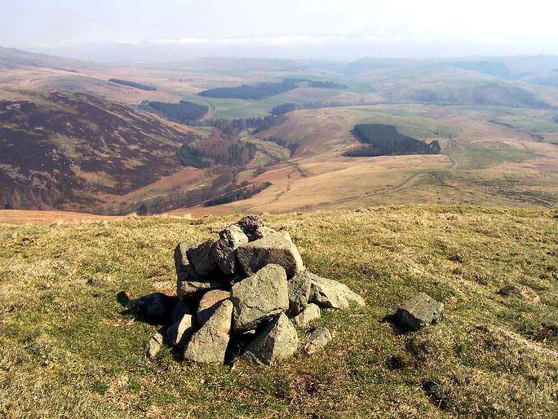
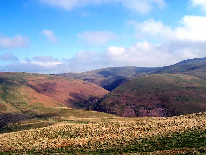
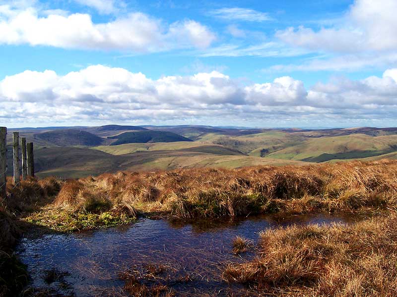
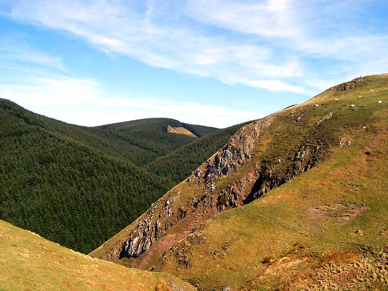
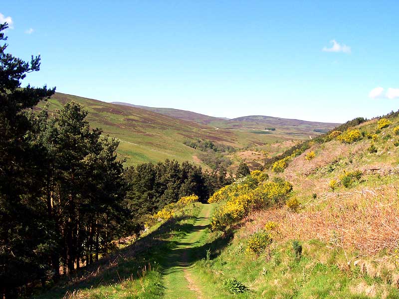
The Cheviot Hills stand on the northern edge of England at the heart of the Northumberland National Park. They roll across the border into Scotland like a tide of small, green waves. These are wild and expansive hills where the echo of history can be heard from every windswept hill and in every tranquil valley. This is ideal walking country.
On each of the eight self-guided walks the reader will uncover a small piece of the Cheviot jigsaw. They will follow less than ordinary routes to summit cairns and distant views. Along the way they will encounter cleughs, burns, sikes, crags, shins, dodds, hopes, linns, shanks and a whole lot more. This is an appetite whetting selection of walks in the Cheviot Hills.
Written by Geoff Holland, author of the acclaimed Cheviot Walks website, recognised as one of the best walking websites in the North of England.
The Walks
WALK 1: THE ULTIMATE HARTHOPE CIRCUIT
An extended and unusual round of the hills of the Harthope Valley takes you on a high level journey of discovery.
- DISTANCE: 14.25 miles ( 22.9 km )
- ASCENT: 3494 feet ( 1065 metres )
- START: Hawsen Burn, Harthope Valley (GR NT954225)
- TERRAIN: Mixed fell with a variety of paths and tracks, many rough and boggy
- FGS Grading F10 [ D2, N2, T2, R2, H2]
WALK 2: THE WANDERING HILLS OF WOOLER
This walk allows you to dip your toes in the waters of the total Cheviot experience as you wander out across the wide open spaces along the extreme edge of the Northumberland National Park.
- DISTANCE: 10 miles (16.1 km)
- ASCENT: 1903 feet ( 580 metres )
- START: Humbleton Burn Picnic Area (GR NT976272)
- TERRAIN: Mainly good green tracks and paths with some gravel tracks
- FGS Grading F9 [ D1, N2, T2, R2, H2]
WALK 3: THE WHITELANDS OF BIDDLESTONE
Trickling sikes, rushing burns, deep cleughs and steep sided valleys characterise this switchback walk of wall to wall panoramas. It is a wide screen, cinematic journey.
- DISTANCE: 8.5 miles ( 13.7 km )
- ASCENT: 1936 feet ( 590 metres )
- START: Alongside road to Clennell Hall, Alwinton ( GR NT925062 )
- TERRAIN: Mixed grassland with a number of good green tracks/paths. Some pathless terrain and short stretches of tarmac and gravel.
- FGS Grading F9 [ D1, N2, T2, R2, H2]
WALK 4: THE ALNHAMMOOR ROUND
This walk introduces you to this south east corner of the Cheviot Hills, offering wide angle views across time swept landscapes.
- DISTANCE: 9.5 miles ( 15.3 km )
- ASCENT: 1,608 feet (490 metres )
- START: Near Hartside Farm (GR NT978162)
- TERRAIN: Mixed fell, mainly good tracks (some gravel), paths and stretches of tarmac.
- FGS Grading F9 [ D1, N2, T2, R2, H2]
WALK 5: THE WINDING ROAD TO WINDY GYLE
This walk takes an unusual and less than direct route to the cairn crowned summit of this elemental hill, revealing along the way a variety of the many elements that make the hills of Upper Coquetdale so extra special.
- DISTANCE: 10.25 miles ( 16.5 km)
- ASCENT: 1837 feet ( 560 metres )
- START: Near Windyhaugh, Upper Coquetdale (GR NT865109)
- TERRAIN: A mixture of paths and tracks, some green, some gravel, one partially paved and a couple potentially muddy along with one stretch of tarmac
- FGS Grading F9 [ D1, N2, T2, R2, H2]
WALK 6: THE HIGH CIRCUIT OF THE USWAY BURN
This walk links together the hills around the Usway Burn and offers a bucket full of outstanding views from the high horseshoe shaped circuit of this, the most delightful of Cheviot burns.
- DISTANCE:10.25 miles (16.5 km)
- ASCENT: 2280 feet (695 metres)
- START: Near Shillmoor, Upper Coquetdale (GR NT885077)
- TERRAIN: Mixed fell (sometimes boggy), some good, green tracks and the occasional gravel track
- FGS Grading F9 [ D1, N2, T2, R2, H2]
WALK 7: THE HETHPOOL BORDER CIRCUIT
This walk explores some of the history of these hills whilst tasting the delights of two long distance footpaths. It even dares to set foot on `foreign` soil.
- DISTANCE: 9 miles ( 14.5 km)
- ASCENT: 2166 feet ( 660 metres )
- START: Hethpool, College Valley ( GR NT893280 )
- TERRAIN: Mainly good green tracks/paths with some stretches of tarmac
- FGS Grading F9 [ D1, N2, T2, R2, H2]
WALK 8: HIGH ALONG THE BORDER LINE
The ancient drove road, once known as `the Clattering Path`, climbs steeply away from the River Coquet and follows a high level route to the border between England and Scotland.
- DISTANCE: 10 miles ( 16.1 km )
- ASCENT: 1739 feet ( 530 metres )
- START: Slymefoot (White Bridge), Upper Coquetdale (GR NT859114)
- TERRAIN: Good green tracks, paved millstone slabs with intermittent worn peat paths, thin paths through areas of grassland.
- FGS Grading F9 [ D1, N2, T2, R2, H2]